Directions to Service First Inc (Boston) with public transportation
The following transit lines have routes that pass near Service First Inc
 Bus: R10, R14.
- Train: LAKE SHORE LIMITED, VERMONTER, AMTRAK HARTFORD LINE, NORTHEAST REGIONAL, VALLEY FLYER.
How to get to Service First Inc by bus?
Click on the bus route to see step by step directions with maps, line arrival times and updated time schedules.
From South High Community School, Worcester
190 minFrom Worcester, MA, Worcester
93 minFrom Polar Park, Worcester
95 minFrom Registry Of Motor Vehicles (Rmv) Branch Office, Worcester
97 minFrom Foxwoods, Worcester
123 minFrom Palladium, Worcester
99 minFrom Dcu Center, Worcester
96 minFrom Walmart Supercenter, Worcester
152 min
How to get to Service First Inc by train?
Click on the train route to see step by step directions with maps, line arrival times and updated time schedules.
Bus stops near Service First Inc in Boston
Train station near Service First Inc in Boston
- Springfield, 55 min walk,VIEW
Bus lines to Service First Inc in Boston
What are the closest stations to Service First Inc?
The closest stations to Service First Inc are:
- Main / Cottage is 1 yards away, 1 min walk.
- Century Plaza is 673 yards away, 8 min walk.
- Springfield is 4607 yards away, 55 min walk.
Which bus lines stop near Service First Inc?
These bus lines stop near Service First Inc: R10, R14.
Which train lines stop near Service First Inc?
These train lines stop near Service First Inc: LAKE SHORE LIMITED, VERMONTER.
What’s the nearest bus station to Service First Inc in Boston?
The nearest bus station to Service First Inc in Boston is Main / Cottage. It’s a 1 min walk away.
What time is the first train to Service First Inc in Boston?
The NORTHEAST REGIONAL is the first train that goes to Service First Inc in Boston. It stops nearby at 4:10 AM.
What time is the last train to Service First Inc in Boston?
The LAKE SHORE LIMITED is the last train that goes to Service First Inc in Boston. It stops nearby at 6:04 PM.
What time is the first bus to Service First Inc in Boston?
The R10 is the first bus that goes to Service First Inc in Boston. It stops nearby at 5:02 AM.
What time is the last bus to Service First Inc in Boston?
The R10 is the last bus that goes to Service First Inc in Boston. It stops nearby at 11:19 PM.
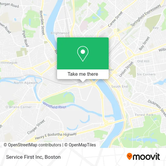
See Service First Inc, Boston, on the map
Public Transit to Service First Inc in Boston
Wondering how to get to Service First Inc in Boston? Moovit helps you find the best way to get to Service First Inc with step-by-step directions from the nearest public transit station.
Moovit provides free maps and live directions to help you navigate through your city. View schedules, routes, timetables, and find out how long does it take to get to Service First Inc in real time.
Looking for the nearest stop or station to Service First Inc? Check out this list of stops closest to your destination: Main / Cottage; Century Plaza; Springfield.
Bus: R10, R14.Train: LAKE SHORE LIMITED, VERMONTER, AMTRAK HARTFORD LINE, NORTHEAST REGIONAL, VALLEY FLYER.
Want to see if there’s another route that gets you there at an earlier time? Moovit helps you find alternative routes or times. Get directions from and directions to Service First Inc easily from the Moovit App or Website.
We make riding to Service First Inc easy, which is why over 1.7 million users, including users in Boston, trust Moovit as the best app for public transit. You don’t need to download an individual bus app or train app, Moovit is your all-in-one transit app that helps you find the best bus time or train time available.
For information on prices of bus and train, costs and ride fares to Service First Inc, please check the Moovit app.
Use the app to navigate to popular places including to the airport, hospital, stadium, grocery store, mall, coffee shop, school, college, and university.
Service First Inc Address: 26 Cook St street in Boston
- Carstar Fathers & Sons Collision Center,
- Standard Plating Co.,
- Auto Kraft Service,
- Al Mulk Furniture,
- Istanbul Super Mar,
- Springfield Day Nursery,
- Keinath Auto Body,
- Rexel,
- ATM,
- Morning Star Chrstn Books & Music,
- Delta Stores,
- International Christian Center,
- Healing Temple Church,
- Sprint,
- Saint Theresa Of Infant Jesus Church,
- Consumer Auto Repair,
- Encountering Ministries,
- Century Shopping Center,
- MC Wireless,
- Appalachian Press
Places Near Service First Inc (Boston)
- Isabella Stewart Gardner Museum, Boston,
- Td Garden, Boston,
- Museum Of Science, Boston,
- North End, Boston,
- Boston Children's Hospital, Boston,
- Mgm Music Hall, Boston,
- Boston Medical Center, Boston,
- House Of Blues, Boston,
- Prudential Center, Boston,
- Quincy Market, Boston,
- Boston Convention & Exhibition Center, Boston,
- Cheers, Boston,
- Boston Common, Boston,
- Seaport District, Boston,
- Wang Theater, Boston,
- Wilbur Theatre, Boston,
- Faneuil Hall, Boston,
- Massachusetts General Hospital, Boston,
- Castle Island, Boston,
- Leader Bank Pavilion (Leader Bank Pavillion), Boston
How to get to popular places in Boston with public transit
Get around Boston by public transit!
Traveling around Boston has never been so easy. See step by step directions as you travel to any attraction, street or major public transit station. View bus and train schedules, arrival times, service alerts and detailed routes on a map, so you know exactly how to get to anywhere in Boston.
When traveling to any destination around Boston use Moovit's Live Directions with Get Off Notifications to know exactly where and how far to walk, how long to wait for your line, and how many stops are left. Moovit will alert you when it's time to get off — no need to constantly re-check whether yours is the next stop.
Wondering how to use public transit in Boston or how to pay for public transit in Boston? Moovit public transit app can help you navigate your way with public transit easily, and at minimum cost. It includes public transit fees, ticket prices, and costs. Looking for a map of Boston public transit lines? Moovit public transit app shows all public transit maps in Boston with all Bus, Train, Subway and Ferry routes and stops on an interactive map.
Boston has 4 transit type(s), including: Bus, Train, Subway and Ferry, operated by several transit agencies, including MBTA, Southeastern Regional Transit Authority, MetroWest Regional Transit Authority, Rhode Island Public Transit Authority, WRTA, Lowell Regional Transit Authority, Merrimack Valley Transit, Montachusett Regional Transit Authority, Cape Cod Regional Transit Authority, Brockton Area Transit Authority, Martha's Vineyard Transit Authority, the WAVE - Nantucket Regional Transit Authority, GATRA, Cape Ann Transportation Authority and Massport