How to get to Seteel Telecomunicaciones by bus?
Click on the bus route to see step by step directions with maps, line arrival times and updated time schedules.
From Paseo de las Delicias, Madrid
58 minFrom Avenida de las Águilas, Madrid
68 minFrom Centro de Especialidades (CEP) de Pontones, Madrid
71 minFrom Alcorcon, Alcorcón
60 minFrom Poligono Industrial Urtinsa, Alcorcón
58 minFrom Metro Buenos Aires, Madrid
90 minFrom Via Lusitana, Madrid
39 minFrom Hospital Universitario 12 De Octubre, Área Metropolitana De Madrid Y Corredor Del Henares
44 minFrom Calle Cerro de la Plata 4, Madrid
62 minFrom Planetario de Madrid, Madrid
57 min
How to get to Seteel Telecomunicaciones by train?
Click on the train route to see step by step directions with maps, line arrival times and updated time schedules.
From Paseo de las Delicias, Madrid
43 minFrom Avenida de las Águilas, Madrid
54 minFrom Centro de Especialidades (CEP) de Pontones, Madrid
56 minFrom Alcorcon, Alcorcón
69 minFrom Metro Buenos Aires, Madrid
67 minFrom Hospital Universitario 12 De Octubre, Área Metropolitana De Madrid Y Corredor Del Henares
36 minFrom Calle Cerro de la Plata 4, Madrid
49 minFrom Planetario de Madrid, Madrid
46 min
How to get to Seteel Telecomunicaciones by metro?
Click on the metro route to see step by step directions with maps, line arrival times and updated time schedules.
From Paseo de las Delicias, Madrid
35 minFrom Avenida de las Águilas, Madrid
59 minFrom Centro de Especialidades (CEP) de Pontones, Madrid
49 minFrom Alcorcon, Alcorcón
42 minFrom Poligono Industrial Urtinsa, Alcorcón
45 minFrom Metro Buenos Aires, Madrid
55 minFrom Via Lusitana, Madrid
53 minFrom Hospital Universitario 12 De Octubre, Área Metropolitana De Madrid Y Corredor Del Henares
30 minFrom Calle Cerro de la Plata 4, Madrid
41 minFrom Planetario de Madrid, Madrid
45 min
Bus stops near Seteel Telecomunicaciones in Getafe
Train stations near Seteel Telecomunicaciones in Getafe
Metro station near Seteel Telecomunicaciones in Getafe
- El Casar, 21 min walk,VIEW
Bus lines to Seteel Telecomunicaciones in Getafe
- 1, Sector III - Cementerio,VIEW
- 4, Hospital - Pol. Ind. Los Ángeles,VIEW
- 442, P.º Sta. M.ª Cabeza - Est. Plaza Elíptica,VIEW
- 447, Pza. Legazpi - Legazpi,VIEW
- N807, C.º Parla - Mester De Clerecía,VIEW
- 2, Arroyo Culebro,VIEW
- 488, Av. Rigoberta Menchú - Est. Los Espartales,VIEW
- N805, Pza. Emperador Carlos V - Atocha,VIEW
- 443, Intercambiador De Plaza Elíptica (Nivel -2),VIEW
- 450, Olímpico Fco. Fdez. Ochoa - Av. Oeste,VIEW
- 3A, Circular de Getafe,VIEW
- 448, Pza. Legazpi - Legazpi,VIEW
What are the closest stations to Seteel Telecomunicaciones?
The closest stations to Seteel Telecomunicaciones are:
- Av. España - Av. Ciudades is 126 meters away, 2 min walk.
- Sánchez Morate - Av. Las Ciudades is 287 meters away, 4 min walk.
- Sánchez Morate - Pza. Jesús Jiménez Díaz is 304 meters away, 5 min walk.
- Av. Don Juan Borbón - Giralda is 567 meters away, 8 min walk.
- Av. Don Juan Borbón - Polideportivo is 634 meters away, 9 min walk.
- Las Margaritas is 1579 meters away, 21 min walk.
- El Casar is 1612 meters away, 21 min walk.
Which bus lines stop near Seteel Telecomunicaciones?
These bus lines stop near Seteel Telecomunicaciones: 4, 443, 447, 448, 450.
Which train lines stop near Seteel Telecomunicaciones?
These train lines stop near Seteel Telecomunicaciones: C3, C4.
Which metro lines stop near Seteel Telecomunicaciones?
These metro lines stop near Seteel Telecomunicaciones: M-12, M-3.
What’s the nearest metro station to Seteel Telecomunicaciones in Getafe?
The nearest metro station to Seteel Telecomunicaciones in Getafe is El Casar. It’s a 21 min walk away.
What’s the nearest train station to Seteel Telecomunicaciones in Getafe?
The nearest train stations to Seteel Telecomunicaciones in Getafe are Las Margaritas and El Casar. The closest one is a 21 min walk away.
What’s the nearest bus station to Seteel Telecomunicaciones in Getafe?
The nearest bus station to Seteel Telecomunicaciones in Getafe is Av. España - Av. Ciudades. It’s a 2 min walk away.
What time is the first metro to Seteel Telecomunicaciones in Getafe?
The M-3 is the first metro that goes to Seteel Telecomunicaciones in Getafe. It stops nearby at 6:05 AM.
What time is the last metro to Seteel Telecomunicaciones in Getafe?
The M-12 is the last metro that goes to Seteel Telecomunicaciones in Getafe. It stops nearby at 2:12 AM.
What time is the first train to Seteel Telecomunicaciones in Getafe?
The C4 is the first train that goes to Seteel Telecomunicaciones in Getafe. It stops nearby at 5:14 AM.
What time is the last train to Seteel Telecomunicaciones in Getafe?
The C4 is the last train that goes to Seteel Telecomunicaciones in Getafe. It stops nearby at 12:10 AM.
What time is the first bus to Seteel Telecomunicaciones in Getafe?
The N807 is the first bus that goes to Seteel Telecomunicaciones in Getafe. It stops nearby at 3:04 AM.
What time is the last bus to Seteel Telecomunicaciones in Getafe?
The N805 is the last bus that goes to Seteel Telecomunicaciones in Getafe. It stops nearby at 3:31 AM.
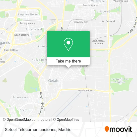
See Seteel Telecomunicaciones, Getafe, on the map
Public Transit to Seteel Telecomunicaciones in Getafe
Wondering how to get to Seteel Telecomunicaciones in Getafe? Moovit helps you find the best way to get to Seteel Telecomunicaciones with step-by-step directions from the nearest public transit station.
Moovit provides free maps and live directions to help you navigate through your city. View schedules, routes, timetables, and find out how long does it take to get to Seteel Telecomunicaciones in real time.
Looking for the nearest stop or station to Seteel Telecomunicaciones? Check out this list of stops closest to your destination: Av. España - Av. Ciudades; Sánchez Morate - Av. Las Ciudades; Sánchez Morate - Pza. Jesús Jiménez Díaz; Av. Don Juan Borbón - Giralda; Av. Don Juan Borbón - Polideportivo; Las Margaritas; El Casar.
Bus: 4, 443, 447, 448, 450, 1, 442, N807, 2, 488, N805.Train: C3, C4, C4A, C4B.Metro: M-12, M-3.
Want to see if there’s another route that gets you there at an earlier time? Moovit helps you find alternative routes or times. Get directions from and directions to Seteel Telecomunicaciones easily from the Moovit App or Website.
We make riding to Seteel Telecomunicaciones easy, which is why over 1.5 million users, including users in Getafe, trust Moovit as the best app for public transit. You don’t need to download an individual bus app or train app, Moovit is your all-in-one transit app that helps you find the best bus time or train time available.
For information on prices of metro, bus and train, costs and ride fares to Seteel Telecomunicaciones, please check the Moovit app.
Use the app to navigate to popular places including to the airport, hospital, stadium, grocery store, mall, coffee shop, school, college, and university.
Seteel Telecomunicaciones Address: Calle Cataluña, 17 28903 Getafe street in Getafe
- Cdad Prop Galeria Comercial Getafe II,
- Amazon Counter-Lanas al Peso Pedrero,
- Fisioterapia y Pilates Xirgú,
- El Cafelito,
- Caixabank,
- Opticagetafe,
- Lanas Pedrero,
- Tu Tienda Getafe,
- Parrado Camarena a,
- Ricardo Rubio Monroy,
- Carnicería Angel Fernández,
- Outlet,
- Medina Fuentes Dolores,
- Centro Comercial Getafe 2 Las Margaritas,
- Bar Martín,
- Calle Cataluña 40,
- Suministros Ind. Euronorma, S.L.,
- Amazon Counter-Zapateria Don Ciempiés,
- Skyline Soluciones Constructivas,
- Valmoni Almazen
Places Near Seteel Telecomunicaciones (Getafe)
- Hospital Clínico Universitario San Carlos, Madrid,
- Estacion de Chamartin, Madrid,
- Centro Comercial Islazul, Área Metropolitana De Madrid Y Corredor Del Henares,
- Calle de López de Hoyos 169, Madrid,
- Centro Comercial La Gavia, Área Metropolitana De Madrid Y Corredor Del Henares,
- Mercadillo de Majadahonda, Majadahonda,
- Centro Comercial Oasiz Madrid, Área Metropolitana De Madrid Y Corredor Del Henares,
- Palacio De Vistalegre, Área Metropolitana De Madrid Y Corredor Del Henares,
- Plenilunio, Área Metropolitana De Madrid Y Corredor Del Henares,
- Mendez Alvaro, Madrid,
- Tres Aguas, Alcorcón,
- Wizink Center, Madrid,
- Sala La Riviera, Madrid,
- Rastro De Madrid, Área Metropolitana De Madrid Y Corredor Del Henares,
- Centro Comercial La Vaguada, Área Metropolitana De Madrid Y Corredor Del Henares,
- Estadio Wanda Metropolitano, Área Metropolitana De Madrid Y Corredor Del Henares,
- Hospital Universitario Ramón y Cajal, Madrid,
- Plaza Mayor, Madrid,
- Hospital Universitario La Paz, Madrid,
- Nassica, Área Metropolitana De Madrid Y Corredor Del Henares
How to get to popular places in Madrid with public transit
Get around Getafe by public transit!
Traveling around Getafe has never been so easy. See step by step directions as you travel to any attraction, street or major public transit station. View bus and train schedules, arrival times, service alerts and detailed routes on a map, so you know exactly how to get to anywhere in Getafe.
When traveling to any destination around Getafe use Moovit's Live Directions with Get Off Notifications to know exactly where and how far to walk, how long to wait for your line, and how many stops are left. Moovit will alert you when it's time to get off — no need to constantly re-check whether yours is the next stop.
Wondering how to use public transit in Getafe or how to pay for public transit in Getafe? Moovit public transit app can help you navigate your way with public transit easily, and at minimum cost. It includes public transit fees, ticket prices, and costs. Looking for a map of Getafe public transit lines? Moovit public transit app shows all public transit maps in Getafe with all Bus, Train, Metro and Light Rail routes and stops on an interactive map.
Madrid has 4 transit type(s), including: Bus, Train, Metro and Light Rail, operated by several transit agencies, including Metro de Madrid, Metro Ligero, Tranvía de Parla, Renfe Cercanías - Servicios de Autobús especiales, Renfe Cercanias, Renfe Cercanías, EMT, Interurbanos, Urbanos de Alcalá de Henares, Urbanos de Alcobendas, Urbanos de Alcorcón, Urbanos de Algete, Urbanos de Aranjuez, Urbanos de Arganda del Rey and Urbanos de Arroyomolinos