Directions to Sh Videography (Boston) with public transportation
The following transit lines have routes that pass near Sh Videography
 Bus: 1, 10, 39, 501, 504.
- Train: NEEDHAM, FOXBORO EVENT SERVICE, FRAMINGHAM/WORCESTER, FRANKLIN/FOXBORO, ORANGE LINE.
- Subway: GREEN LINE B, GREEN LINE C, GREEN LINE D, GREEN LINE E, ORANGE LINE.
How to get to Sh Videography by bus?
Click on the bus route to see step by step directions with maps, line arrival times and updated time schedules.
From Market Basket, Revere
88 minFrom AC Hotel by Marriott Boston Cleveland Circle, Boston
47 minFrom Four Points by Sheraton Boston Logan Airport, Revere
75 minFrom Costco Wholesale, Everett
72 minFrom Qea, Quincy
99 minFrom Chevalier Theatre (Chevalier Theater Show Line), Medford
53 minFrom Dorchester, Boston
61 minFrom West Roxbury, Boston
53 minFrom VFW Parkway, Boston
54 minFrom Belmont, MA, Belmont
56 min
How to get to Sh Videography by train?
Click on the train route to see step by step directions with maps, line arrival times and updated time schedules.
How to get to Sh Videography by subway?
Click on the subway route to see step by step directions with maps, line arrival times and updated time schedules.
Bus stops near Sh Videography in Boston
- Huntington Ave @ Ring Rd, 1 min walk,VIEW
- Announcement #2 - Airport To Back Bay, 4 min walk,VIEW
- Ring Rd @ Boylston St, 4 min walk,VIEW
- Boylston St @ Clarendon St, 4 min walk,VIEW
- Stuart St @ Dartmouth St, 5 min walk,VIEW
- Boston, MA - Copley Square (Corner Of Clarendon St. & St. James Ave. In Front Of Trinity Church), 5 min walk,VIEW
- Copley - Opp 575 Boylston St, 5 min walk,VIEW
- Copley - Boylston St @ Dartmouth St, 6 min walk,VIEW
- Copley - Saint James Ave @ Trinity Pl, 6 min walk,VIEW
- Saint James Ave @ Dartmouth St, 6 min walk,VIEW
- Boylston St @ Dartmouth St, 6 min walk,VIEW
Subway station near Sh Videography in Boston
- Arlington, 4 min walk,VIEW
Train station near Sh Videography in Boston
- Back Bay - South End, 14 min walk,VIEW
Bus lines to Sh Videography in Boston
- 9, Kenmore Via Boston Latin,VIEW
- BB, Back Bay,VIEW
- 39, Haymarket Via Forest Hills,VIEW
- 10, City Point Via South Bay Center,VIEW
- 55, West Fenway,VIEW
- 57, Haymarket Via Kenmore,VIEW
- GREEN LINE D SHUTTLE, Riverside (Shuttle),VIEW
- ORANGE LINE SHUTTLE, Back Bay Via Copley (Shuttle),VIEW
- 501, Downtown via Copley (Express) - Brighton via Copley (Express),VIEW
- 504, Downtown via Copley (Express) - Watertown via Copley and Newton Corner (Express),VIEW
- GREEN LINE B SHUTTLE, Babcock Street - Back Bay,VIEW
- GREEN LINE B SHUTTLE, Boston College - Back Bay (Shuttle),VIEW
- GREEN LINE B SHUTTLE, Kenmore - Back Bay via Copley (Shuttle),VIEW
- GREEN LINE B SHUTTLE, Babcock Street - Back Bay via Copley (Shuttle),VIEW
- GREEN LINE D SHUTTLE, Brookline Hills - Back Bay (Shuttle),VIEW
- GREEN LINE SHUTTLE, Kenmore - Back Bay,VIEW
- GREEN LINE SHUTTLE, Kenmore - Copley,VIEW
- ACTON/CONCORD COMMUTER, Acton,VIEW
- ORANGE LINE SHUTTLE, Forest Hills (Shuttle),VIEW
- ORANGE LINE SHUTTLE, Copley (Shuttle),VIEW
What are the closest stations to Sh Videography?
The closest stations to Sh Videography are:
- Huntington Ave @ Ring Rd is 71 yards away, 1 min walk.
- Announcement #2 - Airport To Back Bay is 256 yards away, 4 min walk.
- Arlington is 258 yards away, 4 min walk.
- Ring Rd @ Boylston St is 274 yards away, 4 min walk.
- Boylston St @ Clarendon St is 284 yards away, 4 min walk.
- Stuart St @ Dartmouth St is 367 yards away, 5 min walk.
- Boston, MA - Copley Square (Corner Of Clarendon St. & St. James Ave. In Front Of Trinity Church) is 389 yards away, 5 min walk.
- Copley - Opp 575 Boylston St is 390 yards away, 5 min walk.
- Copley - Boylston St @ Dartmouth St is 459 yards away, 6 min walk.
- Copley - Saint James Ave @ Trinity Pl is 472 yards away, 6 min walk.
- Saint James Ave @ Dartmouth St is 484 yards away, 6 min walk.
- Boylston St @ Dartmouth St is 494 yards away, 6 min walk.
- Back Bay - South End is 1134 yards away, 14 min walk.
Which bus lines stop near Sh Videography?
These bus lines stop near Sh Videography: 1, 10, 39, 501, 504, 9.
Which train line stops near Sh Videography?
NEEDHAM (#620 | South Station)
Which subway lines stop near Sh Videography?
These subway lines stop near Sh Videography: GREEN LINE B, GREEN LINE C, GREEN LINE D, GREEN LINE E, ORANGE LINE.
What’s the nearest subway station to Sh Videography in Boston?
The nearest subway station to Sh Videography in Boston is Arlington. It’s a 4 min walk away.
What’s the nearest train station to Sh Videography in Boston?
The nearest train station to Sh Videography in Boston is Back Bay - South End. It’s a 14 min walk away.
What’s the nearest bus station to Sh Videography in Boston?
The nearest bus station to Sh Videography in Boston is Huntington Ave @ Ring Rd. It’s a 1 min walk away.
What time is the first subway to Sh Videography in Boston?
The GREEN LINE D is the first subway that goes to Sh Videography in Boston. It stops nearby at 5:03 AM.
What time is the last subway to Sh Videography in Boston?
The GREEN LINE D is the last subway that goes to Sh Videography in Boston. It stops nearby at 2:15 AM.
What time is the first train to Sh Videography in Boston?
The PROVIDENCE/STOUGHTON is the first train that goes to Sh Videography in Boston. It stops nearby at 4:25 AM.
What time is the last train to Sh Videography in Boston?
The LAKE SHORE LIMITED is the last train that goes to Sh Videography in Boston. It stops nearby at 8:26 PM.
What time is the first bus to Sh Videography in Boston?
The 57 is the first bus that goes to Sh Videography in Boston. It stops nearby at 4:51 AM.
What time is the last bus to Sh Videography in Boston?
The 10 is the last bus that goes to Sh Videography in Boston. It stops nearby at 1:16 AM.
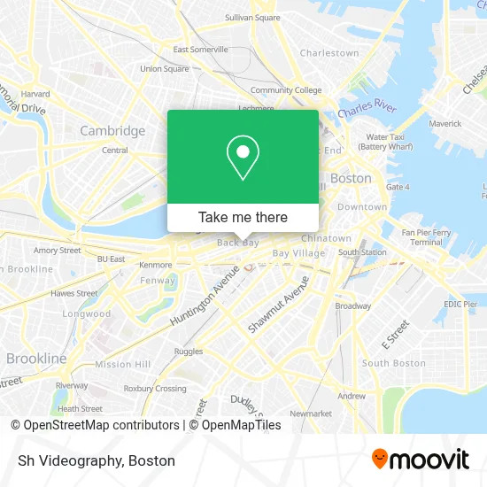
See Sh Videography, Boston, on the map
Public Transit to Sh Videography in Boston
Wondering how to get to Sh Videography in Boston? Moovit helps you find the best way to get to Sh Videography with step-by-step directions from the nearest public transit station.
Moovit provides free maps and live directions to help you navigate through your city. View schedules, routes, timetables, and find out how long does it take to get to Sh Videography in real time.
Looking for the nearest stop or station to Sh Videography? Check out this list of stops closest to your destination: Huntington Ave @ Ring Rd; Announcement #2 - Airport To Back Bay; Arlington; Ring Rd @ Boylston St; Boylston St @ Clarendon St; Stuart St @ Dartmouth St; Boston, MA - Copley Square (Corner Of Clarendon St. & St. James Ave. In Front Of Trinity Church); Copley - Opp 575 Boylston St; Copley - Boylston St @ Dartmouth St; Copley - Saint James Ave @ Trinity Pl; Saint James Ave @ Dartmouth St; Boylston St @ Dartmouth St; Back Bay - South End.
Bus: 1, 10, 39, 501, 504, 9, BB, 55, 57, GREEN LINE D SHUTTLE, ORANGE LINE SHUTTLE.Train: NEEDHAM, FOXBORO EVENT SERVICE, FRAMINGHAM/WORCESTER, FRANKLIN/FOXBORO, ORANGE LINE.Subway: GREEN LINE B, GREEN LINE C, GREEN LINE D, GREEN LINE E, ORANGE LINE.
Want to see if there’s another route that gets you there at an earlier time? Moovit helps you find alternative routes or times. Get directions from and directions to Sh Videography easily from the Moovit App or Website.
We make riding to Sh Videography easy, which is why over 1.7 million users, including users in Boston, trust Moovit as the best app for public transit. You don’t need to download an individual bus app or train app, Moovit is your all-in-one transit app that helps you find the best bus time or train time available.
For information on prices of bus, subway and train, costs and ride fares to Sh Videography, please check the Moovit app.
Use the app to navigate to popular places including to the airport, hospital, stadium, grocery store, mall, coffee shop, school, college, and university.
Sh Videography Address: 162 Newbury St street in Boston
- Cotelac,
- Capital Burger,
- Old South Church (Old South Preschool),
- Weight Watchers,
- Cloud Place,
- Direct Decor,
- sweetgreen,
- Old South Church,
- The Closet,
- Charlesmark Hotel Boston,
- Consulate General of Portugal,
- 28 Exeter at Newbury,
- Marathon Sports,
- Louis C. Epstein Square,
- Copley Health Alliance,
- Gallico Gregory, MD,
- Everbare,
- Joe's on Newbury (Joe's American Bar and Grill),
- MBTA Green Line - E Train,
- Lolita Cocina & Tequila Bar
Places Near Sh Videography (Boston)
- Castle Island, Boston,
- Boston Children's Hospital, Boston,
- Wang Theater, Boston,
- Isabella Stewart Gardner Museum, Boston,
- Seaport District, Boston,
- Td Garden, Boston,
- Museum Of Science, Boston,
- Prudential Center, Boston,
- Quincy Market, Boston,
- Mgm Music Hall, Boston,
- Boston Convention & Exhibition Center, Boston,
- Cheers, Boston,
- Boston Medical Center, Boston,
- Leader Bank Pavilion (Leader Bank Pavillion), Boston,
- Faneuil Hall, Boston,
- Boston Common, Boston,
- Massachusetts General Hospital, Boston,
- Wilbur Theatre, Boston,
- North End, Boston,
- House Of Blues, Boston
How to get to popular places in Boston with public transit
Get around Boston by public transit!
Traveling around Boston has never been so easy. See step by step directions as you travel to any attraction, street or major public transit station. View bus and train schedules, arrival times, service alerts and detailed routes on a map, so you know exactly how to get to anywhere in Boston.
When traveling to any destination around Boston use Moovit's Live Directions with Get Off Notifications to know exactly where and how far to walk, how long to wait for your line, and how many stops are left. Moovit will alert you when it's time to get off — no need to constantly re-check whether yours is the next stop.
Wondering how to use public transit in Boston or how to pay for public transit in Boston? Moovit public transit app can help you navigate your way with public transit easily, and at minimum cost. It includes public transit fees, ticket prices, and costs. Looking for a map of Boston public transit lines? Moovit public transit app shows all public transit maps in Boston with all Bus, Train, Subway and Ferry routes and stops on an interactive map.
Boston has 4 transit type(s), including: Bus, Train, Subway and Ferry, operated by several transit agencies, including MBTA, Southeastern Regional Transit Authority, MetroWest Regional Transit Authority, Rhode Island Public Transit Authority, WRTA, Lowell Regional Transit Authority, Merrimack Valley Transit, Montachusett Regional Transit Authority, Cape Cod Regional Transit Authority, Brockton Area Transit Authority, Martha's Vineyard Transit Authority, the WAVE - Nantucket Regional Transit Authority, GATRA, Cape Ann Transportation Authority and Massport