Directions to Shadaj (Boston) with public transportation
The following transit lines have routes that pass near Shadaj
 Bus: 14, 19, 23, 28, SL5.
- Train: FAIRMOUNT, NEEDHAM, FRANKLIN/FOXBORO, ORANGE LINE, PROVIDENCE/STOUGHTON.
- Subway: ORANGE LINE, RED LINE.
How to get to Shadaj by bus?
Click on the bus route to see step by step directions with maps, line arrival times and updated time schedules.
From MBTA Suffolk Downs Station, Boston
92 minFrom Ac Hotel Cambridge, Cambridge
88 minFrom Milton, MA, Milton
68 minFrom Residence Inn by Marriott Boston Harbor on Tudor Wharf, Boston
64 minFrom Belle Isle Lobster & Seafood, Winthrop Town
98 minFrom Hebrew Rehab Center, Boston
49 minFrom Santarpio's Pizza, Boston
69 minFrom AC Hotel Boston Cambridge, Cambridge
95 minFrom Medford, MA, Medford
94 minFrom Quincy Market, Quincy
83 min
How to get to Shadaj by train?
Click on the train route to see step by step directions with maps, line arrival times and updated time schedules.
How to get to Shadaj by subway?
Click on the subway route to see step by step directions with maps, line arrival times and updated time schedules.
From MBTA Suffolk Downs Station, Boston
51 minFrom Ac Hotel Cambridge, Cambridge
66 minFrom Milton, MA, Milton
91 minFrom Residence Inn by Marriott Boston Harbor on Tudor Wharf, Boston
53 minFrom Belle Isle Lobster & Seafood, Winthrop Town
68 minFrom Hebrew Rehab Center, Boston
57 minFrom Santarpio's Pizza, Boston
52 minFrom AC Hotel Boston Cambridge, Cambridge
73 minFrom Medford, MA, Medford
78 minFrom Quincy Market, Quincy
55 min
Bus stops near Shadaj in Boston
Bus lines to Shadaj in Boston
What are the closest stations to Shadaj?
The closest stations to Shadaj are:
- Warren St @ Waverly St is 223 yards away, 3 min walk.
- Walnut Ave @ Rockland St is 389 yards away, 5 min walk.
- Blue Hill Ave @ Moreland St is 431 yards away, 6 min walk.
- Ruggles is 463 yards away, 6 min walk.
- Uphams Corner is 956 yards away, 12 min walk.
Which bus lines stop near Shadaj?
These bus lines stop near Shadaj: 14, 19, 23, 28, SL5.
Which train lines stop near Shadaj?
These train lines stop near Shadaj: FAIRMOUNT, NEEDHAM.
Which subway lines stop near Shadaj?
These subway lines stop near Shadaj: ORANGE LINE, RED LINE.
What’s the nearest train station to Shadaj in Boston?
The nearest train station to Shadaj in Boston is Ruggles. It’s a 6 min walk away.
What’s the nearest bus station to Shadaj in Boston?
The nearest bus station to Shadaj in Boston is Warren St @ Waverly St. It’s a 3 min walk away.
What time is the first subway to Shadaj in Boston?
The ORANGE LINE is the first subway that goes to Shadaj in Boston. It stops nearby at 5:20 AM.
What time is the last subway to Shadaj in Boston?
The ORANGE LINE is the last subway that goes to Shadaj in Boston. It stops nearby at 1:52 AM.
What time is the first train to Shadaj in Boston?
The PROVIDENCE/STOUGHTON is the first train that goes to Shadaj in Boston. It stops nearby at 4:28 AM.
What time is the last train to Shadaj in Boston?
The PROVIDENCE/STOUGHTON is the last train that goes to Shadaj in Boston. It stops nearby at 12:34 AM.
What time is the first bus to Shadaj in Boston?
The 28 is the first bus that goes to Shadaj in Boston. It stops nearby at 3:18 AM.
What time is the last bus to Shadaj in Boston?
The 23 is the last bus that goes to Shadaj in Boston. It stops nearby at 2:31 AM.
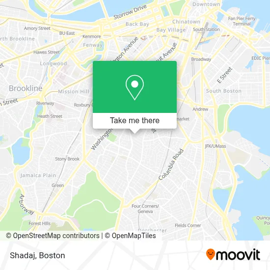
See Shadaj, Boston, on the map
Public Transit to Shadaj in Boston
Wondering how to get to Shadaj in Boston? Moovit helps you find the best way to get to Shadaj with step-by-step directions from the nearest public transit station.
Moovit provides free maps and live directions to help you navigate through your city. View schedules, routes, timetables, and find out how long does it take to get to Shadaj in real time.
Looking for the nearest stop or station to Shadaj? Check out this list of stops closest to your destination: Warren St @ Waverly St; Walnut Ave @ Rockland St; Blue Hill Ave @ Moreland St; Ruggles; Uphams Corner.
Bus: 14, 19, 23, 28, SL5, 10, 44, 45.Train: FAIRMOUNT, NEEDHAM, FRANKLIN/FOXBORO, ORANGE LINE, PROVIDENCE/STOUGHTON.Subway: ORANGE LINE, RED LINE.
Want to see if there’s another route that gets you there at an earlier time? Moovit helps you find alternative routes or times. Get directions from and directions to Shadaj easily from the Moovit App or Website.
We make riding to Shadaj easy, which is why over 1.7 million users, including users in Boston, trust Moovit as the best app for public transit. You don’t need to download an individual bus app or train app, Moovit is your all-in-one transit app that helps you find the best bus time or train time available.
For information on prices of bus, subway and train, costs and ride fares to Shadaj, please check the Moovit app.
Use the app to navigate to popular places including to the airport, hospital, stadium, grocery store, mall, coffee shop, school, college, and university.
Shadaj Address: 6 Tewksbury Street street in Boston
- JD Romero Home Cleaning,
- Xposure by Noel,
- Apartments,
- Sarah J. Baker School,
- Makings of Mo,
- Moreland Street Historic District,
- E&J Auto Tech Center and Tire: Enrique,
- Dudley Square,
- Allan Construction,
- Stacks Management,
- Analla Café,
- La Chapi Market,
- Rey del Pollo,
- Alluring Concepts Interior Design Alluring,
- Shipyard Home Health,
- Velocidad Auto Repair,
- JB Johnson Funeral Home,
- Washington Park Mall,
- Speed Boston Dating,
- One Night Stand
Places Near Shadaj (Boston)
- North End, Boston,
- Massachusetts General Hospital, Boston,
- Boston Medical Center, Boston,
- Wilbur Theatre, Boston,
- Quincy Market, Boston,
- Seaport District, Boston,
- Cheers, Boston,
- Boston Children's Hospital, Boston,
- Prudential Center, Boston,
- Td Garden, Boston,
- Castle Island, Boston,
- Mgm Music Hall, Boston,
- House Of Blues, Boston,
- Isabella Stewart Gardner Museum, Boston,
- Faneuil Hall, Boston,
- Leader Bank Pavilion (Leader Bank Pavillion), Boston,
- Boston Common, Boston,
- Boston Convention & Exhibition Center, Boston,
- Wang Theater, Boston,
- Museum Of Science, Boston
How to get to popular places in Boston with public transit
Get around Boston by public transit!
Traveling around Boston has never been so easy. See step by step directions as you travel to any attraction, street or major public transit station. View bus and train schedules, arrival times, service alerts and detailed routes on a map, so you know exactly how to get to anywhere in Boston.
When traveling to any destination around Boston use Moovit's Live Directions with Get Off Notifications to know exactly where and how far to walk, how long to wait for your line, and how many stops are left. Moovit will alert you when it's time to get off — no need to constantly re-check whether yours is the next stop.
Wondering how to use public transit in Boston or how to pay for public transit in Boston? Moovit public transit app can help you navigate your way with public transit easily, and at minimum cost. It includes public transit fees, ticket prices, and costs. Looking for a map of Boston public transit lines? Moovit public transit app shows all public transit maps in Boston with all Bus, Train, Subway and Ferry routes and stops on an interactive map.
Boston has 4 transit type(s), including: Bus, Train, Subway and Ferry, operated by several transit agencies, including MBTA, Southeastern Regional Transit Authority, MetroWest Regional Transit Authority, Rhode Island Public Transit Authority, WRTA, Lowell Regional Transit Authority, Merrimack Valley Transit, Montachusett Regional Transit Authority, Cape Cod Regional Transit Authority, Brockton Area Transit Authority, Martha's Vineyard Transit Authority, the WAVE - Nantucket Regional Transit Authority, GATRA, Cape Ann Transportation Authority and Massport