Directions to Shahi Prabhakaran, Msn Fnp-Bc (Baltimore) with public transportation
The following transit lines have routes that pass near Shahi Prabhakaran, Msn Fnp-Bc
 Bus: 26, 73, 71, CHERRY ROUTE, 70.
- Train: MARC.
- Metro: METRO.
- Light Rail: LIGHT RAILLINK.
How to get to Shahi Prabhakaran, Msn Fnp-Bc by bus?
Click on the bus route to see step by step directions with maps, line arrival times and updated time schedules.
From Walters Art Museum, Baltimore
49 minFrom I-695 @ Exit 17 (Security Blvd/MD 122), Baltimore County
49 minFrom Walmart, Baltimore County
52 minFrom Glen Burnie, MD, Anne Arundel County
55 minFrom MVA Glen Burnie, Anne Arundel County
39 minFrom NSA Friendship Annex (FANX), Anne Arundel County
61 minFrom Mva, Baltimore
59 minFrom Bwi2 Employee Shuttles, Baltimore
45 minFrom Sinai Hospital, Baltimore
52 minFrom University Of Maryland Baltimore (Umbc), Baltimore County
46 min
How to get to Shahi Prabhakaran, Msn Fnp-Bc by metro?
Click on the metro route to see step by step directions with maps, line arrival times and updated time schedules.
Bus stops near Shahi Prabhakaran, Msn Fnp-Bc in Baltimore
Train station near Shahi Prabhakaran, Msn Fnp-Bc in Baltimore
- Camden Station Marc, 25 min walk,VIEW
Light Rail stations near Shahi Prabhakaran, Msn Fnp-Bc in Baltimore
- Hamburg Street, 25 min walk,VIEW
Bus lines to Shahi Prabhakaran, Msn Fnp-Bc in Baltimore
What are the closest stations to Shahi Prabhakaran, Msn Fnp-Bc?
The closest stations to Shahi Prabhakaran, Msn Fnp-Bc are:
- Waterview Ave & Csx Nb is 256 yards away, 4 min walk.
- Cherry Hill Rd & Light Rail Sb is 256 yards away, 4 min walk.
- Cherry Hill Light Rail is 257 yards away, 4 min walk.
- Waterview Ave & Sidney Ave Opp Nb is 317 yards away, 5 min walk.
- Hollins Ferry Rd & Harman Ave Sb is 427 yards away, 6 min walk.
- Camden Station Marc is 2081 yards away, 25 min walk.
- Hamburg Street is 2113 yards away, 25 min walk.
Which bus lines stop near Shahi Prabhakaran, Msn Fnp-Bc?
These bus lines stop near Shahi Prabhakaran, Msn Fnp-Bc: 26, 73.
Which metro line stops near Shahi Prabhakaran, Msn Fnp-Bc?
METRO (Towards John Hopkins)
Which light rail line stops near Shahi Prabhakaran, Msn Fnp-Bc?
LIGHT RAILLINK (Soutbound)
What’s the nearest light rail station to Shahi Prabhakaran, Msn Fnp-Bc in Baltimore?
The nearest light rail station to Shahi Prabhakaran, Msn Fnp-Bc in Baltimore is Hamburg Street. It’s a 25 min walk away.
What’s the nearest train station to Shahi Prabhakaran, Msn Fnp-Bc in Baltimore?
The nearest train station to Shahi Prabhakaran, Msn Fnp-Bc in Baltimore is Camden Station Marc. It’s a 25 min walk away.
What’s the nearest bus station to Shahi Prabhakaran, Msn Fnp-Bc in Baltimore?
The nearest bus stations to Shahi Prabhakaran, Msn Fnp-Bc in Baltimore are Waterview Ave & Csx Nb, Cherry Hill Rd & Light Rail Sb and Cherry Hill Light Rail. The closest one is a 4 min walk away.
What time is the first light rail to Shahi Prabhakaran, Msn Fnp-Bc in Baltimore?
The LIGHT RAILLINK is the first light rail that goes to Shahi Prabhakaran, Msn Fnp-Bc in Baltimore. It stops nearby at 4:20 AM.
What time is the last light rail to Shahi Prabhakaran, Msn Fnp-Bc in Baltimore?
The LIGHT RAILLINK is the last light rail that goes to Shahi Prabhakaran, Msn Fnp-Bc in Baltimore. It stops nearby at 1:04 AM.
What time is the first train to Shahi Prabhakaran, Msn Fnp-Bc in Baltimore?
The MARC is the first train that goes to Shahi Prabhakaran, Msn Fnp-Bc in Baltimore. It stops nearby at 5:00 AM.
What time is the last train to Shahi Prabhakaran, Msn Fnp-Bc in Baltimore?
The MARC is the last train that goes to Shahi Prabhakaran, Msn Fnp-Bc in Baltimore. It stops nearby at 8:55 PM.
What time is the first bus to Shahi Prabhakaran, Msn Fnp-Bc in Baltimore?
The 73 is the first bus that goes to Shahi Prabhakaran, Msn Fnp-Bc in Baltimore. It stops nearby at 3:03 AM.
What time is the last bus to Shahi Prabhakaran, Msn Fnp-Bc in Baltimore?
The 73 is the last bus that goes to Shahi Prabhakaran, Msn Fnp-Bc in Baltimore. It stops nearby at 3:05 AM.
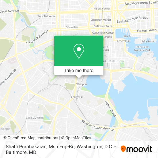
See Shahi Prabhakaran, Msn Fnp-Bc, Baltimore, on the map
Public Transit to Shahi Prabhakaran, Msn Fnp-Bc in Baltimore
Wondering how to get to Shahi Prabhakaran, Msn Fnp-Bc in Baltimore? Moovit helps you find the best way to get to Shahi Prabhakaran, Msn Fnp-Bc with step-by-step directions from the nearest public transit station.
Moovit provides free maps and live directions to help you navigate through your city. View schedules, routes, timetables, and find out how long does it take to get to Shahi Prabhakaran, Msn Fnp-Bc in real time.
Looking for the nearest stop or station to Shahi Prabhakaran, Msn Fnp-Bc? Check out this list of stops closest to your destination: Waterview Ave & Csx Nb; Cherry Hill Rd & Light Rail Sb; Cherry Hill Light Rail; Waterview Ave & Sidney Ave Opp Nb; Hollins Ferry Rd & Harman Ave Sb; Camden Station Marc; Hamburg Street.
Bus: 26, 73, 71, CHERRY ROUTE, 70, 69.Train: MARC.Metro: METRO.Light Rail: LIGHT RAILLINK.
Want to see if there’s another route that gets you there at an earlier time? Moovit helps you find alternative routes or times. Get directions from and directions to Shahi Prabhakaran, Msn Fnp-Bc easily from the Moovit App or Website.
We make riding to Shahi Prabhakaran, Msn Fnp-Bc easy, which is why over 1.7 million users, including users in Baltimore, trust Moovit as the best app for public transit. You don’t need to download an individual bus app or train app, Moovit is your all-in-one transit app that helps you find the best bus time or train time available.
For information on prices of bus, light rail and metro, costs and ride fares to Shahi Prabhakaran, Msn Fnp-Bc, please check the Moovit app.
Use the app to navigate to popular places including to the airport, hospital, stadium, grocery store, mall, coffee shop, school, college, and university.
Shahi Prabhakaran, Msn Fnp-Bc Address: 2301 Annapolis Rd street in Baltimore
- B-W Pkwy (MD 295) - Annapolis Rd (MD 648) Exit,
- Cherry Hill, Maryland,
- Maisel Ct Building 2424,
- The Baltimore VPC,
- Baltimore Downtown,
- Baltimore Greyhound Station,
- Greyhound Station,
- Greyhound-Baltimore,
- Bush St (russell street and bush),
- Second Chance,
- Entrance I-95 N,
- Horseshoe Baltimore,
- Horseshoe Casino Baltimore,
- 1401 Severn Street,
- Horseshoe Baltimore (Horseshoe Casino Baltimore),
- 1401 Severn St,
- Johnson-Satterfield Renee,
- 1410 Bush St,
- 1410 Bush Street,
- Goodwill
Places Near Shahi Prabhakaran, Msn Fnp-Bc (Baltimore)
- Marriott Marquis Washington, DC, Washington,
- Washington DC VA Medical Center, Washington,
- PG Mall, Prince George's County,
- Sibley Memorial Hospital, Washington,
- Rock Creek Tennis Center, Washington,
- Camden Yards, Baltimore,
- The Anthem, Washington,
- Warner Theatre, Washington,
- Georgetown, Washington,
- National Museum of African American History and Culture, Washington,
- Westfield Montgomery Mall, Montgomery County,
- Basilica of the National Shrine, Washington,
- Amazon Hq2, Arlington County,
- Pennsylvania Ave NW (3rd st and pennsylvania), Washington,
- M&T Bank Stadium, Baltimore,
- National Zoo, Washington,
- Capital One Arena, Washington,
- National Theatre, Washington,
- Washington National Cathedral, Washington,
- Museum Of The Bible, Washington
How to get to popular places in Washington, D.C. - Baltimore, MD with public transit
Get around Baltimore by public transit!
Traveling around Baltimore has never been so easy. See step by step directions as you travel to any attraction, street or major public transit station. View bus and train schedules, arrival times, service alerts and detailed routes on a map, so you know exactly how to get to anywhere in Baltimore.
When traveling to any destination around Baltimore use Moovit's Live Directions with Get Off Notifications to know exactly where and how far to walk, how long to wait for your line, and how many stops are left. Moovit will alert you when it's time to get off — no need to constantly re-check whether yours is the next stop.
Wondering how to use public transit in Baltimore or how to pay for public transit in Baltimore? Moovit public transit app can help you navigate your way with public transit easily, and at minimum cost. It includes public transit fees, ticket prices, and costs. Looking for a map of Baltimore public transit lines? Moovit public transit app shows all public transit maps in Baltimore with all Bus, Train, Metro, Light Rail and Ferry routes and stops on an interactive map.
Washington, D.C. - Baltimore, MD has 5 transit type(s), including: Bus, Train, Metro, Light Rail and Ferry, operated by several transit agencies, including WMATA, Montgomery County Ride On, Fairfax Connector, TheBus, PRTC, DASH - Alexandria, Arlington Transit (ART), RTA of Central Maryland, MDOT MTA, MDOT MTA Light RailLink, MDOT MTA Commuter Bus, MDOT MTA Local Bus, FXBGO!, Virginia Railway Express (VRE) and MARC