How to get to Shaping Beauty Studio by bus?
Click on the bus route to see step by step directions with maps, line arrival times and updated time schedules.
From Saint Vincent Hospital at Worcester Medical Center, Worcester
98 minFrom South High Community School, Worcester
117 minFrom Dcu Center, Worcester
70 minFrom Worcester, MA, Worcester
71 minFrom Foxwoods, Worcester
95 minFrom Polar Park, Worcester
73 minFrom St Vincent Hospital TH Medical, Worcester
73 minFrom Walmart Supercenter, Worcester
83 minFrom Registry Of Motor Vehicles (Rmv) Branch Office, Worcester
78 minFrom Palladium, Worcester
83 min
Bus stop near Shaping Beauty Studio in Sturbridge
- Big Bunny Plaza Southbridge, 17 min walk,VIEW
Bus lines to Shaping Beauty Studio in Sturbridge
What are the closest stations to Shaping Beauty Studio?
The closest stations to Shaping Beauty Studio are:
- Big Bunny Plaza Southbridge is 1425 yards away, 17 min walk.
Which bus line stops near Shaping Beauty Studio?
29 (Central Hub→Big Bunny Plaza Southbridge)
What time is the first bus to Shaping Beauty Studio in Sturbridge?
The 51 is the first bus that goes to Shaping Beauty Studio in Sturbridge. It stops nearby at 5:10 AM.
What time is the last bus to Shaping Beauty Studio in Sturbridge?
The 51 is the last bus that goes to Shaping Beauty Studio in Sturbridge. It stops nearby at 7:10 PM.
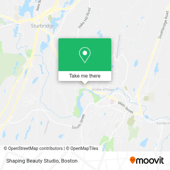
See Shaping Beauty Studio, Sturbridge, on the map
Public Transit to Shaping Beauty Studio in Sturbridge
Wondering how to get to Shaping Beauty Studio in Sturbridge? Moovit helps you find the best way to get to Shaping Beauty Studio with step-by-step directions from the nearest public transit station.
Moovit provides free maps and live directions to help you navigate through your city. View schedules, routes, timetables, and find out how long does it take to get to Shaping Beauty Studio in real time.
Looking for the nearest stop or station to Shaping Beauty Studio? Check out this list of stops closest to your destination: Big Bunny Plaza Southbridge.
Bus: 29, 51.
Want to see if there’s another route that gets you there at an earlier time? Moovit helps you find alternative routes or times. Get directions from and directions to Shaping Beauty Studio easily from the Moovit App or Website.
We make riding to Shaping Beauty Studio easy, which is why over 1.7 million users, including users in Sturbridge, trust Moovit as the best app for public transit. You don’t need to download an individual bus app or train app, Moovit is your all-in-one transit app that helps you find the best bus time or train time available.
For information on prices of bus, costs and ride fares to Shaping Beauty Studio, please check the Moovit app.
Use the app to navigate to popular places including to the airport, hospital, stadium, grocery store, mall, coffee shop, school, college, and university.
Shaping Beauty Studio Address: 21 Main St street in Sturbridge
- Old Sturbridge Village,
- Latour and Sons Trucking,
- Coin Cloud DCM,
- KeyMe,
- Dunk'n Foam It Car Was,
- Dollz,
- James Sharp,
- Ew Landscape and General Labor,
- Laser Lite, Inc.,
- Createkinc,
- Naldo Customs,
- Fresh City,
- Mildred Rodriguez,
- Massachusetts Housing Development,
- Southbridge Music Hall,
- Hamilton Mill Brick House,
- Iglesia Pentecostal Getsemani, Inc. en Southbridge, Ma.,
- Hillcrest Apiary,
- Chamberlain - Bordeau House,
- Rose Fine Alterations
Places Near Shaping Beauty Studio (Sturbridge)
- Boston Convention & Exhibition Center, Boston,
- Cheers, Boston,
- Museum Of Science, Boston,
- Castle Island, Boston,
- Quincy Market, Boston,
- Boston Medical Center, Boston,
- Isabella Stewart Gardner Museum, Boston,
- Mgm Music Hall, Boston,
- Boston Children's Hospital, Boston,
- Faneuil Hall, Boston,
- Td Garden, Boston,
- Wang Theater, Boston,
- Seaport District, Boston,
- House Of Blues, Boston,
- Wilbur Theatre, Boston,
- Leader Bank Pavilion (Leader Bank Pavillion), Boston,
- Prudential Center, Boston,
- Boston Common, Boston,
- North End, Boston,
- Massachusetts General Hospital, Boston
How to get to popular places in Boston with public transit
Get around Sturbridge by public transit!
Traveling around Sturbridge has never been so easy. See step by step directions as you travel to any attraction, street or major public transit station. View bus and train schedules, arrival times, service alerts and detailed routes on a map, so you know exactly how to get to anywhere in Sturbridge.
When traveling to any destination around Sturbridge use Moovit's Live Directions with Get Off Notifications to know exactly where and how far to walk, how long to wait for your line, and how many stops are left. Moovit will alert you when it's time to get off — no need to constantly re-check whether yours is the next stop.
Wondering how to use public transit in Sturbridge or how to pay for public transit in Sturbridge? Moovit public transit app can help you navigate your way with public transit easily, and at minimum cost. It includes public transit fees, ticket prices, and costs. Looking for a map of Sturbridge public transit lines? Moovit public transit app shows all public transit maps in Sturbridge with all Bus, Train, Subway and Ferry routes and stops on an interactive map.
Boston has 4 transit type(s), including: Bus, Train, Subway and Ferry, operated by several transit agencies, including MBTA, Southeastern Regional Transit Authority, MetroWest Regional Transit Authority, Rhode Island Public Transit Authority, WRTA, Lowell Regional Transit Authority, Merrimack Valley Transit, Montachusett Regional Transit Authority, Cape Cod Regional Transit Authority, Brockton Area Transit Authority, Martha's Vineyard Transit Authority, the WAVE - Nantucket Regional Transit Authority, GATRA, Cape Ann Transportation Authority and Massport