How to get to Shattuck Heights Hardware by bus?
Click on the bus route to see step by step directions with maps, line arrival times and updated time schedules.
From Sonia, Boston
59 minFrom Biogen, Cambridge
57 minFrom Fairfield Inn Suites by Marriott Boston Cambridge, Cambridge
48 minFrom Hewlett Room 32-G882 (MIT Stata Center), Cambridge
52 minFrom Hood Park, Boston
53 minFrom Warrior Ice Arena, Boston
58 minFrom Chevalier Theater, Medford
32 minFrom Winter Hill, Somerville
48 minFrom The Schrafft Center, Boston
52 minFrom Cambridge Hospital, Cambridge
49 min
Bus stops near Shattuck Heights Hardware in Arlington
Train stations near Shattuck Heights Hardware in Arlington
Bus lines to Shattuck Heights Hardware in Arlington
What are the closest stations to Shattuck Heights Hardware?
The closest stations to Shattuck Heights Hardware are:
- Massachusetts Ave Opp Paul Revere Rd is 16 yards away, 1 min walk.
- Massachusetts Ave Opp Appleton St is 229 yards away, 4 min walk.
- Wachusett Ave @ Appleton St is 970 yards away, 12 min walk.
- Belmont is 3989 yards away, 47 min walk.
- West Medford is 4326 yards away, 52 min walk.
Which bus line stops near Shattuck Heights Hardware?
77 (Arlington Heights)
What’s the nearest bus station to Shattuck Heights Hardware in Arlington?
The nearest bus station to Shattuck Heights Hardware in Arlington is Massachusetts Ave Opp Paul Revere Rd. It’s a 1 min walk away.
What time is the first train to Shattuck Heights Hardware in Arlington?
The LOWELL is the first train that goes to Shattuck Heights Hardware in Arlington. It stops nearby at 5:31 AM.
What time is the last train to Shattuck Heights Hardware in Arlington?
The LOWELL is the last train that goes to Shattuck Heights Hardware in Arlington. It stops nearby at 12:20 AM.
What time is the first bus to Shattuck Heights Hardware in Arlington?
The 77 is the first bus that goes to Shattuck Heights Hardware in Arlington. It stops nearby at 4:49 AM.
What time is the last bus to Shattuck Heights Hardware in Arlington?
The 77 is the last bus that goes to Shattuck Heights Hardware in Arlington. It stops nearby at 1:29 AM.
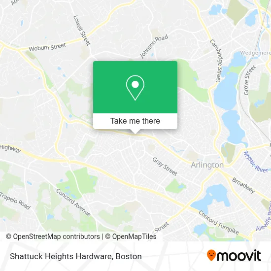
See Shattuck Heights Hardware, Arlington, on the map
Public Transit to Shattuck Heights Hardware in Arlington
Wondering how to get to Shattuck Heights Hardware in Arlington? Moovit helps you find the best way to get to Shattuck Heights Hardware with step-by-step directions from the nearest public transit station.
Moovit provides free maps and live directions to help you navigate through your city. View schedules, routes, timetables, and find out how long does it take to get to Shattuck Heights Hardware in real time.
Looking for the nearest stop or station to Shattuck Heights Hardware? Check out this list of stops closest to your destination: Massachusetts Ave Opp Paul Revere Rd; Massachusetts Ave Opp Appleton St; Wachusett Ave @ Appleton St; Belmont; West Medford.
Bus: 77, 62, 78.Train: FITCHBURG, LOWELL.
Want to see if there’s another route that gets you there at an earlier time? Moovit helps you find alternative routes or times. Get directions from and directions to Shattuck Heights Hardware easily from the Moovit App or Website.
We make riding to Shattuck Heights Hardware easy, which is why over 1.7 million users, including users in Arlington, trust Moovit as the best app for public transit. You don’t need to download an individual bus app or train app, Moovit is your all-in-one transit app that helps you find the best bus time or train time available.
For information on prices of bus and subway, costs and ride fares to Shattuck Heights Hardware, please check the Moovit app.
Use the app to navigate to popular places including to the airport, hospital, stadium, grocery store, mall, coffee shop, school, college, and university.
Shattuck Heights Hardware Address: 1298 Massachusetts Ave street in Arlington
- Penzeys Spices,
- Arlington Heights Chriopractc Office,
- The Wholesome Hair,
- RB Ace Disposal,
- Boston Pizza,
- Fiesta Bites Pizzeria,
- Myeyedr.,
- Jitterbugs,
- Road Warrior Moving,
- Shred Nations,
- Ugandan North American Association - Unaa,
- Kds Productions,
- 28 Litsea,
- Xfinity,
- Rephairations,
- Forced Exposure,
- Personal Safety,
- James Trano Realtor Arlington Real Estate Senn Re,
- Victoria Painting of Massachusetts,
- Nextburb
Places Near Shattuck Heights Hardware (Arlington)
- Mgm Music Hall, Boston,
- Quincy Market, Boston,
- Boston Common, Boston,
- Boston Medical Center, Boston,
- North End, Boston,
- Td Garden, Boston,
- Seaport District, Boston,
- Isabella Stewart Gardner Museum, Boston,
- Cheers, Boston,
- Boston Children's Hospital, Boston,
- Prudential Center, Boston,
- Massachusetts General Hospital, Boston,
- Leader Bank Pavilion (Leader Bank Pavillion), Boston,
- Museum Of Science, Boston,
- House Of Blues, Boston,
- Wilbur Theatre, Boston,
- Wang Theater, Boston,
- Boston Convention & Exhibition Center, Boston,
- Castle Island, Boston,
- Faneuil Hall, Boston
How to get to popular places in Boston with public transit
Get around Arlington by public transit!
Traveling around Arlington has never been so easy. See step by step directions as you travel to any attraction, street or major public transit station. View bus and train schedules, arrival times, service alerts and detailed routes on a map, so you know exactly how to get to anywhere in Arlington.
When traveling to any destination around Arlington use Moovit's Live Directions with Get Off Notifications to know exactly where and how far to walk, how long to wait for your line, and how many stops are left. Moovit will alert you when it's time to get off — no need to constantly re-check whether yours is the next stop.
Wondering how to use public transit in Arlington or how to pay for public transit in Arlington? Moovit public transit app can help you navigate your way with public transit easily, and at minimum cost. It includes public transit fees, ticket prices, and costs. Looking for a map of Arlington public transit lines? Moovit public transit app shows all public transit maps in Arlington with all Bus, Train, Subway and Ferry routes and stops on an interactive map.
Boston has 4 transit type(s), including: Bus, Train, Subway and Ferry, operated by several transit agencies, including MBTA, Southeastern Regional Transit Authority, MetroWest Regional Transit Authority, Rhode Island Public Transit Authority, WRTA, Lowell Regional Transit Authority, Merrimack Valley Transit, Montachusett Regional Transit Authority, Cape Cod Regional Transit Authority, Brockton Area Transit Authority, Martha's Vineyard Transit Authority, the WAVE - Nantucket Regional Transit Authority, GATRA, Cape Ann Transportation Authority and Massport