Directions to Shawn Mcgee (Newburyport) with public transportation
The following transit lines have routes that pass near Shawn Mcgee
 Bus: 11, 20, 19.
- Train: NEWBURYPORT/ROCKPORT.
How to get to Shawn Mcgee by bus?
Click on the bus route to see step by step directions with maps, line arrival times and updated time schedules.
How to get to Shawn Mcgee by train?
Click on the train route to see step by step directions with maps, line arrival times and updated time schedules.
Bus stops near Shawn Mcgee in Newburyport
Train station near Shawn Mcgee in Newburyport
- Newburyport, 20 min walk,VIEW
Bus lines to Shawn Mcgee in Newburyport
What are the closest stations to Shawn Mcgee?
The closest stations to Shawn Mcgee are:
- State Street & High Street is 440 yards away, 6 min walk.
- Pond Street - Cvs is 499 yards away, 6 min walk.
- Newburyport is 1695 yards away, 20 min walk.
Which bus lines stop near Shawn Mcgee?
These bus lines stop near Shawn Mcgee: 11, 20.
Which train line stops near Shawn Mcgee?
NEWBURYPORT/ROCKPORT (#131 | Newburyport)
What’s the nearest train station to Shawn Mcgee in Newburyport?
The nearest train station to Shawn Mcgee in Newburyport is Newburyport. It’s a 20 min walk away.
What’s the nearest bus station to Shawn Mcgee in Newburyport?
The nearest bus stations to Shawn Mcgee in Newburyport are State Street & High Street and Pond Street - Cvs. The closest one is a 6 min walk away.
What time is the first train to Shawn Mcgee in Newburyport?
The NEWBURYPORT/ROCKPORT is the first train that goes to Shawn Mcgee in Newburyport. It stops nearby at 4:48 AM.
What time is the last train to Shawn Mcgee in Newburyport?
The NEWBURYPORT/ROCKPORT is the last train that goes to Shawn Mcgee in Newburyport. It stops nearby at 1:03 AM.
What time is the first bus to Shawn Mcgee in Newburyport?
The 20 is the first bus that goes to Shawn Mcgee in Newburyport. It stops nearby at 5:20 AM.
What time is the last bus to Shawn Mcgee in Newburyport?
The 11 is the last bus that goes to Shawn Mcgee in Newburyport. It stops nearby at 7:35 PM.
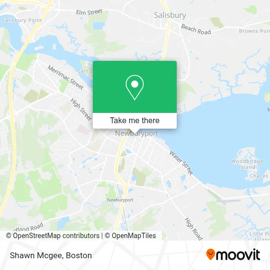
See Shawn Mcgee, Newburyport, on the map
Public Transit to Shawn Mcgee in Newburyport
Wondering how to get to Shawn Mcgee in Newburyport? Moovit helps you find the best way to get to Shawn Mcgee with step-by-step directions from the nearest public transit station.
Moovit provides free maps and live directions to help you navigate through your city. View schedules, routes, timetables, and find out how long does it take to get to Shawn Mcgee in real time.
Looking for the nearest stop or station to Shawn Mcgee? Check out this list of stops closest to your destination: State Street & High Street; Pond Street - Cvs; Newburyport.
Bus: 11, 20, 19.Train: NEWBURYPORT/ROCKPORT.
Want to see if there’s another route that gets you there at an earlier time? Moovit helps you find alternative routes or times. Get directions from and directions to Shawn Mcgee easily from the Moovit App or Website.
We make riding to Shawn Mcgee easy, which is why over 1.7 million users, including users in Newburyport, trust Moovit as the best app for public transit. You don’t need to download an individual bus app or train app, Moovit is your all-in-one transit app that helps you find the best bus time or train time available.
For information on prices of bus and train, costs and ride fares to Shawn Mcgee, please check the Moovit app.
Use the app to navigate to popular places including to the airport, hospital, stadium, grocery store, mall, coffee shop, school, college, and university.
Shawn Mcgee Address: 44 Merrimac St street in Newburyport
- FedEx Drop Box,
- We Put Heroes in Homes,
- Law Offices of Jffryl Roelofs,
- Atlantic Designworks,
- Innova Services Corporation,
- Ecco Global Holdings,
- Primary Residential Mortgage,
- Ethernet Direct,
- Value Source Global,
- Armstrong Field Real Estate,
- Benefits Assure,
- Alcea Collection,
- Newburyport Ale,
- Constellation Health Services,
- Plum Island Beach,
- Newburyport Development,
- Plum Island Coffee,
- Christine Sosa-Re / Max on the River,
- The East Imports,
- Newburyport, Massachusetts
Places Near Shawn Mcgee (Newburyport)
- Quincy Market, Boston,
- Museum Of Science, Boston,
- Td Garden, Boston,
- Wang Theater, Boston,
- Boston Children's Hospital, Boston,
- Castle Island, Boston,
- Wilbur Theatre, Boston,
- Massachusetts General Hospital, Boston,
- Cheers, Boston,
- Prudential Center, Boston,
- Faneuil Hall, Boston,
- Boston Common, Boston,
- Boston Convention & Exhibition Center, Boston,
- Mgm Music Hall, Boston,
- Boston Medical Center, Boston,
- House Of Blues, Boston,
- Isabella Stewart Gardner Museum, Boston,
- North End, Boston,
- Seaport District, Boston,
- Leader Bank Pavilion (Leader Bank Pavillion), Boston
How to get to popular places in Boston with public transit
Get around Newburyport by public transit!
Traveling around Newburyport has never been so easy. See step by step directions as you travel to any attraction, street or major public transit station. View bus and train schedules, arrival times, service alerts and detailed routes on a map, so you know exactly how to get to anywhere in Newburyport.
When traveling to any destination around Newburyport use Moovit's Live Directions with Get Off Notifications to know exactly where and how far to walk, how long to wait for your line, and how many stops are left. Moovit will alert you when it's time to get off — no need to constantly re-check whether yours is the next stop.
Wondering how to use public transit in Newburyport or how to pay for public transit in Newburyport? Moovit public transit app can help you navigate your way with public transit easily, and at minimum cost. It includes public transit fees, ticket prices, and costs. Looking for a map of Newburyport public transit lines? Moovit public transit app shows all public transit maps in Newburyport with all Bus, Train, Subway and Ferry routes and stops on an interactive map.
Boston has 4 transit type(s), including: Bus, Train, Subway and Ferry, operated by several transit agencies, including MBTA, Southeastern Regional Transit Authority, MetroWest Regional Transit Authority, Rhode Island Public Transit Authority, WRTA, Lowell Regional Transit Authority, Merrimack Valley Transit, Montachusett Regional Transit Authority, Cape Cod Regional Transit Authority, Brockton Area Transit Authority, Martha's Vineyard Transit Authority, the WAVE - Nantucket Regional Transit Authority, GATRA, Cape Ann Transportation Authority and Massport