Directions to Shaws #3507 (Melrose) with public transportation
The following transit lines have routes that pass near Shaws #3507
 Bus: 137, 131, HAVERHILL LINE SHUTTLE, HAVERHILL LINE SHUTTLE, HAVERHILL LINE SHUTTLE.
- Train: HAVERHILL, ORANGE LINE.
- Subway: ORANGE LINE.
How to get to Shaws #3507 by bus?
Click on the bus route to see step by step directions with maps, line arrival times and updated time schedules.
From Embassy Suites by Hilton Boston at Logan Airport, Boston
72 minFrom Fairfield Inn Suites by Marriott Boston Cambridge, Cambridge
91 minFrom Boston North Station, Boston
90 minFrom Galleria Mall, Cambridge
97 minFrom Chelsea, MA, Chelsea
60 minFrom Royal Sonesta Hotel, Cambridge
99 minFrom Harvard University, Cambridge
79 minFrom Crowne Plaza Boston - Woburn, Woburn
96 minFrom Inman Square, Cambridge
94 minFrom Embassy Suites-Boston, Boston
73 min
How to get to Shaws #3507 by train?
Click on the train route to see step by step directions with maps, line arrival times and updated time schedules.
How to get to Shaws #3507 by subway?
Click on the subway route to see step by step directions with maps, line arrival times and updated time schedules.
From Embassy Suites by Hilton Boston at Logan Airport, Boston
69 minFrom Fairfield Inn Suites by Marriott Boston Cambridge, Cambridge
61 minFrom Boston North Station, Boston
52 minFrom Galleria Mall, Cambridge
58 minFrom Royal Sonesta Hotel, Cambridge
58 minFrom Harvard University, Cambridge
72 minFrom Inman Square, Cambridge
72 minFrom Embassy Suites-Boston, Boston
69 min
Bus stops near Shaws #3507 in Melrose
Train station near Shaws #3507 in Melrose
- Oak Grove, 31 min walk,VIEW
Bus lines to Shaws #3507 in Melrose
- 137, Malden,VIEW
- 131, Malden Via Oak Grove,VIEW
- HAVERHILL LINE SHUTTLE, Ballardvale - Malden Center,VIEW
- HAVERHILL LINE SHUTTLE, Reading - Oak Grove,VIEW
- HAVERHILL LINE SHUTTLE, Haverhill - Malden Center,VIEW
- HAVERHILL LINE SHUTTLE, Haverhill - North Station,VIEW
- HAVERHILL LINE SHUTTLE, Ballardvale - North Station,VIEW
- HAVERHILL, Haverhill,VIEW
What are the closest stations to Shaws #3507?
The closest stations to Shaws #3507 are:
- Main St @ Upham St is 4 yards away, 1 min walk.
- Upham St @ Main St is 45 yards away, 1 min walk.
- Melrose/Cedar Park is 620 yards away, 8 min walk.
- Oak Grove is 2631 yards away, 31 min walk.
Which bus line stops near Shaws #3507?
137 (Reading Depot)
Which train line stops near Shaws #3507?
HAVERHILL (#223 | Haverhill)
Which subway line stops near Shaws #3507?
ORANGE LINE (Oak Grove)
What’s the nearest bus station to Shaws #3507 in Melrose?
The nearest bus stations to Shaws #3507 in Melrose are Main St @ Upham St and Upham St @ Main St. The closest one is a 1 min walk away.
What time is the first subway to Shaws #3507 in Melrose?
The ORANGE LINE is the first subway that goes to Shaws #3507 in Melrose. It stops nearby at 5:15 AM.
What time is the last subway to Shaws #3507 in Melrose?
The ORANGE LINE is the last subway that goes to Shaws #3507 in Melrose. It stops nearby at 1:59 AM.
What time is the first train to Shaws #3507 in Melrose?
The HAVERHILL is the first train that goes to Shaws #3507 in Melrose. It stops nearby at 5:31 AM.
What time is the last train to Shaws #3507 in Melrose?
The HAVERHILL is the last train that goes to Shaws #3507 in Melrose. It stops nearby at 11:57 PM.
What time is the first bus to Shaws #3507 in Melrose?
The 137 is the first bus that goes to Shaws #3507 in Melrose. It stops nearby at 5:00 AM.
What time is the last bus to Shaws #3507 in Melrose?
The 137 is the last bus that goes to Shaws #3507 in Melrose. It stops nearby at 10:55 PM.
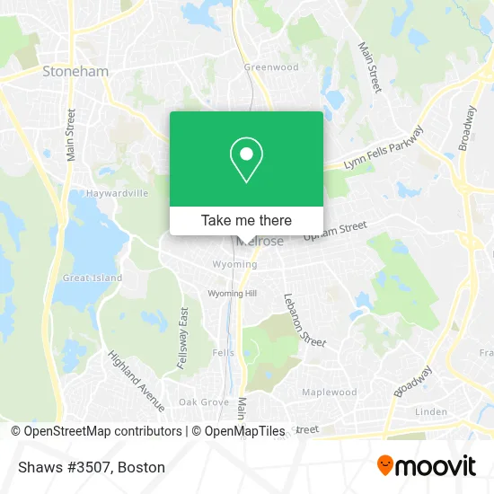
See Shaws #3507, Melrose, on the map
Public Transit to Shaws #3507 in Melrose
Wondering how to get to Shaws #3507 in Melrose? Moovit helps you find the best way to get to Shaws #3507 with step-by-step directions from the nearest public transit station.
Moovit provides free maps and live directions to help you navigate through your city. View schedules, routes, timetables, and find out how long does it take to get to Shaws #3507 in real time.
Looking for the nearest stop or station to Shaws #3507? Check out this list of stops closest to your destination: Main St @ Upham St; Upham St @ Main St; Melrose/Cedar Park; Oak Grove.
Bus: 137, 131, HAVERHILL LINE SHUTTLE, HAVERHILL LINE SHUTTLE, HAVERHILL LINE SHUTTLE, HAVERHILL LINE SHUTTLE, HAVERHILL LINE SHUTTLE.Train: HAVERHILL, ORANGE LINE.Subway: ORANGE LINE.
Want to see if there’s another route that gets you there at an earlier time? Moovit helps you find alternative routes or times. Get directions from and directions to Shaws #3507 easily from the Moovit App or Website.
We make riding to Shaws #3507 easy, which is why over 1.7 million users, including users in Melrose, trust Moovit as the best app for public transit. You don’t need to download an individual bus app or train app, Moovit is your all-in-one transit app that helps you find the best bus time or train time available.
For information on prices of bus, subway and train, costs and ride fares to Shaws #3507, please check the Moovit app.
Use the app to navigate to popular places including to the airport, hospital, stadium, grocery store, mall, coffee shop, school, college, and university.
Shaws #3507 Address: 34 Essex St street in Melrose
- Northeast School Of Ballet,
- RZN,
- Global Express Tours (Montreal Express),
- Julie A Ventola Attorney,
- Melrose MA USA,
- Melrose, Massachusetts,
- West Emerson,
- Journal of Abdominal Surgery,
- Coinstar,
- Melrose, MA,
- ADT,
- Hanna Yapikhina, PMHNP,
- Grace and Faith Christian Church,
- Follow Your Art Community Studios,
- Southern Baptist Convention,
- MBTA Melrose Cedar Park Station,
- Mollys Bookstore,
- USPS Collection Box - Blue Box,
- Eric S Schreiber, MD, PC,
- Trinity Episcopal Church (Trinity Church Thrift Shop)
Places Near Shaws #3507 (Melrose)
- Massachusetts General Hospital, Boston,
- Boston Convention & Exhibition Center, Boston,
- House Of Blues, Boston,
- Boston Common, Boston,
- Quincy Market, Boston,
- Leader Bank Pavilion (Leader Bank Pavillion), Boston,
- Boston Medical Center, Boston,
- Seaport District, Boston,
- Faneuil Hall, Boston,
- Castle Island, Boston,
- Prudential Center, Boston,
- Cheers, Boston,
- Wang Theater, Boston,
- Wilbur Theatre, Boston,
- Td Garden, Boston,
- North End, Boston,
- Museum Of Science, Boston,
- Mgm Music Hall, Boston,
- Isabella Stewart Gardner Museum, Boston,
- Boston Children's Hospital, Boston
How to get to popular places in Boston with public transit
Get around Melrose by public transit!
Traveling around Melrose has never been so easy. See step by step directions as you travel to any attraction, street or major public transit station. View bus and train schedules, arrival times, service alerts and detailed routes on a map, so you know exactly how to get to anywhere in Melrose.
When traveling to any destination around Melrose use Moovit's Live Directions with Get Off Notifications to know exactly where and how far to walk, how long to wait for your line, and how many stops are left. Moovit will alert you when it's time to get off — no need to constantly re-check whether yours is the next stop.
Wondering how to use public transit in Melrose or how to pay for public transit in Melrose? Moovit public transit app can help you navigate your way with public transit easily, and at minimum cost. It includes public transit fees, ticket prices, and costs. Looking for a map of Melrose public transit lines? Moovit public transit app shows all public transit maps in Melrose with all Bus, Train, Subway and Ferry routes and stops on an interactive map.
Boston has 4 transit type(s), including: Bus, Train, Subway and Ferry, operated by several transit agencies, including MBTA, Southeastern Regional Transit Authority, MetroWest Regional Transit Authority, Rhode Island Public Transit Authority, WRTA, Lowell Regional Transit Authority, Merrimack Valley Transit, Montachusett Regional Transit Authority, Cape Cod Regional Transit Authority, Brockton Area Transit Authority, Martha's Vineyard Transit Authority, the WAVE - Nantucket Regional Transit Authority, GATRA, Cape Ann Transportation Authority and Massport