Directions to Shaws #4496 (Beverly) with public transportation
The following transit lines have routes that pass near Shaws #4496
How to get to Shaws #4496 by bus?
Click on the bus route to see step by step directions with maps, line arrival times and updated time schedules.
How to get to Shaws #4496 by train?
Click on the train route to see step by step directions with maps, line arrival times and updated time schedules.
Bus stops near Shaws #4496 in Beverly
Train station near Shaws #4496 in Beverly
- Montserrat, 44 min walk,VIEW
Bus lines to Shaws #4496 in Beverly
What are the closest stations to Shaws #4496?
The closest stations to Shaws #4496 are:
- Dodge St @ Conant St is 343 yards away, 5 min walk.
- North Beverly is 717 yards away, 9 min walk.
- North Beverly Plaza - Shaw's is 1830 yards away, 22 min walk.
- Montserrat is 3704 yards away, 44 min walk.
Which bus lines stop near Shaws #4496?
These bus lines stop near Shaws #4496: 451, CITY OF BEVERLY SHUTTLE.
Which train line stops near Shaws #4496?
NEWBURYPORT/ROCKPORT (#27 | Rockport)
What’s the nearest bus station to Shaws #4496 in Beverly?
The nearest bus station to Shaws #4496 in Beverly is Dodge St @ Conant St. It’s a 5 min walk away.
What time is the first train to Shaws #4496 in Beverly?
The NEWBURYPORT/ROCKPORT is the first train that goes to Shaws #4496 in Beverly. It stops nearby at 5:07 AM.
What time is the last train to Shaws #4496 in Beverly?
The NEWBURYPORT/ROCKPORT is the last train that goes to Shaws #4496 in Beverly. It stops nearby at 12:40 AM.
What time is the first bus to Shaws #4496 in Beverly?
The 451 is the first bus that goes to Shaws #4496 in Beverly. It stops nearby at 6:33 AM.
What time is the last bus to Shaws #4496 in Beverly?
The 451 is the last bus that goes to Shaws #4496 in Beverly. It stops nearby at 7:26 PM.
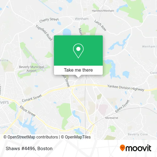
See Shaws #4496, Beverly, on the map
Public Transit to Shaws #4496 in Beverly
Wondering how to get to Shaws #4496 in Beverly? Moovit helps you find the best way to get to Shaws #4496 with step-by-step directions from the nearest public transit station.
Moovit provides free maps and live directions to help you navigate through your city. View schedules, routes, timetables, and find out how long does it take to get to Shaws #4496 in real time.
Looking for the nearest stop or station to Shaws #4496? Check out this list of stops closest to your destination: Dodge St @ Conant St; North Beverly; North Beverly Plaza - Shaw's; Montserrat.
Bus: 451, CITY OF BEVERLY SHUTTLE, NEWBURYPORT LINE SHUTTLE, NEWBURYPORT LINE SHUTTLE, NEWBURYPORT LINE SHUTTLE.Train: NEWBURYPORT/ROCKPORT.
Want to see if there’s another route that gets you there at an earlier time? Moovit helps you find alternative routes or times. Get directions from and directions to Shaws #4496 easily from the Moovit App or Website.
We make riding to Shaws #4496 easy, which is why over 1.7 million users, including users in Beverly, trust Moovit as the best app for public transit. You don’t need to download an individual bus app or train app, Moovit is your all-in-one transit app that helps you find the best bus time or train time available.
For information on prices of bus and train, costs and ride fares to Shaws #4496, please check the Moovit app.
Use the app to navigate to popular places including to the airport, hospital, stadium, grocery store, mall, coffee shop, school, college, and university.
Shaws #4496 Address: 71 Dodge St street in Beverly
- Starbucks,
- Russell Cellular,
- Talented Plumbing Service Plumbers,
- Coinstar - Bitcoin ATM,
- Teal Homeschool,
- Amazon Locker-Tabioda,
- Door To Door Long Distance Moving,
- Mary Harper at Guaranteed Rate Affinity,
- ADT 24 7 Alarm & Security,
- David Brown, the Gentleman Realtor,
- Beverly Medicare Insurance,
- Family Plans Medicare,
- Amazon Locker-Nades,
- Shred Nations,
- Personal Injury Beverly Lawyer,
- Athina's Salon,
- Phenix Salon Suites Beverly,
- Patrick Meehan - TD Wealth Financial Advisor,
- Hair Chix,
- A & 24 Hour Locksmith
Places Near Shaws #4496 (Beverly)
- Cheers, Boston,
- Quincy Market, Boston,
- North End, Boston,
- House Of Blues, Boston,
- Castle Island, Boston,
- Museum Of Science, Boston,
- Boston Children's Hospital, Boston,
- Faneuil Hall, Boston,
- Td Garden, Boston,
- Boston Convention & Exhibition Center, Boston,
- Boston Common, Boston,
- Massachusetts General Hospital, Boston,
- Wilbur Theatre, Boston,
- Isabella Stewart Gardner Museum, Boston,
- Wang Theater, Boston,
- Mgm Music Hall, Boston,
- Seaport District, Boston,
- Prudential Center, Boston,
- Leader Bank Pavilion (Leader Bank Pavillion), Boston,
- Boston Medical Center, Boston
How to get to popular places in Boston with public transit
Get around Beverly by public transit!
Traveling around Beverly has never been so easy. See step by step directions as you travel to any attraction, street or major public transit station. View bus and train schedules, arrival times, service alerts and detailed routes on a map, so you know exactly how to get to anywhere in Beverly.
When traveling to any destination around Beverly use Moovit's Live Directions with Get Off Notifications to know exactly where and how far to walk, how long to wait for your line, and how many stops are left. Moovit will alert you when it's time to get off — no need to constantly re-check whether yours is the next stop.
Wondering how to use public transit in Beverly or how to pay for public transit in Beverly? Moovit public transit app can help you navigate your way with public transit easily, and at minimum cost. It includes public transit fees, ticket prices, and costs. Looking for a map of Beverly public transit lines? Moovit public transit app shows all public transit maps in Beverly with all Bus, Train, Subway and Ferry routes and stops on an interactive map.
Boston has 4 transit type(s), including: Bus, Train, Subway and Ferry, operated by several transit agencies, including MBTA, Southeastern Regional Transit Authority, MetroWest Regional Transit Authority, Rhode Island Public Transit Authority, WRTA, Lowell Regional Transit Authority, Merrimack Valley Transit, Montachusett Regional Transit Authority, Cape Cod Regional Transit Authority, Brockton Area Transit Authority, Martha's Vineyard Transit Authority, the WAVE - Nantucket Regional Transit Authority, GATRA, Cape Ann Transportation Authority and Massport