How to get to She Knows Ink by bus?
Click on the bus route to see step by step directions with maps, line arrival times and updated time schedules.
From Copley Place, Boston
69 minFrom Google, Cambridge
53 minFrom Boston Children's Hospital, Boston
79 minFrom The Salty Pig, Boston
70 minFrom Track 7 (MBTA Back Bay Station), Boston
69 minFrom Brigham & Women's Hospital, Boston
74 minFrom DoubleTree Suites by Hilton Hotel Boston - Cambridge, Boston
58 minFrom Newbury Boston, Boston
71 minFrom John Hancock Tower (200 Clarendon), Boston
69 minFrom Acorn Street, Boston
81 min
How to get to She Knows Ink by train?
Click on the train route to see step by step directions with maps, line arrival times and updated time schedules.
How to get to She Knows Ink by subway?
Click on the subway route to see step by step directions with maps, line arrival times and updated time schedules.
From Copley Place, Boston
77 minFrom Google, Cambridge
64 minFrom Boston Children's Hospital, Boston
96 minFrom The Salty Pig, Boston
78 minFrom Track 7 (MBTA Back Bay Station), Boston
77 minFrom Brigham & Women's Hospital, Boston
95 minFrom DoubleTree Suites by Hilton Hotel Boston - Cambridge, Boston
78 minFrom Newbury Boston, Boston
76 minFrom John Hancock Tower (200 Clarendon), Boston
80 minFrom Acorn Street, Boston
72 min
Bus stops near She Knows Ink in Belmont
Train stations near She Knows Ink in Belmont
Subway station near She Knows Ink in Belmont
- Alewife, 45 min walk,VIEW
Bus lines to She Knows Ink in Belmont
What are the closest stations to She Knows Ink?
The closest stations to She Knows Ink are:
- Concord Ave Opp Orchard St is 1012 yards away, 12 min walk.
- Belmont is 1471 yards away, 18 min walk.
- West Medford is 2650 yards away, 31 min walk.
- Alewife is 3799 yards away, 45 min walk.
- Waverley is 4018 yards away, 48 min walk.
Which bus lines stop near She Knows Ink?
These bus lines stop near She Knows Ink: 74, 75.
Which train line stops near She Knows Ink?
FITCHBURG (#409 | Wachusett)
Which subway line stops near She Knows Ink?
RED LINE (Alewife)
What’s the nearest bus station to She Knows Ink in Belmont?
The nearest bus station to She Knows Ink in Belmont is Concord Ave Opp Orchard St. It’s a 12 min walk away.
What time is the first subway to She Knows Ink in Belmont?
The RED LINE is the first subway that goes to She Knows Ink in Belmont. It stops nearby at 5:15 AM.
What time is the last subway to She Knows Ink in Belmont?
The RED LINE is the last subway that goes to She Knows Ink in Belmont. It stops nearby at 2:06 AM.
What time is the first train to She Knows Ink in Belmont?
The LOWELL is the first train that goes to She Knows Ink in Belmont. It stops nearby at 5:31 AM.
What time is the last train to She Knows Ink in Belmont?
The LOWELL is the last train that goes to She Knows Ink in Belmont. It stops nearby at 12:20 AM.
What time is the first bus to She Knows Ink in Belmont?
The 74 is the first bus that goes to She Knows Ink in Belmont. It stops nearby at 5:10 AM.
What time is the last bus to She Knows Ink in Belmont?
The 74 is the last bus that goes to She Knows Ink in Belmont. It stops nearby at 1:28 AM.
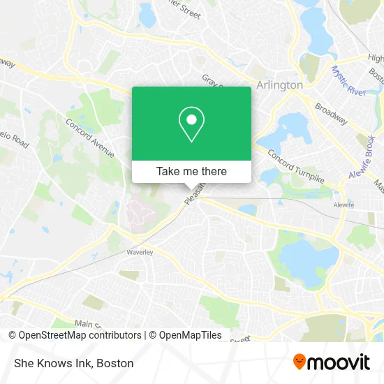
See She Knows Ink, Belmont, on the map
Public Transit to She Knows Ink in Belmont
Wondering how to get to She Knows Ink in Belmont? Moovit helps you find the best way to get to She Knows Ink with step-by-step directions from the nearest public transit station.
Moovit provides free maps and live directions to help you navigate through your city. View schedules, routes, timetables, and find out how long does it take to get to She Knows Ink in real time.
Looking for the nearest stop or station to She Knows Ink? Check out this list of stops closest to your destination: Concord Ave Opp Orchard St; Belmont; West Medford; Alewife; Waverley.
Bus: 74, 75, FITCHBURG LINE SHUTTLE.Train: FITCHBURG, LOWELL.Subway: RED LINE.
Want to see if there’s another route that gets you there at an earlier time? Moovit helps you find alternative routes or times. Get directions from and directions to She Knows Ink easily from the Moovit App or Website.
We make riding to She Knows Ink easy, which is why over 1.7 million users, including users in Belmont, trust Moovit as the best app for public transit. You don’t need to download an individual bus app or train app, Moovit is your all-in-one transit app that helps you find the best bus time or train time available.
For information on prices of bus, subway and train, costs and ride fares to She Knows Ink, please check the Moovit app.
Use the app to navigate to popular places including to the airport, hospital, stadium, grocery store, mall, coffee shop, school, college, and university.
Location: Belmont, Boston
- Elliot Daniels Electrician,
- Belmont Food Pantry,
- Belmont High School,
- Belmont MA USA,
- Joan E Horgan, DMD,
- CJ Car Wash,
- Like My House,
- Avantguard Locksmith,
- Koca Hair Design,
- Cheeky Monkey Home,
- Kabloom,
- Jozsef Daniels Portrait Studio,
- Codemakers,
- Waverly MBTA station,
- Craft Beer Cellar Belmont,
- Presidential Carpet Cleaning,
- Luke Secura Locksmith,
- Emergency Locksmith Available 24 7,
- Coco-Belmont Store,
- Butternut Bakehouse
Places Near She Knows Ink (Belmont)
- Castle Island, Boston,
- North End, Boston,
- Td Garden, Boston,
- House Of Blues, Boston,
- Leader Bank Pavilion (Leader Bank Pavillion), Boston,
- Boston Common, Boston,
- Mgm Music Hall, Boston,
- Wang Theater, Boston,
- Boston Children's Hospital, Boston,
- Museum Of Science, Boston,
- Massachusetts General Hospital, Boston,
- Boston Medical Center, Boston,
- Seaport District, Boston,
- Prudential Center, Boston,
- Faneuil Hall, Boston,
- Quincy Market, Boston,
- Isabella Stewart Gardner Museum, Boston,
- Boston Convention & Exhibition Center, Boston,
- Cheers, Boston,
- Wilbur Theatre, Boston
How to get to popular places in Boston with public transit
Get around Belmont by public transit!
Traveling around Belmont has never been so easy. See step by step directions as you travel to any attraction, street or major public transit station. View bus and train schedules, arrival times, service alerts and detailed routes on a map, so you know exactly how to get to anywhere in Belmont.
When traveling to any destination around Belmont use Moovit's Live Directions with Get Off Notifications to know exactly where and how far to walk, how long to wait for your line, and how many stops are left. Moovit will alert you when it's time to get off — no need to constantly re-check whether yours is the next stop.
Wondering how to use public transit in Belmont or how to pay for public transit in Belmont? Moovit public transit app can help you navigate your way with public transit easily, and at minimum cost. It includes public transit fees, ticket prices, and costs. Looking for a map of Belmont public transit lines? Moovit public transit app shows all public transit maps in Belmont with all Bus, Train, Subway and Ferry routes and stops on an interactive map.
Boston has 4 transit type(s), including: Bus, Train, Subway and Ferry, operated by several transit agencies, including MBTA, Southeastern Regional Transit Authority, MetroWest Regional Transit Authority, Rhode Island Public Transit Authority, WRTA, Lowell Regional Transit Authority, Merrimack Valley Transit, Montachusett Regional Transit Authority, Cape Cod Regional Transit Authority, Brockton Area Transit Authority, Martha's Vineyard Transit Authority, the WAVE - Nantucket Regional Transit Authority, GATRA, Cape Ann Transportation Authority and Massport