See Sheepshead Bay, New York, New York - New Jersey, on the map
Directions to Sheepshead Bay, New York (New York - New Jersey) with public transportation
The following transit lines have routes that pass near Sheepshead Bay, New York
 Bus:
Bus: - Subway:
How to get to Sheepshead Bay, New York by bus?
Click on the bus route to see step by step directions with maps, line arrival times and updated time schedules.
How to get to Sheepshead Bay, New York by subway?
Click on the subway route to see step by step directions with maps, line arrival times and updated time schedules.
Subway stations near Sheepshead Bay, New York in New York - New Jersey
- Brighton Beach,1 min walk,
Bus stations near Sheepshead Bay, New York in New York - New Jersey
- Avenue Z/Bedford Av,4 min walk,
- Avenue X / Bedford Av,4 min walk,
- Nostrand Av/Avenue Y,6 min walk,
- Ocean Av/Avenue Y,6 min walk,
Bus lines to Sheepshead Bay, New York in New York - New Jersey
- B36,Sheepshead Bay Avenue U,
- BM3,Midtown 57 St Via Church St Via Madison Av,
- B44,Emmons Av,
- B49,Bed-Stuy Fulton St Via Ocean Via Rogers,
What are the closest stations to Sheepshead Bay, New York?
The closest stations to Sheepshead Bay, New York are:
- Brighton Beach is 26 yards away, 1 min walk.
- Avenue Z/Bedford Av is 258 yards away, 4 min walk.
- Avenue X / Bedford Av is 304 yards away, 4 min walk.
- Nostrand Av/Avenue Y is 476 yards away, 6 min walk.
- Ocean Av/Avenue Y is 498 yards away, 6 min walk.
Which bus lines stop near Sheepshead Bay, New York?
These bus lines stop near Sheepshead Bay, New York: B36, B44, B44-SBS.
Which subway lines stop near Sheepshead Bay, New York?
These subway lines stop near Sheepshead Bay, New York: B, Q.
What’s the nearest subway station to Sheepshead Bay, New York in New York - New Jersey?
The nearest subway station to Sheepshead Bay, New York in New York - New Jersey is Brighton Beach. It’s a 1 min walk away.
What’s the nearest bus stop to Sheepshead Bay, New York in New York - New Jersey?
The nearest bus stops to Sheepshead Bay, New York in New York - New Jersey are Avenue Z/Bedford Av and Avenue X / Bedford Av. The closest one is a 4 min walk away.
What time is the first subway to Sheepshead Bay, New York in New York - New Jersey?
The Q is the first subway that goes to Sheepshead Bay, New York in New York - New Jersey. It stops nearby at 3:02 AM.
What time is the last subway to Sheepshead Bay, New York in New York - New Jersey?
The Q is the last subway that goes to Sheepshead Bay, New York in New York - New Jersey. It stops nearby at 3:45 AM.
What time is the first bus to Sheepshead Bay, New York in New York - New Jersey?
The B44 is the first bus that goes to Sheepshead Bay, New York in New York - New Jersey. It stops nearby at 3:04 AM.
What time is the last bus to Sheepshead Bay, New York in New York - New Jersey?
The B36 is the last bus that goes to Sheepshead Bay, New York in New York - New Jersey. It stops nearby at 2:57 AM.
How much is the bus fare to Sheepshead Bay, New York?
The bus fare to Sheepshead Bay, New York costs about $2.90.
How much is the subway fare to Sheepshead Bay, New York?
The subway fare to Sheepshead Bay, New York costs about $2.90.
See Sheepshead Bay, New York, New York - New Jersey, on the map
Public Transit to Sheepshead Bay, New York in New York - New Jersey
Wondering how to get to Sheepshead Bay, New York in New York - New Jersey, United States? Moovit helps you find the best way to get to Sheepshead Bay, New York with step-by-step directions from the nearest public transit station.
Moovit provides free maps and live directions to help you navigate through your city. View schedules, routes, timetables, and find out how long does it take to get to Sheepshead Bay, New York in real time.
Looking for the nearest stop or station to Sheepshead Bay, New York? Check out this list of stops closest to your destination: Brighton Beach; Avenue Z/Bedford Av; Avenue X / Bedford Av; Nostrand Av/Avenue Y; Ocean Av/Avenue Y.
Bus:Subway:
Want to see if there’s another route that gets you there at an earlier time? Moovit helps you find alternative routes or times. Get directions from and directions to Sheepshead Bay, New York easily from the Moovit App or Website.
We make riding to Sheepshead Bay, New York easy, which is why over 1.5 million users, including users in New York - New Jersey, trust Moovit as the best app for public transit. You don’t need to download an individual bus app or train app, Moovit is your all-in-one transit app that helps you find the best bus time or train time available.
For information on prices of subway and bus, costs and ride fares to Sheepshead Bay, New York, please check the Moovit app.
Use the app to navigate to popular places including to the airport, hospital, stadium, grocery store, mall, coffee shop, school, college, and university.
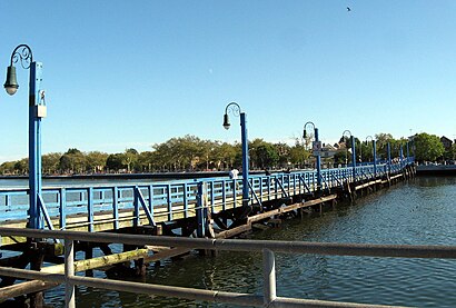
Sheepshead Bay, New York Address: Brooklyn, NY 11223 street in New York - New Jersey
Attractions near Sheepshead Bay, New York
Sheepshead Bay,Mikeneat,Public Restroom,Ave Y & E 23rd St,Domotics,E 26th Street,World of Tax,Avenue Z (bedford ave & Avenue Z),Koifman CPA and Associates,Bedford Park,USPS Collection Box - Blue Box,Emergency Service 24 / 7 Go To Portfolio,Israel Congregation Machne,Andy's Murphy Bed,Iturbu,2401 Avenue X (Avenue X,2401),Lobo 1,Avenue Z (avenue z east 28th st),Bounceback Botanicals,Equine Bandaflex BandagesHow to get to popular attractions in New York - New Jersey with public transit
Gregory's Coffee, Manhattan,Peter Luger Steak House,Atlantic City, NJ, Atlantic City, Nj,Culture Espresso, Manhattan,Clinton St. Baking Co. & Restaurant, Manhattan,High Line, Manhattan,Doughnut Plant, Manhattan,Nan Xiang Xiao Long Bao, Queens,Mad Dog & Beans Mexican Cantina, Manhattan,LIRR - Babylon Station, Babylon, Ny,Hair of the Dog, Manhattan,New Jersey Turnpike - Newark, Newark, Nj,Stout, Manhattan,Upper West Side, Manhattan,Eataly, Manhattan,The 13th Step, Manhattan,Jersey Shore University Medical Center, Neptune, Nj,Tacombi at Fonda Nolita, Manhattan,Joe's Shanghai 鹿嗚春, Manhattan,Gramercy Tavern, ManhattanGet around New York - New Jersey by public transit!
Traveling around New York - New Jersey has never been so easy. See step by step directions as you travel to any attraction, street or major public transit station. View bus and train schedules, arrival times, service alerts and detailed routes on a map, so you know exactly how to get to anywhere in New York - New Jersey.
When traveling to any destination around New York - New Jersey use Moovit's Live Directions with Get Off Notifications to know exactly where and how far to walk, how long to wait for your line, and how many stops are left. Moovit will alert you when it's time to get off — no need to constantly re-check whether yours is the next stop.
Wondering how to use public transit in New York - New Jersey or how to pay for public transit in New York - New Jersey? Moovit public transit app can help you navigate your way with public transit easily, and at minimum cost. It includes public transit fees, ticket prices, and costs. Looking for a map of New York - New Jersey public transit lines? Moovit public transit app shows all public transit maps in New York - New Jersey with all subway or bus routes and stops on an interactive map.
New York - New Jersey has 2 transit type(s), including: subway or bus, operated by several transit agencies, including MTA Subway, Metro-North Railroad, LIRR, PATH, Shore Line East, MTA Bus Company, MTA New York City Transit - Express routes, MTA Bus, NJ Transit, NYC Ferry, NICE bus, Bee-Line Bus, NJ Transit Rail, NJ Transit Rail and Norwalk Transit District