Directions to Shield System Car Wash And Detail Center (Boston) with public transportation
The following transit lines have routes that pass near Shield System Car Wash And Detail Center
 Bus: 70, 86, 66, WORCESTER LINE SHUTTLE, WORCESTER LINE SHUTTLE.
- Train: FITCHBURG, FRAMINGHAM/WORCESTER.
- Subway: GREEN LINE B, RED LINE.
How to get to Shield System Car Wash And Detail Center by bus?
Click on the bus route to see step by step directions with maps, line arrival times and updated time schedules.
From Massachusetts General Hospital, Boston
52 minFrom Melrose Wakefield Hospital, Malden
94 minFrom VA Hospital, Boston
67 minFrom Hyatt Centric Faneuil, Boston
45 minFrom Medford Square, Medford
49 minFrom I-95 / Route 128 & Route 16 Interchange (Exit 21), Newton
76 minFrom Boston Marriott Newton, Newton
67 minFrom West Roxbury VA Medical Center, Boston
70 minFrom Copley Square, Boston
28 minFrom Godfrey Hotel Boston, Boston
44 min
How to get to Shield System Car Wash And Detail Center by train?
Click on the train route to see step by step directions with maps, line arrival times and updated time schedules.
From Massachusetts General Hospital, Boston
56 minFrom Melrose Wakefield Hospital, Malden
142 minFrom VA Hospital, Boston
82 minFrom Hyatt Centric Faneuil, Boston
40 minFrom I-95 / Route 128 & Route 16 Interchange (Exit 21), Newton
55 minFrom Boston Marriott Newton, Newton
38 minFrom West Roxbury VA Medical Center, Boston
84 minFrom Copley Square, Boston
32 minFrom Godfrey Hotel Boston, Boston
40 min
How to get to Shield System Car Wash And Detail Center by subway?
Click on the subway route to see step by step directions with maps, line arrival times and updated time schedules.
From Massachusetts General Hospital, Boston
46 minFrom Melrose Wakefield Hospital, Malden
72 minFrom Hyatt Centric Faneuil, Boston
47 minFrom Medford Square, Medford
90 minFrom I-95 / Route 128 & Route 16 Interchange (Exit 21), Newton
78 minFrom Boston Marriott Newton, Newton
90 minFrom Copley Square, Boston
49 minFrom Godfrey Hotel Boston, Boston
45 min
Bus stops near Shield System Car Wash And Detail Center in Boston
Subway station near Shield System Car Wash And Detail Center in Boston
- Warren Street, 6 min walk,VIEW
Bus lines to Shield System Car Wash And Detail Center in Boston
What are the closest stations to Shield System Car Wash And Detail Center?
The closest stations to Shield System Car Wash And Detail Center are:
- N Harvard St @ Kingsley St is 152 yards away, 2 min walk.
- Western Ave @ N Harvard St is 367 yards away, 5 min walk.
- 450 Western Ave is 376 yards away, 5 min walk.
- Warren Street is 491 yards away, 6 min walk.
- Boston Landing is 575 yards away, 7 min walk.
Which bus lines stop near Shield System Car Wash And Detail Center?
These bus lines stop near Shield System Car Wash And Detail Center: 70, 86.
Which train lines stop near Shield System Car Wash And Detail Center?
These train lines stop near Shield System Car Wash And Detail Center: FITCHBURG, FRAMINGHAM/WORCESTER.
Which subway lines stop near Shield System Car Wash And Detail Center?
These subway lines stop near Shield System Car Wash And Detail Center: GREEN LINE B, RED LINE.
What’s the nearest subway station to Shield System Car Wash And Detail Center in Boston?
The nearest subway station to Shield System Car Wash And Detail Center in Boston is Warren Street. It’s a 6 min walk away.
What’s the nearest bus station to Shield System Car Wash And Detail Center in Boston?
The nearest bus station to Shield System Car Wash And Detail Center in Boston is N Harvard St @ Kingsley St. It’s a 2 min walk away.
What time is the first subway to Shield System Car Wash And Detail Center in Boston?
The GREEN LINE B is the first subway that goes to Shield System Car Wash And Detail Center in Boston. It stops nearby at 5:12 AM.
What time is the last subway to Shield System Car Wash And Detail Center in Boston?
The GREEN LINE B is the last subway that goes to Shield System Car Wash And Detail Center in Boston. It stops nearby at 2:28 AM.
What time is the first train to Shield System Car Wash And Detail Center in Boston?
The FRAMINGHAM/WORCESTER is the first train that goes to Shield System Car Wash And Detail Center in Boston. It stops nearby at 5:00 AM.
What time is the last train to Shield System Car Wash And Detail Center in Boston?
The FRAMINGHAM/WORCESTER is the last train that goes to Shield System Car Wash And Detail Center in Boston. It stops nearby at 12:12 AM.
What time is the first bus to Shield System Car Wash And Detail Center in Boston?
The 70 is the first bus that goes to Shield System Car Wash And Detail Center in Boston. It stops nearby at 4:31 AM.
What time is the last bus to Shield System Car Wash And Detail Center in Boston?
The 66 is the last bus that goes to Shield System Car Wash And Detail Center in Boston. It stops nearby at 2:29 AM.
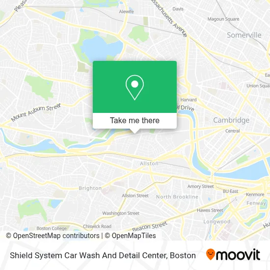
See Shield System Car Wash And Detail Center, Boston, on the map
Public Transit to Shield System Car Wash And Detail Center in Boston
Wondering how to get to Shield System Car Wash And Detail Center in Boston? Moovit helps you find the best way to get to Shield System Car Wash And Detail Center with step-by-step directions from the nearest public transit station.
Moovit provides free maps and live directions to help you navigate through your city. View schedules, routes, timetables, and find out how long does it take to get to Shield System Car Wash And Detail Center in real time.
Looking for the nearest stop or station to Shield System Car Wash And Detail Center? Check out this list of stops closest to your destination: N Harvard St @ Kingsley St; Western Ave @ N Harvard St; 450 Western Ave; Warren Street; Boston Landing.
Bus: 70, 86, 66, WORCESTER LINE SHUTTLE, WORCESTER LINE SHUTTLE, FRAMINGHAM/WORCESTER.Train: FITCHBURG, FRAMINGHAM/WORCESTER.Subway: GREEN LINE B, RED LINE.
Want to see if there’s another route that gets you there at an earlier time? Moovit helps you find alternative routes or times. Get directions from and directions to Shield System Car Wash And Detail Center easily from the Moovit App or Website.
We make riding to Shield System Car Wash And Detail Center easy, which is why over 1.7 million users, including users in Boston, trust Moovit as the best app for public transit. You don’t need to download an individual bus app or train app, Moovit is your all-in-one transit app that helps you find the best bus time or train time available.
For information on prices of bus, subway and train, costs and ride fares to Shield System Car Wash And Detail Center, please check the Moovit app.
Use the app to navigate to popular places including to the airport, hospital, stadium, grocery store, mall, coffee shop, school, college, and university.
Shield System Car Wash And Detail Center Address: 365 Western Ave street in Boston
- Josephine A. Fiorentino Community Center,
- Shields Mri Brighton,
- Spring Shabu Shabu,
- Skating Club Of Boston,
- Days Hotel-Boston (Studio Allston Hotel),
- Petco,
- Miki Miki Japanese Sushi Restaurant (Maki Maki Japanese Sushi and Seafood Buffet Restaurant),
- Brighton Mills Plaza,
- Studio Allston,
- Artesani Park Wading Pool,
- Artesani Park,
- Brighton Mills Shopping Center,
- Boston Fire Department Special Operations Training Center,
- German International School Boston (GISBOS),
- St Anthony Catholic Church,
- Gardner Pilot Academy (Thomas Gardner School),
- Gordon Indoor Track- Harvard University,
- WBZ-TV ( CBS ),
- Christian A Herter Park,
- School St & S Waverly St
Places Near Shield System Car Wash And Detail Center (Boston)
- Leader Bank Pavilion (Leader Bank Pavillion), Boston,
- Prudential Center, Boston,
- Faneuil Hall, Boston,
- Quincy Market, Boston,
- Td Garden, Boston,
- Cheers, Boston,
- Mgm Music Hall, Boston,
- Wang Theater, Boston,
- Boston Convention & Exhibition Center, Boston,
- Massachusetts General Hospital, Boston,
- Isabella Stewart Gardner Museum, Boston,
- Boston Children's Hospital, Boston,
- Wilbur Theatre, Boston,
- North End, Boston,
- House Of Blues, Boston,
- Museum Of Science, Boston,
- Boston Medical Center, Boston,
- Boston Common, Boston,
- Castle Island, Boston,
- Seaport District, Boston
How to get to popular places in Boston with public transit
Get around Boston by public transit!
Traveling around Boston has never been so easy. See step by step directions as you travel to any attraction, street or major public transit station. View bus and train schedules, arrival times, service alerts and detailed routes on a map, so you know exactly how to get to anywhere in Boston.
When traveling to any destination around Boston use Moovit's Live Directions with Get Off Notifications to know exactly where and how far to walk, how long to wait for your line, and how many stops are left. Moovit will alert you when it's time to get off — no need to constantly re-check whether yours is the next stop.
Wondering how to use public transit in Boston or how to pay for public transit in Boston? Moovit public transit app can help you navigate your way with public transit easily, and at minimum cost. It includes public transit fees, ticket prices, and costs. Looking for a map of Boston public transit lines? Moovit public transit app shows all public transit maps in Boston with all Bus, Train, Subway and Ferry routes and stops on an interactive map.
Boston has 4 transit type(s), including: Bus, Train, Subway and Ferry, operated by several transit agencies, including MBTA, Southeastern Regional Transit Authority, MetroWest Regional Transit Authority, Rhode Island Public Transit Authority, WRTA, Lowell Regional Transit Authority, Merrimack Valley Transit, Montachusett Regional Transit Authority, Cape Cod Regional Transit Authority, Brockton Area Transit Authority, Martha's Vineyard Transit Authority, the WAVE - Nantucket Regional Transit Authority, GATRA, Cape Ann Transportation Authority and Massport