Directions to Shields Mri (Worcester) with public transportation
The following transit lines have routes that pass near Shields Mri
 Bus: 14, 15, CLINTON-WORCESTER COMMUTER SHUTTLE, GREYHOUND US0230, 24.
- Train: FRAMINGHAM/WORCESTER.
How to get to Shields Mri by bus?
Click on the bus route to see step by step directions with maps, line arrival times and updated time schedules.
Bus stops near Shields Mri in Worcester
What are the closest stations to Shields Mri?
The closest stations to Shields Mri are:
- Shrewsbury St at Waite St is 12 yards away, 1 min walk.
- Seabury Heights is 860 yards away, 11 min walk.
Which bus lines stop near Shields Mri?
These bus lines stop near Shields Mri: 14, 15, CLINTON-WORCESTER COMMUTER SHUTTLE, GREYHOUND US0230.
Which train line stops near Shields Mri?
FRAMINGHAM/WORCESTER (#525 | Worcester)
What’s the nearest bus station to Shields Mri in Worcester?
The nearest bus station to Shields Mri in Worcester is Shrewsbury St at Waite St. It’s a 1 min walk away.
What time is the first bus to Shields Mri in Worcester?
The 15 is the first bus that goes to Shields Mri in Worcester. It stops nearby at 5:21 AM.
What time is the last bus to Shields Mri in Worcester?
The 15 is the last bus that goes to Shields Mri in Worcester. It stops nearby at 9:20 PM.
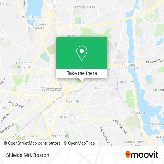
See Shields Mri, Worcester, on the map
Public Transit to Shields Mri in Worcester
Wondering how to get to Shields Mri in Worcester? Moovit helps you find the best way to get to Shields Mri with step-by-step directions from the nearest public transit station.
Moovit provides free maps and live directions to help you navigate through your city. View schedules, routes, timetables, and find out how long does it take to get to Shields Mri in real time.
Looking for the nearest stop or station to Shields Mri? Check out this list of stops closest to your destination: Shrewsbury St at Waite St; Seabury Heights.
Bus: 14, 15, CLINTON-WORCESTER COMMUTER SHUTTLE, GREYHOUND US0230, 24.Train: FRAMINGHAM/WORCESTER.
Want to see if there’s another route that gets you there at an earlier time? Moovit helps you find alternative routes or times. Get directions from and directions to Shields Mri easily from the Moovit App or Website.
We make riding to Shields Mri easy, which is why over 1.7 million users, including users in Worcester, trust Moovit as the best app for public transit. You don’t need to download an individual bus app or train app, Moovit is your all-in-one transit app that helps you find the best bus time or train time available.
For information on prices of bus and train, costs and ride fares to Shields Mri, please check the Moovit app.
Use the app to navigate to popular places including to the airport, hospital, stadium, grocery store, mall, coffee shop, school, college, and university.
Shields Mri Address: 214 Shrewsbury St street in Worcester
- Shelly Taft LPN, Ibclc,
- Lexy Lynch Acupuncturist,
- Sage & Grace an Organic Salon,
- Tampa Hair Replacement,
- Zia Young Adult Access Center at the Kiva Center & Open Sky,
- Lights Banquet Hall,
- Law Offices of Maria D Rivera,
- Mexicali Cantina and Grill,
- Home Decor Group-Worce,
- Nilda's Day Spa,
- Woo Bus Stop,
- New Image Auto Body,
- Shrewsbury Street, Massachusetts,
- Thyme Herbal Apothe,
- Wave Dental,
- Flashbomb,
- Sisters of Saint Joseph,
- Phoenix Detailing,
- Mls Property Information Network, Inc.,
- The Diroberto Team
Places Near Shields Mri (Worcester)
- Prudential Center, Boston,
- Castle Island, Boston,
- North End, Boston,
- Seaport District, Boston,
- House Of Blues, Boston,
- Boston Convention & Exhibition Center, Boston,
- Quincy Market, Boston,
- Td Garden, Boston,
- Faneuil Hall, Boston,
- Boston Medical Center, Boston,
- Mgm Music Hall, Boston,
- Museum Of Science, Boston,
- Cheers, Boston,
- Leader Bank Pavilion (Leader Bank Pavillion), Boston,
- Wang Theater, Boston,
- Massachusetts General Hospital, Boston,
- Wilbur Theatre, Boston,
- Boston Children's Hospital, Boston,
- Boston Common, Boston,
- Isabella Stewart Gardner Museum, Boston
How to get to popular places in Boston with public transit
Get around Worcester by public transit!
Traveling around Worcester has never been so easy. See step by step directions as you travel to any attraction, street or major public transit station. View bus and train schedules, arrival times, service alerts and detailed routes on a map, so you know exactly how to get to anywhere in Worcester.
When traveling to any destination around Worcester use Moovit's Live Directions with Get Off Notifications to know exactly where and how far to walk, how long to wait for your line, and how many stops are left. Moovit will alert you when it's time to get off — no need to constantly re-check whether yours is the next stop.
Wondering how to use public transit in Worcester or how to pay for public transit in Worcester? Moovit public transit app can help you navigate your way with public transit easily, and at minimum cost. It includes public transit fees, ticket prices, and costs. Looking for a map of Worcester public transit lines? Moovit public transit app shows all public transit maps in Worcester with all Bus, Train, Subway and Ferry routes and stops on an interactive map.
Boston has 4 transit type(s), including: Bus, Train, Subway and Ferry, operated by several transit agencies, including MBTA, Southeastern Regional Transit Authority, MetroWest Regional Transit Authority, Rhode Island Public Transit Authority, WRTA, Lowell Regional Transit Authority, Merrimack Valley Transit, Montachusett Regional Transit Authority, Cape Cod Regional Transit Authority, Brockton Area Transit Authority, Martha's Vineyard Transit Authority, the WAVE - Nantucket Regional Transit Authority, GATRA, Cape Ann Transportation Authority and Massport