Directions to Shirley Eat More Sunshine (Somerville) with public transportation
The following transit lines have routes that pass near Shirley Eat More Sunshine
 Bus: 87, 88, 89, 96, 90.
- Train: FITCHBURG.
- Subway: RED LINE, GREEN LINE B, GREEN LINE C, GREEN LINE E.
How to get to Shirley Eat More Sunshine by bus?
Click on the bus route to see step by step directions with maps, line arrival times and updated time schedules.
From Wang Theater, Boston
58 minFrom PwC, Boston
59 minFrom Uscis Biometrics Office, Revere
74 minFrom Beth Israel Hospital, Boston
49 minFrom 7F Everett Street, Revere
73 minFrom The Strand Theater, Boston
85 minFrom Newton, MA, Newton
86 minFrom Comfort Inn & Suites Logan International Airport, Revere
76 minFrom Beth Israel Deaconess Medical Center Is, Boston
54 minFrom Showa Boston Institute, Boston
95 min
How to get to Shirley Eat More Sunshine by subway?
Click on the subway route to see step by step directions with maps, line arrival times and updated time schedules.
From Wang Theater, Boston
29 minFrom PwC, Boston
39 minFrom Uscis Biometrics Office, Revere
60 minFrom Beth Israel Hospital, Boston
53 minFrom 7F Everett Street, Revere
59 minFrom The Strand Theater, Boston
53 minFrom Newton, MA, Newton
67 minFrom Comfort Inn & Suites Logan International Airport, Revere
61 minFrom Beth Israel Deaconess Medical Center Is, Boston
37 min
Bus stops near Shirley Eat More Sunshine in Somerville
Subway stations near Shirley Eat More Sunshine in Somerville
Train station near Shirley Eat More Sunshine in Somerville
- Porter, 19 min walk,VIEW
Bus lines to Shirley Eat More Sunshine in Somerville
- 87, Arlington Center,VIEW
- 88, Lechmere,VIEW
- 90, Assembly,VIEW
- 89, Sullivan,VIEW
- 94, Davis,VIEW
- 96, Medford Square,VIEW
- RED LINE SHUTTLE, Alewife - Park Street,VIEW
- RED LINE SHUTTLE, Alewife - Harvard via Brattle Street,VIEW
- RED LINE SHUTTLE, Alewife - Davis,VIEW
- RED LINE SHUTTLE, Alewife - Harvard via Holyoke Street,VIEW
- RED LINE SHUTTLE, Alewife - Kendall/MIT,VIEW
- 89/93, Haymarket Via Sullivan,VIEW
What are the closest stations to Shirley Eat More Sunshine?
The closest stations to Shirley Eat More Sunshine are:
- Holland St @ Simpson Ave is 44 yards away, 1 min walk.
- Highland Ave @ Cutter Ave is 243 yards away, 3 min walk.
- Grove St @ Highland Ave is 249 yards away, 3 min walk.
- Holland St @ Dover St is 287 yards away, 4 min walk.
- Davis Sq. is 288 yards away, 4 min walk.
- Broadway @ Simpson Ave is 374 yards away, 5 min walk.
- Ball Square Station is 1424 yards away, 17 min walk.
- Porter is 1532 yards away, 19 min walk.
Which bus lines stop near Shirley Eat More Sunshine?
These bus lines stop near Shirley Eat More Sunshine: 87, 88, 89, 96.
Which subway line stops near Shirley Eat More Sunshine?
RED LINE (Alewife)
What’s the nearest subway station to Shirley Eat More Sunshine in Somerville?
The nearest subway station to Shirley Eat More Sunshine in Somerville is Davis Sq.. It’s a 4 min walk away.
What’s the nearest train station to Shirley Eat More Sunshine in Somerville?
The nearest train station to Shirley Eat More Sunshine in Somerville is Porter. It’s a 19 min walk away.
What’s the nearest bus station to Shirley Eat More Sunshine in Somerville?
The nearest bus station to Shirley Eat More Sunshine in Somerville is Holland St @ Simpson Ave. It’s a 1 min walk away.
What time is the first subway to Shirley Eat More Sunshine in Somerville?
The GREEN LINE E is the first subway that goes to Shirley Eat More Sunshine in Somerville. It stops nearby at 4:53 AM.
What time is the last subway to Shirley Eat More Sunshine in Somerville?
The GREEN LINE E is the last subway that goes to Shirley Eat More Sunshine in Somerville. It stops nearby at 2:41 AM.
What time is the first train to Shirley Eat More Sunshine in Somerville?
The FITCHBURG is the first train that goes to Shirley Eat More Sunshine in Somerville. It stops nearby at 5:47 AM.
What time is the last train to Shirley Eat More Sunshine in Somerville?
The FITCHBURG is the last train that goes to Shirley Eat More Sunshine in Somerville. It stops nearby at 12:17 AM.
What time is the first bus to Shirley Eat More Sunshine in Somerville?
The 89/93 is the first bus that goes to Shirley Eat More Sunshine in Somerville. It stops nearby at 4:33 AM.
What time is the last bus to Shirley Eat More Sunshine in Somerville?
The 89 is the last bus that goes to Shirley Eat More Sunshine in Somerville. It stops nearby at 1:39 AM.
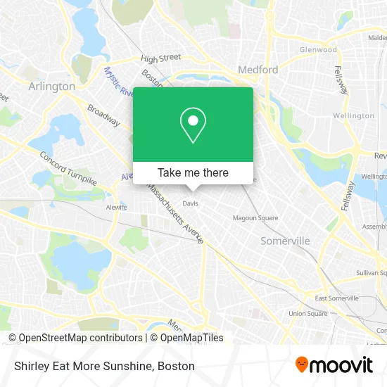
See Shirley Eat More Sunshine, Somerville, on the map
Public Transit to Shirley Eat More Sunshine in Somerville
Wondering how to get to Shirley Eat More Sunshine in Somerville? Moovit helps you find the best way to get to Shirley Eat More Sunshine with step-by-step directions from the nearest public transit station.
Moovit provides free maps and live directions to help you navigate through your city. View schedules, routes, timetables, and find out how long does it take to get to Shirley Eat More Sunshine in real time.
Looking for the nearest stop or station to Shirley Eat More Sunshine? Check out this list of stops closest to your destination: Holland St @ Simpson Ave; Highland Ave @ Cutter Ave; Grove St @ Highland Ave; Holland St @ Dover St; Davis Sq.; Broadway @ Simpson Ave; Ball Square Station; Porter.
Bus: 87, 88, 89, 96, 90, 94.Train: FITCHBURG.Subway: RED LINE, GREEN LINE B, GREEN LINE C, GREEN LINE E.
Want to see if there’s another route that gets you there at an earlier time? Moovit helps you find alternative routes or times. Get directions from and directions to Shirley Eat More Sunshine easily from the Moovit App or Website.
We make riding to Shirley Eat More Sunshine easy, which is why over 1.7 million users, including users in Somerville, trust Moovit as the best app for public transit. You don’t need to download an individual bus app or train app, Moovit is your all-in-one transit app that helps you find the best bus time or train time available.
For information on prices of subway and bus, costs and ride fares to Shirley Eat More Sunshine, please check the Moovit app.
Use the app to navigate to popular places including to the airport, hospital, stadium, grocery store, mall, coffee shop, school, college, and university.
Shirley Eat More Sunshine Address: 22 College Ave street in Somerville
- The Braces Place,
- Sofia A Ostrer,
- Dental Surgery of Massachusetts,
- Gardner Bassett, DMD,
- 4 College Ave Parking,
- Navy Federal Credit Union,
- Isaac Baker Locksmiths,
- Casablanca Barber Shop,
- Somerville Housing Aut,
- Most Holy Redeemer Rectory,
- MBTA Davis Square Station,
- Boston Rental Exchange, Inc.,
- Psychic Sessions,
- Tarley Taylor,
- Saigon Tiger,
- Middlesex Federal Savings Bank,
- Davis Station MBTA,
- Sommerville Theatre,
- Mike's Food and Spirits,
- Used Sound
Places Near Shirley Eat More Sunshine (Somerville)
- Boston Children's Hospital, Boston,
- Wang Theater, Boston,
- Quincy Market, Boston,
- House Of Blues, Boston,
- Td Garden, Boston,
- Boston Common, Boston,
- Boston Medical Center, Boston,
- Boston Convention & Exhibition Center, Boston,
- Wilbur Theatre, Boston,
- Faneuil Hall, Boston,
- Castle Island, Boston,
- Museum Of Science, Boston,
- Isabella Stewart Gardner Museum, Boston,
- North End, Boston,
- Massachusetts General Hospital, Boston,
- Cheers, Boston,
- Seaport District, Boston,
- Leader Bank Pavilion (Leader Bank Pavillion), Boston,
- Mgm Music Hall, Boston,
- Prudential Center, Boston
How to get to popular places in Boston with public transit
Get around Somerville by public transit!
Traveling around Somerville has never been so easy. See step by step directions as you travel to any attraction, street or major public transit station. View bus and train schedules, arrival times, service alerts and detailed routes on a map, so you know exactly how to get to anywhere in Somerville.
When traveling to any destination around Somerville use Moovit's Live Directions with Get Off Notifications to know exactly where and how far to walk, how long to wait for your line, and how many stops are left. Moovit will alert you when it's time to get off — no need to constantly re-check whether yours is the next stop.
Wondering how to use public transit in Somerville or how to pay for public transit in Somerville? Moovit public transit app can help you navigate your way with public transit easily, and at minimum cost. It includes public transit fees, ticket prices, and costs. Looking for a map of Somerville public transit lines? Moovit public transit app shows all public transit maps in Somerville with all Bus, Train, Subway and Ferry routes and stops on an interactive map.
Boston has 4 transit type(s), including: Bus, Train, Subway and Ferry, operated by several transit agencies, including MBTA, Southeastern Regional Transit Authority, MetroWest Regional Transit Authority, Rhode Island Public Transit Authority, WRTA, Lowell Regional Transit Authority, Merrimack Valley Transit, Montachusett Regional Transit Authority, Cape Cod Regional Transit Authority, Brockton Area Transit Authority, Martha's Vineyard Transit Authority, the WAVE - Nantucket Regional Transit Authority, GATRA, Cape Ann Transportation Authority and Massport