Directions to Shk Music (Boston) with public transportation
The following transit lines have routes that pass near Shk Music
 Bus: 19, 201, 210, 215, 202.
- Subway: RED LINE, MATTAPAN LINE.
- Ferry: QUINCY FERRY, WINTHROP/QUINCY FERRY.
How to get to Shk Music by bus?
Click on the bus route to see step by step directions with maps, line arrival times and updated time schedules.
From Boston Common Visitor Center, Boston
72 minFrom Whole Foods, Boston
70 minFrom rmv Braintree, Braintree Town
71 minFrom Brighton Music Hall, Boston
100 minFrom Cheers, Boston
78 minFrom West Roxbury, Boston
71 minFrom Wentworth Institute Of Technology, Boston
65 minFrom Kkkk, Boston
136 minFrom Downeast Cider House, Boston
130 minFrom Bunker Hill, Boston
137 min
How to get to Shk Music by subway?
Click on the subway route to see step by step directions with maps, line arrival times and updated time schedules.
Bus stops near Shk Music in Boston
Ferry station near Shk Music in Boston
- Quincy, 10 min walk,VIEW
Bus lines to Shk Music in Boston
What are the closest stations to Shk Music?
The closest stations to Shk Music are:
- Puritan Mall Service Rd is 95 yards away, 2 min walk.
- 248 Neponset Ave is 487 yards away, 6 min walk.
- Quincy is 780 yards away, 10 min walk.
- North Quincy is 1017 yards away, 12 min walk.
- Cedar Grove is 1714 yards away, 21 min walk.
Which bus lines stop near Shk Music?
These bus lines stop near Shk Music: 19, 201, 210, 215.
Which subway line stops near Shk Music?
RED LINE (Alewife)
What’s the nearest subway station to Shk Music in Boston?
The nearest subway station to Shk Music in Boston is North Quincy. It’s a 12 min walk away.
What’s the nearest bus station to Shk Music in Boston?
The nearest bus station to Shk Music in Boston is Puritan Mall Service Rd. It’s a 2 min walk away.
What’s the nearest ferry station to Shk Music in Boston?
The nearest ferry station to Shk Music in Boston is Quincy. It’s a 10 min walk away.
What time is the first subway to Shk Music in Boston?
The MATTAPAN LINE is the first subway that goes to Shk Music in Boston. It stops nearby at 5:10 AM.
What time is the last subway to Shk Music in Boston?
The MATTAPAN LINE is the last subway that goes to Shk Music in Boston. It stops nearby at 2:31 AM.
What time is the first bus to Shk Music in Boston?
The 210 is the first bus that goes to Shk Music in Boston. It stops nearby at 5:12 AM.
What time is the last bus to Shk Music in Boston?
The 210 is the last bus that goes to Shk Music in Boston. It stops nearby at 1:06 AM.
What time is the first ferry to Shk Music in Boston?
The QUINCY FERRY is the first ferry that goes to Shk Music in Boston. It stops nearby at 6:15 AM.
What time is the last ferry to Shk Music in Boston?
The QUINCY FERRY is the last ferry that goes to Shk Music in Boston. It stops nearby at 8:55 PM.
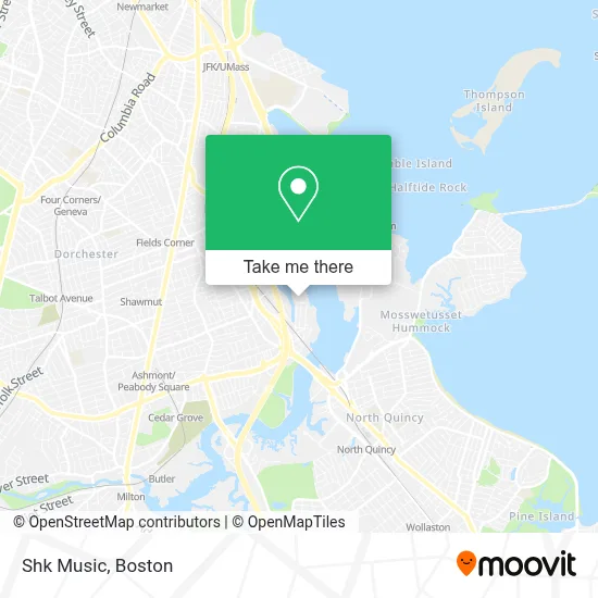
See Shk Music, Boston, on the map
Public Transit to Shk Music in Boston
Wondering how to get to Shk Music in Boston? Moovit helps you find the best way to get to Shk Music with step-by-step directions from the nearest public transit station.
Moovit provides free maps and live directions to help you navigate through your city. View schedules, routes, timetables, and find out how long does it take to get to Shk Music in real time.
Looking for the nearest stop or station to Shk Music? Check out this list of stops closest to your destination: Puritan Mall Service Rd; 248 Neponset Ave; Quincy; North Quincy; Cedar Grove.
Bus: 19, 201, 210, 215, 202.Subway: RED LINE, MATTAPAN LINE.Ferry: QUINCY FERRY, WINTHROP/QUINCY FERRY.
Want to see if there’s another route that gets you there at an earlier time? Moovit helps you find alternative routes or times. Get directions from and directions to Shk Music easily from the Moovit App or Website.
We make riding to Shk Music easy, which is why over 1.7 million users, including users in Boston, trust Moovit as the best app for public transit. You don’t need to download an individual bus app or train app, Moovit is your all-in-one transit app that helps you find the best bus time or train time available.
For information on prices of bus and subway, costs and ride fares to Shk Music, please check the Moovit app.
Use the app to navigate to popular places including to the airport, hospital, stadium, grocery store, mall, coffee shop, school, college, and university.
Shk Music Address: 12 Ericsson St street in Boston
- Boston Harbor Distillery,
- Mobsters and Lobsters,
- Boston Winery,
- Venezia,
- Walnut Street,
- Boston Exteriors,
- First Cliff Construction,
- Chiropractor Disc Herniation Treatment,
- Uber Boston,
- Metro Credit Union,
- Andrew Sobers - CMG Home Loans,
- Boston Bowl - Dorchester,
- Boston Bowl,
- JoS. A. BANK,
- Comfort Inn,
- Comfort Inn - Boston Hotel Boston,
- Ramada by Wyndham Boston,
- Ramada Inn,
- Ramada Boston,
- DUNKIN'
Places Near Shk Music (Boston)
- Td Garden, Boston,
- Mgm Music Hall, Boston,
- Seaport District, Boston,
- Isabella Stewart Gardner Museum, Boston,
- Boston Medical Center, Boston,
- Wilbur Theatre, Boston,
- Prudential Center, Boston,
- Cheers, Boston,
- Quincy Market, Boston,
- House Of Blues, Boston,
- Boston Children's Hospital, Boston,
- Boston Common, Boston,
- Boston Convention & Exhibition Center, Boston,
- Massachusetts General Hospital, Boston,
- Museum Of Science, Boston,
- Wang Theater, Boston,
- Leader Bank Pavilion (Leader Bank Pavillion), Boston,
- North End, Boston,
- Faneuil Hall, Boston,
- Castle Island, Boston
How to get to popular places in Boston with public transit
Get around Boston by public transit!
Traveling around Boston has never been so easy. See step by step directions as you travel to any attraction, street or major public transit station. View bus and train schedules, arrival times, service alerts and detailed routes on a map, so you know exactly how to get to anywhere in Boston.
When traveling to any destination around Boston use Moovit's Live Directions with Get Off Notifications to know exactly where and how far to walk, how long to wait for your line, and how many stops are left. Moovit will alert you when it's time to get off — no need to constantly re-check whether yours is the next stop.
Wondering how to use public transit in Boston or how to pay for public transit in Boston? Moovit public transit app can help you navigate your way with public transit easily, and at minimum cost. It includes public transit fees, ticket prices, and costs. Looking for a map of Boston public transit lines? Moovit public transit app shows all public transit maps in Boston with all Bus, Train, Subway and Ferry routes and stops on an interactive map.
Boston has 4 transit type(s), including: Bus, Train, Subway and Ferry, operated by several transit agencies, including MBTA, Southeastern Regional Transit Authority, MetroWest Regional Transit Authority, Rhode Island Public Transit Authority, WRTA, Lowell Regional Transit Authority, Merrimack Valley Transit, Montachusett Regional Transit Authority, Cape Cod Regional Transit Authority, Brockton Area Transit Authority, Martha's Vineyard Transit Authority, the WAVE - Nantucket Regional Transit Authority, GATRA, Cape Ann Transportation Authority and Massport