See Shoreline Amphitheater, San Francisco - San Jose, CA, on the map
Directions to Shoreline Amphitheater (San Francisco - San Jose, CA) with public transportation
The following transit lines have routes that pass near Shoreline Amphitheater
 Bus:
Bus: - Train:
How to get to Shoreline Amphitheater by bus?
Click on the bus route to see step by step directions with maps, line arrival times and updated time schedules.
How to get to Shoreline Amphitheater by train?
Click on the train route to see step by step directions with maps, line arrival times and updated time schedules.
Bus stations near Shoreline Amphitheater in San Francisco - San Jose, CA
- Charleston & Google,12 min walk,
- Shoreline & Charleston,12 min walk,
Bus lines to Shoreline Amphitheater in San Francisco - San Jose, CA
- ACE ORANGE,Great America ACE Station,
- 40,Foothill College,
- B - AM,Shoreline, La Avenida, Crittenden,
- B - PM,Shoreline, Crittenden, La Avenida,
What are the closest stations to Shoreline Amphitheater?
The closest stations to Shoreline Amphitheater are:
- Charleston & Google is 943 yards away, 12 min walk.
- Shoreline & Charleston is 1001 yards away, 12 min walk.
Which bus lines stop near Shoreline Amphitheater?
These bus lines stop near Shoreline Amphitheater: 185, 40, WEST BAYSHORE.
Which train lines stop near Shoreline Amphitheater?
These train lines stop near Shoreline Amphitheater: BABY BULLET, LIMITED.
What’s the nearest bus stop to Shoreline Amphitheater in San Francisco - San Jose, CA?
The nearest bus stops to Shoreline Amphitheater in San Francisco - San Jose, CA are Charleston & Google and Shoreline & Charleston. The closest one is a 12 min walk away.
See Shoreline Amphitheater, San Francisco - San Jose, CA, on the map
Public Transit to Shoreline Amphitheater in San Francisco - San Jose, CA
Wondering how to get to Shoreline Amphitheater in San Francisco - San Jose, CA, United States? Moovit helps you find the best way to get to Shoreline Amphitheater with step-by-step directions from the nearest public transit station.
Moovit provides free maps and live directions to help you navigate through your city. View schedules, routes, timetables, and find out how long does it take to get to Shoreline Amphitheater in real time.
Looking for the nearest stop or station to Shoreline Amphitheater? Check out this list of stops closest to your destination: Charleston & Google; Shoreline & Charleston.
Bus:Train:
Want to see if there’s another route that gets you there at an earlier time? Moovit helps you find alternative routes or times. Get directions from and directions to Shoreline Amphitheater easily from the Moovit App or Website.
We make riding to Shoreline Amphitheater easy, which is why over 1.5 million users, including users in San Francisco - San Jose, CA, trust Moovit as the best app for public transit. You don’t need to download an individual bus app or train app, Moovit is your all-in-one transit app that helps you find the best bus time or train time available.
For information on prices of bus and train, costs and ride fares to Shoreline Amphitheater, please check the Moovit app.
Use the app to navigate to popular places including to the airport, hospital, stadium, grocery store, mall, coffee shop, school, college, and university.
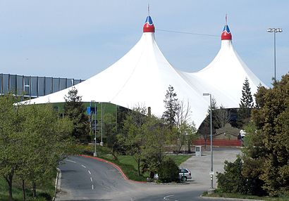
Shoreline Amphitheater Address: 1 Amphitheatre Parkway, Mountain View, CA 94043 street in San Francisco - San Jose, CA
Attractions near Shoreline Amphitheater
Bridge School Benefit Concert,Shoreline Amphitheatre,1 Amphitheatre Parkway,Main Stage at Shoreline,Comedy Fest,Rock Med - Main Med,The Lawn,The Beer Booth,In Line,Shoreline-VIP Lounge,Shoreline Security Office,Guy's Burger Joint,Shoreline Employee Check In / Out,Ben & Jerry's Food Truck,Rocko's Ice Cream Tacos,Lucky's Place,Shoreline Gate 3,Shoreline Gates 1 & 2,Powermat Charging Lounge - BFD,Shoreline Box OfficeHow to get to popular attractions in San Francisco - San Jose, CA with public transit
Kaiser Permanente Medical Center, Santa Clara,Safeway Corporate Headquarters, Pleasanton,Googleplex - B40 Gym,Nordstrom Broadway Plaza in Walnut Creek, Walnut Creek,Googleplex - Crittenden Campus,Mountain View VTA Light Rail Station,Japantown (日本町), San Jose,Colma, Colma,AMC Saratoga 14, San Jose,Costco Wholesale, Santa Clara,Renaissance ClubSport Walnut Creek Hotel, Contra Costa Centre,City of San Carlos, San Carlos,Genentech Inc, South San Francisco,Downtown San Jose, San Jose,Campbell, CA, Campbell,Apple Valley Fair, San Jose,Walmart Supercenter, Milpitas,City of Pinole, Pinole,City of Redwood City, Redwood City,City of Los Altos, Los AltosGet around San Francisco - San Jose, CA by public transit!
Traveling around San Francisco - San Jose, CA has never been so easy. See step by step directions as you travel to any attraction, street or major public transit station. View bus and train schedules, arrival times, service alerts and detailed routes on a map, so you know exactly how to get to anywhere in San Francisco - San Jose, CA.
When traveling to any destination around San Francisco - San Jose, CA use Moovit's Live Directions with Get Off Notifications to know exactly where and how far to walk, how long to wait for your line, and how many stops are left. Moovit will alert you when it's time to get off — no need to constantly re-check whether yours is the next stop.
Wondering how to use public transit in San Francisco - San Jose, CA or how to pay for public transit in San Francisco - San Jose, CA? Moovit public transit app can help you navigate your way with public transit easily, and at minimum cost. It includes public transit fees, ticket prices, and costs. Looking for a map of San Francisco - San Jose, CA public transit lines? Moovit public transit app shows all public transit maps in San Francisco - San Jose, CA with all bus or train routes and stops on an interactive map.
San Francisco - San Jose, CA has 2 transit type(s), including: bus or train, operated by several transit agencies, including BART, Bay Area Rapid Transit, Muni Metro, Caltrain, VTA, Capitol Corridor, Sonoma Marin Area Rail Transit, MUNI, VTA, SF Cable Car, AC Transit, Dumbarton Express, Golden Gate Transit, County Connection and SamTrans