Directions to Shred Nations (Watertown Town) with public transportation
The following transit lines have routes that pass near Shred Nations
 Bus: 504, 52, 57, 70, 71.
- Train: FITCHBURG, FRAMINGHAM/WORCESTER.
- Subway: GREEN LINE B.
How to get to Shred Nations by bus?
Click on the bus route to see step by step directions with maps, line arrival times and updated time schedules.
From Moxy Hotel, Boston
31 minFrom Beth Israel Deaconess Medical Center, Boston
42 minFrom Endicott College Boston, Boston
31 minFrom Costco, Everett
88 minFrom Hilton Garden Inn, Brookline
38 minFrom The Monument, Boston
64 minFrom Newton-Wellesley Hospital, Newton
53 minFrom Sam Adams Boston Brewery Tour, Boston
71 minFrom Wilbur Theatre, Boston
31 minFrom Massachusetts State House, Boston
42 min
How to get to Shred Nations by train?
Click on the train route to see step by step directions with maps, line arrival times and updated time schedules.
Bus stops near Shred Nations in Watertown Town
Train stations near Shred Nations in Watertown Town
Subway station near Shred Nations in Watertown Town
- South Street, 47 min walk,VIEW
Bus lines to Shred Nations in Watertown Town
What are the closest stations to Shred Nations?
The closest stations to Shred Nations are:
- Mt Auburn St @ Main St is 207 yards away, 3 min walk.
- Arsenal St @ Irving St is 282 yards away, 4 min walk.
- Watertown Square is 410 yards away, 5 min walk.
- Galen St @ Water St is 487 yards away, 6 min walk.
- Belmont is 2369 yards away, 28 min walk.
- South Street is 3951 yards away, 47 min walk.
- Newtonville is 5234 yards away, 62 min walk.
Which bus lines stop near Shred Nations?
These bus lines stop near Shred Nations: 504, 52, 57, 70, 71.
Which train lines stop near Shred Nations?
These train lines stop near Shred Nations: FITCHBURG, FRAMINGHAM/WORCESTER.
What’s the nearest train station to Shred Nations in Watertown Town?
The nearest train station to Shred Nations in Watertown Town is Belmont. It’s a 28 min walk away.
What’s the nearest bus station to Shred Nations in Watertown Town?
The nearest bus station to Shred Nations in Watertown Town is Mt Auburn St @ Main St. It’s a 3 min walk away.
What time is the first subway to Shred Nations in Watertown Town?
The GREEN LINE B is the first subway that goes to Shred Nations in Watertown Town. It stops nearby at 5:01 AM.
What time is the last subway to Shred Nations in Watertown Town?
The GREEN LINE B is the last subway that goes to Shred Nations in Watertown Town. It stops nearby at 2:39 AM.
What time is the first train to Shred Nations in Watertown Town?
The FRAMINGHAM/WORCESTER is the first train that goes to Shred Nations in Watertown Town. It stops nearby at 5:25 AM.
What time is the last train to Shred Nations in Watertown Town?
The FRAMINGHAM/WORCESTER is the last train that goes to Shred Nations in Watertown Town. It stops nearby at 12:17 AM.
What time is the first bus to Shred Nations in Watertown Town?
The 57 is the first bus that goes to Shred Nations in Watertown Town. It stops nearby at 4:30 AM.
What time is the last bus to Shred Nations in Watertown Town?
The 57 is the last bus that goes to Shred Nations in Watertown Town. It stops nearby at 2:34 AM.
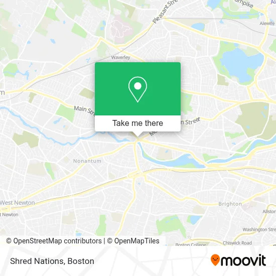
See Shred Nations, Watertown Town, on the map
Public Transit to Shred Nations in Watertown Town
Wondering how to get to Shred Nations in Watertown Town? Moovit helps you find the best way to get to Shred Nations with step-by-step directions from the nearest public transit station.
Moovit provides free maps and live directions to help you navigate through your city. View schedules, routes, timetables, and find out how long does it take to get to Shred Nations in real time.
Looking for the nearest stop or station to Shred Nations? Check out this list of stops closest to your destination: Mt Auburn St @ Main St; Arsenal St @ Irving St; Watertown Square; Galen St @ Water St; Belmont; South Street; Newtonville.
Bus: 504, 52, 57, 70, 71, 59.Train: FITCHBURG, FRAMINGHAM/WORCESTER.Subway: GREEN LINE B.
Want to see if there’s another route that gets you there at an earlier time? Moovit helps you find alternative routes or times. Get directions from and directions to Shred Nations easily from the Moovit App or Website.
We make riding to Shred Nations easy, which is why over 1.7 million users, including users in Watertown Town, trust Moovit as the best app for public transit. You don’t need to download an individual bus app or train app, Moovit is your all-in-one transit app that helps you find the best bus time or train time available.
For information on prices of bus, train and subway, costs and ride fares to Shred Nations, please check the Moovit app.
Use the app to navigate to popular places including to the airport, hospital, stadium, grocery store, mall, coffee shop, school, college, and university.
Shred Nations Address: 15 Main St street in Watertown Town
- Shekinah Glory Worship Center,
- Marcou Jewelers,
- Plush Beauty Bar,
- Dino Tangredi Attorney,
- Watertown Square,
- Eyebrow Threading Watertown,
- Sunshine Massage,
- Boston Color Group,
- Specific Chiropractic Centers - Boston,
- Watertown Spa,
- Style Fix Studio,
- Hue Realty Group,
- General Pacific LLC,
- New England Property Management & Maintenance,
- Law Offices of David W Downes,
- West End Cabinets,
- Charles River Zen,
- Boston Massage & Craniosacral Therapy,
- Ixtapa,
- Avinoam Lerner
Places Near Shred Nations (Watertown Town)
- Seaport District, Boston,
- Boston Common, Boston,
- Castle Island, Boston,
- Leader Bank Pavilion (Leader Bank Pavillion), Boston,
- Wilbur Theatre, Boston,
- Cheers, Boston,
- Isabella Stewart Gardner Museum, Boston,
- Td Garden, Boston,
- Boston Medical Center, Boston,
- North End, Boston,
- Massachusetts General Hospital, Boston,
- Prudential Center, Boston,
- Quincy Market, Boston,
- Mgm Music Hall, Boston,
- Museum Of Science, Boston,
- Boston Convention & Exhibition Center, Boston,
- Faneuil Hall, Boston,
- Boston Children's Hospital, Boston,
- House Of Blues, Boston,
- Wang Theater, Boston
How to get to popular places in Boston with public transit
Get around Watertown Town by public transit!
Traveling around Watertown Town has never been so easy. See step by step directions as you travel to any attraction, street or major public transit station. View bus and train schedules, arrival times, service alerts and detailed routes on a map, so you know exactly how to get to anywhere in Watertown Town.
When traveling to any destination around Watertown Town use Moovit's Live Directions with Get Off Notifications to know exactly where and how far to walk, how long to wait for your line, and how many stops are left. Moovit will alert you when it's time to get off — no need to constantly re-check whether yours is the next stop.
Wondering how to use public transit in Watertown Town or how to pay for public transit in Watertown Town? Moovit public transit app can help you navigate your way with public transit easily, and at minimum cost. It includes public transit fees, ticket prices, and costs. Looking for a map of Watertown Town public transit lines? Moovit public transit app shows all public transit maps in Watertown Town with all Bus, Train, Subway and Ferry routes and stops on an interactive map.
Boston has 4 transit type(s), including: Bus, Train, Subway and Ferry, operated by several transit agencies, including MBTA, Southeastern Regional Transit Authority, MetroWest Regional Transit Authority, Rhode Island Public Transit Authority, WRTA, Lowell Regional Transit Authority, Merrimack Valley Transit, Montachusett Regional Transit Authority, Cape Cod Regional Transit Authority, Brockton Area Transit Authority, Martha's Vineyard Transit Authority, the WAVE - Nantucket Regional Transit Authority, GATRA, Cape Ann Transportation Authority and Massport