Directions to Siagel Productions (Needham) with public transportation
The following transit lines have routes that pass near Siagel Productions
 Bus: 52, 59.
- Train: NEEDHAM.
- Subway: GREEN LINE D.
How to get to Siagel Productions by bus?
Click on the bus route to see step by step directions with maps, line arrival times and updated time schedules.
From Boston Children's Hospital at Waltham, Waltham
60 minFrom Boston University Track and Tennis Center, Boston
65 minFrom Boston Dynamics, Waltham
95 minFrom Dana-Farber Cancer Institute, Boston
74 minFrom Goodwill Store, Boston
64 minFrom Sanofi-Genzyme, Waltham
105 minFrom Academy Of the Pacific Rim Charter Public School, Boston
135 minFrom Brigham and Women's, Boston
76 minFrom Sonia, Boston
62 minFrom Brigham and Women's Hospital, Boston
75 min
How to get to Siagel Productions by train?
Click on the train route to see step by step directions with maps, line arrival times and updated time schedules.
From Boston University Track and Tennis Center, Boston
123 minFrom Dana-Farber Cancer Institute, Boston
87 minFrom Goodwill Store, Boston
118 minFrom Academy Of the Pacific Rim Charter Public School, Boston
137 minFrom Brigham and Women's, Boston
85 minFrom Sonia, Boston
111 minFrom Brigham and Women's Hospital, Boston
86 min
How to get to Siagel Productions by subway?
Click on the subway route to see step by step directions with maps, line arrival times and updated time schedules.
Bus stop near Siagel Productions in Needham
- Oak St @ Elliot St, 7 min walk,VIEW
Train station near Siagel Productions in Needham
- Needham Center, 26 min walk,VIEW
Subway station near Siagel Productions in Needham
- Eliot, 27 min walk,VIEW
Bus lines to Siagel Productions in Needham
- 59, Needham Junction Via Needham St,VIEW
What are the closest stations to Siagel Productions?
The closest stations to Siagel Productions are:
- Oak St @ Elliot St is 525 yards away, 7 min walk.
- Needham Center is 2175 yards away, 26 min walk.
- Eliot is 2248 yards away, 27 min walk.
Which bus lines stop near Siagel Productions?
These bus lines stop near Siagel Productions: 52, 59.
Which train line stops near Siagel Productions?
NEEDHAM (#625 | Needham Heights)
Which subway line stops near Siagel Productions?
GREEN LINE D (Riverside)
What’s the nearest subway station to Siagel Productions in Needham?
The nearest subway station to Siagel Productions in Needham is Eliot. It’s a 27 min walk away.
What’s the nearest train station to Siagel Productions in Needham?
The nearest train station to Siagel Productions in Needham is Needham Center. It’s a 26 min walk away.
What’s the nearest bus station to Siagel Productions in Needham?
The nearest bus station to Siagel Productions in Needham is Oak St @ Elliot St. It’s a 7 min walk away.
What time is the first subway to Siagel Productions in Needham?
The GREEN LINE D is the first subway that goes to Siagel Productions in Needham. It stops nearby at 4:48 AM.
What time is the last subway to Siagel Productions in Needham?
The GREEN LINE D is the last subway that goes to Siagel Productions in Needham. It stops nearby at 2:44 AM.
What time is the first train to Siagel Productions in Needham?
The NEEDHAM is the first train that goes to Siagel Productions in Needham. It stops nearby at 7:05 AM.
What time is the last train to Siagel Productions in Needham?
The NEEDHAM is the last train that goes to Siagel Productions in Needham. It stops nearby at 6:38 PM.
What time is the first bus to Siagel Productions in Needham?
The 59 is the first bus that goes to Siagel Productions in Needham. It stops nearby at 6:22 AM.
What time is the last bus to Siagel Productions in Needham?
The 59 is the last bus that goes to Siagel Productions in Needham. It stops nearby at 8:03 PM.
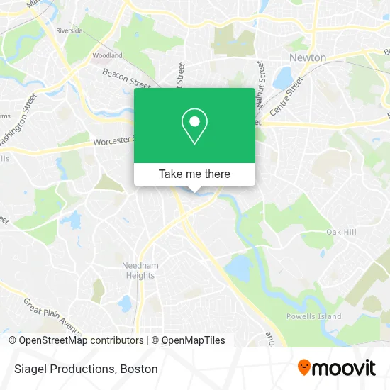
See Siagel Productions, Needham, on the map
Public Transit to Siagel Productions in Needham
Wondering how to get to Siagel Productions in Needham? Moovit helps you find the best way to get to Siagel Productions with step-by-step directions from the nearest public transit station.
Moovit provides free maps and live directions to help you navigate through your city. View schedules, routes, timetables, and find out how long does it take to get to Siagel Productions in real time.
Looking for the nearest stop or station to Siagel Productions? Check out this list of stops closest to your destination: Oak St @ Elliot St; Needham Center; Eliot.
Bus: 52, 59.Train: NEEDHAM.Subway: GREEN LINE D.
Want to see if there’s another route that gets you there at an earlier time? Moovit helps you find alternative routes or times. Get directions from and directions to Siagel Productions easily from the Moovit App or Website.
We make riding to Siagel Productions easy, which is why over 1.7 million users, including users in Needham, trust Moovit as the best app for public transit. You don’t need to download an individual bus app or train app, Moovit is your all-in-one transit app that helps you find the best bus time or train time available.
For information on prices of bus, train and subway, costs and ride fares to Siagel Productions, please check the Moovit app.
Use the app to navigate to popular places including to the airport, hospital, stadium, grocery store, mall, coffee shop, school, college, and university.
Siagel Productions Address: 30 Charles St street in Needham
- Open Software Development,
- Chenguang,
- Blair's The Locksmith,
- Streaming Stan 's Garage Door Repairs,
- Mobius Executive L,
- Micro Time Computers,
- Boston Broadcasting,
- Temple Beth Shalom,
- Boston Behavior Learning Centers,
- Ala Recycling Industries,
- Serpentino Stained Glass,
- Albion Interactive,
- Consolidated Graphics,
- Neighborhood Restaurant Group,
- Advigo Development Group,
- Genalco Inc,
- Number One Source,
- Soya's,
- Little Lukes Cafe,
- Ae Game Golf
Places Near Siagel Productions (Needham)
- North End, Boston,
- Boston Common, Boston,
- Museum Of Science, Boston,
- Boston Convention & Exhibition Center, Boston,
- Mgm Music Hall, Boston,
- Leader Bank Pavilion (Leader Bank Pavillion), Boston,
- Faneuil Hall, Boston,
- Prudential Center, Boston,
- Quincy Market, Boston,
- Seaport District, Boston,
- Massachusetts General Hospital, Boston,
- Cheers, Boston,
- Boston Medical Center, Boston,
- Boston Children's Hospital, Boston,
- Castle Island, Boston,
- House Of Blues, Boston,
- Td Garden, Boston,
- Isabella Stewart Gardner Museum, Boston,
- Wang Theater, Boston,
- Wilbur Theatre, Boston
How to get to popular places in Boston with public transit
Get around Needham by public transit!
Traveling around Needham has never been so easy. See step by step directions as you travel to any attraction, street or major public transit station. View bus and train schedules, arrival times, service alerts and detailed routes on a map, so you know exactly how to get to anywhere in Needham.
When traveling to any destination around Needham use Moovit's Live Directions with Get Off Notifications to know exactly where and how far to walk, how long to wait for your line, and how many stops are left. Moovit will alert you when it's time to get off — no need to constantly re-check whether yours is the next stop.
Wondering how to use public transit in Needham or how to pay for public transit in Needham? Moovit public transit app can help you navigate your way with public transit easily, and at minimum cost. It includes public transit fees, ticket prices, and costs. Looking for a map of Needham public transit lines? Moovit public transit app shows all public transit maps in Needham with all Bus, Train, Subway and Ferry routes and stops on an interactive map.
Boston has 4 transit type(s), including: Bus, Train, Subway and Ferry, operated by several transit agencies, including MBTA, Southeastern Regional Transit Authority, MetroWest Regional Transit Authority, Rhode Island Public Transit Authority, WRTA, Lowell Regional Transit Authority, Merrimack Valley Transit, Montachusett Regional Transit Authority, Cape Cod Regional Transit Authority, Brockton Area Transit Authority, Martha's Vineyard Transit Authority, the WAVE - Nantucket Regional Transit Authority, GATRA, Cape Ann Transportation Authority and Massport