Directions to Sid Harvey's (Malden) with public transportation
The following transit lines have routes that pass near Sid Harvey's
 Bus: 104, 105, 106, 411, 97.
- Train: HAVERHILL, NEWBURYPORT/ROCKPORT.
- Subway: ORANGE LINE.
How to get to Sid Harvey's by bus?
Click on the bus route to see step by step directions with maps, line arrival times and updated time schedules.
From MGH 50 Staniford Street 3rd flr, Boston
59 minFrom Old North Church, Boston
55 minFrom Reggie Lewis Athletic Center, Boston
93 minFrom Berklee College of Music, Boston
64 minFrom Pax East, Boston
67 minFrom Harvard Stadium, Boston
77 minFrom Brigham and Women's, Boston
84 minFrom Roxbury, Boston
94 minFrom Brigham & Women's Hospital, Boston
87 minFrom Boston City Hall, Boston
89 min
How to get to Sid Harvey's by train?
Click on the train route to see step by step directions with maps, line arrival times and updated time schedules.
How to get to Sid Harvey's by subway?
Click on the subway route to see step by step directions with maps, line arrival times and updated time schedules.
From MGH 50 Staniford Street 3rd flr, Boston
40 minFrom Old North Church, Boston
41 minFrom Reggie Lewis Athletic Center, Boston
48 minFrom Berklee College of Music, Boston
52 minFrom Pax East, Boston
54 minFrom Harvard Stadium, Boston
67 minFrom Brigham and Women's, Boston
63 minFrom Roxbury, Boston
53 minFrom Brigham & Women's Hospital, Boston
61 minFrom Boston City Hall, Boston
48 min
Bus stops near Sid Harvey's in Malden
Subway station near Sid Harvey's in Malden
- Assembly, 12 min walk,VIEW
Bus lines to Sid Harvey's in Malden
What are the closest stations to Sid Harvey's?
The closest stations to Sid Harvey's are:
- Centre St @ Stop & Shop is 362 yards away, 5 min walk.
- Commercial St @ Charles St is 470 yards away, 6 min walk.
- Assembly is 965 yards away, 12 min walk.
- Oak Grove is 2276 yards away, 27 min walk.
- Chelsea is 4335 yards away, 51 min walk.
Which bus lines stop near Sid Harvey's?
These bus lines stop near Sid Harvey's: 104, 105, 106, 411, 97, 99.
Which train line stops near Sid Harvey's?
HAVERHILL (#229 | Haverhill)
Which subway line stops near Sid Harvey's?
ORANGE LINE (Oak Grove)
What’s the nearest subway station to Sid Harvey's in Malden?
The nearest subway station to Sid Harvey's in Malden is Assembly. It’s a 12 min walk away.
What’s the nearest train station to Sid Harvey's in Malden?
The nearest train station to Sid Harvey's in Malden is Oak Grove. It’s a 27 min walk away.
What’s the nearest bus station to Sid Harvey's in Malden?
The nearest bus station to Sid Harvey's in Malden is Centre St @ Stop & Shop. It’s a 5 min walk away.
What time is the first subway to Sid Harvey's in Malden?
The ORANGE LINE is the first subway that goes to Sid Harvey's in Malden. It stops nearby at 5:15 AM.
What time is the last subway to Sid Harvey's in Malden?
The ORANGE LINE is the last subway that goes to Sid Harvey's in Malden. It stops nearby at 1:59 AM.
What time is the first train to Sid Harvey's in Malden?
The HAVERHILL is the first train that goes to Sid Harvey's in Malden. It stops nearby at 5:35 AM.
What time is the last train to Sid Harvey's in Malden?
The NEWBURYPORT/ROCKPORT is the last train that goes to Sid Harvey's in Malden. It stops nearby at 12:06 AM.
What time is the first bus to Sid Harvey's in Malden?
The 104 is the first bus that goes to Sid Harvey's in Malden. It stops nearby at 4:27 AM.
What time is the last bus to Sid Harvey's in Malden?
The 108 is the last bus that goes to Sid Harvey's in Malden. It stops nearby at 1:36 AM.
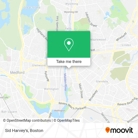
See Sid Harvey's, Malden, on the map
Public Transit to Sid Harvey's in Malden
Wondering how to get to Sid Harvey's in Malden? Moovit helps you find the best way to get to Sid Harvey's with step-by-step directions from the nearest public transit station.
Moovit provides free maps and live directions to help you navigate through your city. View schedules, routes, timetables, and find out how long does it take to get to Sid Harvey's in real time.
Looking for the nearest stop or station to Sid Harvey's? Check out this list of stops closest to your destination: Centre St @ Stop & Shop; Commercial St @ Charles St; Assembly; Oak Grove; Chelsea.
Bus: 104, 105, 106, 411, 97, 99, 108.Train: HAVERHILL, NEWBURYPORT/ROCKPORT.Subway: ORANGE LINE.
Want to see if there’s another route that gets you there at an earlier time? Moovit helps you find alternative routes or times. Get directions from and directions to Sid Harvey's easily from the Moovit App or Website.
We make riding to Sid Harvey's easy, which is why over 1.7 million users, including users in Malden, trust Moovit as the best app for public transit. You don’t need to download an individual bus app or train app, Moovit is your all-in-one transit app that helps you find the best bus time or train time available.
For information on prices of bus, subway and train, costs and ride fares to Sid Harvey's, please check the Moovit app.
Use the app to navigate to popular places including to the airport, hospital, stadium, grocery store, mall, coffee shop, school, college, and university.
Sid Harvey's Address: 18 Green St street in Malden
- GBS Construction,
- Cataldo Education Center,
- Canal Street Plumbing,
- Body Healing Therapy,
- First Choice Cars,
- Malden Rotary Club,
- Cha Malden Care Center,
- Coinstar - Bitcoin ATM,
- American Reliability Labs,
- Radio Brazuca,
- Medicare Insurance Advisors Malden,
- Auto Braz,
- Digi Burgers,
- Paws & Purrfection Company,
- Beca Shoes,
- Super 88 Market,
- Onemain Financial,
- Maxima Automobile Sales Co.,
- F F Motorsports,
- New England Sports Car Center
Places Near Sid Harvey's (Malden)
- Td Garden, Boston,
- Wang Theater, Boston,
- Museum Of Science, Boston,
- North End, Boston,
- Isabella Stewart Gardner Museum, Boston,
- Faneuil Hall, Boston,
- Boston Medical Center, Boston,
- Wilbur Theatre, Boston,
- Prudential Center, Boston,
- Cheers, Boston,
- Boston Common, Boston,
- Mgm Music Hall, Boston,
- House Of Blues, Boston,
- Massachusetts General Hospital, Boston,
- Quincy Market, Boston,
- Boston Children's Hospital, Boston,
- Boston Convention & Exhibition Center, Boston,
- Seaport District, Boston,
- Leader Bank Pavilion (Leader Bank Pavillion), Boston,
- Castle Island, Boston
How to get to popular places in Boston with public transit
Get around Malden by public transit!
Traveling around Malden has never been so easy. See step by step directions as you travel to any attraction, street or major public transit station. View bus and train schedules, arrival times, service alerts and detailed routes on a map, so you know exactly how to get to anywhere in Malden.
When traveling to any destination around Malden use Moovit's Live Directions with Get Off Notifications to know exactly where and how far to walk, how long to wait for your line, and how many stops are left. Moovit will alert you when it's time to get off — no need to constantly re-check whether yours is the next stop.
Wondering how to use public transit in Malden or how to pay for public transit in Malden? Moovit public transit app can help you navigate your way with public transit easily, and at minimum cost. It includes public transit fees, ticket prices, and costs. Looking for a map of Malden public transit lines? Moovit public transit app shows all public transit maps in Malden with all Bus, Train, Subway and Ferry routes and stops on an interactive map.
Boston has 4 transit type(s), including: Bus, Train, Subway and Ferry, operated by several transit agencies, including MBTA, Southeastern Regional Transit Authority, MetroWest Regional Transit Authority, Rhode Island Public Transit Authority, WRTA, Lowell Regional Transit Authority, Merrimack Valley Transit, Montachusett Regional Transit Authority, Cape Cod Regional Transit Authority, Brockton Area Transit Authority, Martha's Vineyard Transit Authority, the WAVE - Nantucket Regional Transit Authority, GATRA, Cape Ann Transportation Authority and Massport