Directions to Sign Works Group (Watertown Town) with public transportation
The following transit lines have routes that pass near Sign Works Group
 Bus: 504, 70, 71, 59.
- Train: FITCHBURG, FRAMINGHAM/WORCESTER.
- Subway: GREEN LINE B.
How to get to Sign Works Group by bus?
Click on the bus route to see step by step directions with maps, line arrival times and updated time schedules.
From Legal Sea Foods, Boston
30 minFrom Grill 23 & Bar, Boston
30 minFrom JFK Federal Building, Boston
51 minFrom City Winery Boston, Boston
53 minFrom The Middle East Downstairs, Cambridge
28 minFrom Primark Boston, Boston
41 minFrom Endicott College Boston, Boston
34 minFrom Childrens Museum, Boston
59 minFrom MBTA-Government Center, Boston
47 minFrom Abe & Louie's, Boston
32 min
How to get to Sign Works Group by train?
Click on the train route to see step by step directions with maps, line arrival times and updated time schedules.
From Legal Sea Foods, Boston
62 minFrom Grill 23 & Bar, Boston
61 minFrom JFK Federal Building, Boston
72 minFrom City Winery Boston, Boston
68 minFrom Primark Boston, Boston
71 minFrom Endicott College Boston, Boston
70 minFrom Childrens Museum, Boston
165 minFrom MBTA-Government Center, Boston
76 minFrom Abe & Louie's, Boston
65 min
Bus stops near Sign Works Group in Watertown Town
Train stations near Sign Works Group in Watertown Town
Subway station near Sign Works Group in Watertown Town
- Boston College, 32 min walk,VIEW
Bus lines to Sign Works Group in Watertown Town
What are the closest stations to Sign Works Group?
The closest stations to Sign Works Group are:
- Mt Auburn St @ Main St is 217 yards away, 3 min walk.
- Arsenal St @ Irving St is 344 yards away, 5 min walk.
- Watertown Square is 459 yards away, 6 min walk.
- Galen St @ Water St is 560 yards away, 7 min walk.
- Newtonville is 1727 yards away, 21 min walk.
- Boston College is 2649 yards away, 32 min walk.
- Waverley is 4514 yards away, 53 min walk.
Which bus lines stop near Sign Works Group?
These bus lines stop near Sign Works Group: 504, 70.
Which train lines stop near Sign Works Group?
These train lines stop near Sign Works Group: FITCHBURG, FRAMINGHAM/WORCESTER.
What’s the nearest train station to Sign Works Group in Watertown Town?
The nearest train station to Sign Works Group in Watertown Town is Newtonville. It’s a 21 min walk away.
What’s the nearest bus station to Sign Works Group in Watertown Town?
The nearest bus station to Sign Works Group in Watertown Town is Mt Auburn St @ Main St. It’s a 3 min walk away.
What time is the first subway to Sign Works Group in Watertown Town?
The GREEN LINE B is the first subway that goes to Sign Works Group in Watertown Town. It stops nearby at 5:01 AM.
What time is the last subway to Sign Works Group in Watertown Town?
The GREEN LINE B is the last subway that goes to Sign Works Group in Watertown Town. It stops nearby at 2:39 AM.
What time is the first train to Sign Works Group in Watertown Town?
The FRAMINGHAM/WORCESTER is the first train that goes to Sign Works Group in Watertown Town. It stops nearby at 5:25 AM.
What time is the last train to Sign Works Group in Watertown Town?
The FRAMINGHAM/WORCESTER is the last train that goes to Sign Works Group in Watertown Town. It stops nearby at 12:17 AM.
What time is the first bus to Sign Works Group in Watertown Town?
The 57 is the first bus that goes to Sign Works Group in Watertown Town. It stops nearby at 4:30 AM.
What time is the last bus to Sign Works Group in Watertown Town?
The 57 is the last bus that goes to Sign Works Group in Watertown Town. It stops nearby at 2:34 AM.
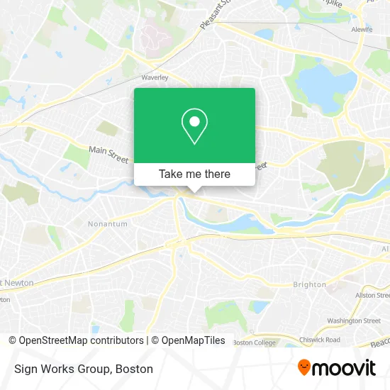
See Sign Works Group, Watertown Town, on the map
Public Transit to Sign Works Group in Watertown Town
Wondering how to get to Sign Works Group in Watertown Town? Moovit helps you find the best way to get to Sign Works Group with step-by-step directions from the nearest public transit station.
Moovit provides free maps and live directions to help you navigate through your city. View schedules, routes, timetables, and find out how long does it take to get to Sign Works Group in real time.
Looking for the nearest stop or station to Sign Works Group? Check out this list of stops closest to your destination: Mt Auburn St @ Main St; Arsenal St @ Irving St; Watertown Square; Galen St @ Water St; Newtonville; Boston College; Waverley.
Bus: 504, 70, 71, 59.Train: FITCHBURG, FRAMINGHAM/WORCESTER.Subway: GREEN LINE B.
Want to see if there’s another route that gets you there at an earlier time? Moovit helps you find alternative routes or times. Get directions from and directions to Sign Works Group easily from the Moovit App or Website.
We make riding to Sign Works Group easy, which is why over 1.7 million users, including users in Watertown Town, trust Moovit as the best app for public transit. You don’t need to download an individual bus app or train app, Moovit is your all-in-one transit app that helps you find the best bus time or train time available.
For information on prices of bus, train and subway, costs and ride fares to Sign Works Group, please check the Moovit app.
Use the app to navigate to popular places including to the airport, hospital, stadium, grocery store, mall, coffee shop, school, college, and university.
Sign Works Group Address: 60 Arsenal St street in Watertown Town
- Matthew Chen,
- People's United Bank,
- M&T Bank,
- DUNKIN',
- SUBWAY,
- Luminous Dental,
- Argand Realty Capital,
- STARBUCKS,
- Halva Kebab,
- Bostonian Towing,
- Michael Computer Repair & Tech Services,
- Medvadis Research,
- Alex Realty,
- Tabrizi,
- Mindful Wellness,
- Erie 1928,
- Verizon Wireless,
- Russell Cellular,
- Belleza Studio,
- ATM
Places Near Sign Works Group (Watertown Town)
- Seaport District, Boston,
- Boston Common, Boston,
- Castle Island, Boston,
- Leader Bank Pavilion (Leader Bank Pavillion), Boston,
- Wilbur Theatre, Boston,
- Cheers, Boston,
- Isabella Stewart Gardner Museum, Boston,
- Td Garden, Boston,
- Boston Medical Center, Boston,
- North End, Boston,
- Massachusetts General Hospital, Boston,
- Prudential Center, Boston,
- Quincy Market, Boston,
- Mgm Music Hall, Boston,
- Museum Of Science, Boston,
- Boston Convention & Exhibition Center, Boston,
- Faneuil Hall, Boston,
- Boston Children's Hospital, Boston,
- House Of Blues, Boston,
- Wang Theater, Boston
How to get to popular places in Boston with public transit
Get around Watertown Town by public transit!
Traveling around Watertown Town has never been so easy. See step by step directions as you travel to any attraction, street or major public transit station. View bus and train schedules, arrival times, service alerts and detailed routes on a map, so you know exactly how to get to anywhere in Watertown Town.
When traveling to any destination around Watertown Town use Moovit's Live Directions with Get Off Notifications to know exactly where and how far to walk, how long to wait for your line, and how many stops are left. Moovit will alert you when it's time to get off — no need to constantly re-check whether yours is the next stop.
Wondering how to use public transit in Watertown Town or how to pay for public transit in Watertown Town? Moovit public transit app can help you navigate your way with public transit easily, and at minimum cost. It includes public transit fees, ticket prices, and costs. Looking for a map of Watertown Town public transit lines? Moovit public transit app shows all public transit maps in Watertown Town with all Bus, Train, Subway and Ferry routes and stops on an interactive map.
Boston has 4 transit type(s), including: Bus, Train, Subway and Ferry, operated by several transit agencies, including MBTA, Southeastern Regional Transit Authority, MetroWest Regional Transit Authority, Rhode Island Public Transit Authority, WRTA, Lowell Regional Transit Authority, Merrimack Valley Transit, Montachusett Regional Transit Authority, Cape Cod Regional Transit Authority, Brockton Area Transit Authority, Martha's Vineyard Transit Authority, the WAVE - Nantucket Regional Transit Authority, GATRA, Cape Ann Transportation Authority and Massport