See Signal Station Pizza, Portland, on the map
Directions to Signal Station Pizza (Portland) with public transportation
The following transit lines have routes that pass near Signal Station Pizza
 Bus:
Bus:
How to get to Signal Station Pizza by bus?
Click on the bus route to see step by step directions with maps, line arrival times and updated time schedules.
Bus stations near Signal Station Pizza in Portland
- N Lombard & John (West),1 min walk,
- N Ivanhoe & Charleston (East),3 min walk,
Bus lines to Signal Station Pizza in Portland
- 4,Fessenden,
- 16,Front Ave/St Helens Rd,
- 44,Capitol Hwy/Mocks Crest,
- 75,Cesar Chavez/Lombard,
- 11,N Richmond & Princeton (South),
What are the closest stations to Signal Station Pizza?
The closest stations to Signal Station Pizza are:
- N Lombard & John (West) is 33 yards away, 1 min walk.
- N Ivanhoe & Charleston (East) is 170 yards away, 3 min walk.
Which bus lines stop near Signal Station Pizza?
These bus lines stop near Signal Station Pizza: 16, 4, 44, 75.
What’s the nearest bus stop to Signal Station Pizza in Portland?
The nearest bus stop to Signal Station Pizza in Portland is N Lombard & John (West). It’s a 1 min walk away.
See Signal Station Pizza, Portland, on the map
Public Transit to Signal Station Pizza in Portland
Wondering how to get to Signal Station Pizza in Portland, United States? Moovit helps you find the best way to get to Signal Station Pizza with step-by-step directions from the nearest public transit station.
Moovit provides free maps and live directions to help you navigate through your city. View schedules, routes, timetables, and find out how long does it take to get to Signal Station Pizza in real time.
Looking for the nearest stop or station to Signal Station Pizza? Check out this list of stops closest to your destination: N Lombard & John (West); N Ivanhoe & Charleston (East).
Bus:
Want to see if there’s another route that gets you there at an earlier time? Moovit helps you find alternative routes or times. Get directions from and directions to Signal Station Pizza easily from the Moovit App or Website.
We make riding to Signal Station Pizza easy, which is why over 1.5 million users, including users in Portland, trust Moovit as the best app for public transit. You don’t need to download an individual bus app or train app, Moovit is your all-in-one transit app that helps you find the best bus time or train time available.
For information on prices of bus and light rail, costs and ride fares to Signal Station Pizza, please check the Moovit app.
Use the app to navigate to popular places including to the airport, hospital, stadium, grocery store, mall, coffee shop, school, college, and university.
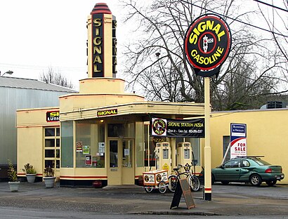
Signal Station Pizza Address: North Lombard Street street in Portland
Attractions near Signal Station Pizza
The Baowry,Messiah Finnish Lutheran Church,Pioneer United Methodist Church,McMenamins St. John's Theater and Pub,The Fixin' To,St. Johns Theater & Pub,James John Elementary,James John Elementary School,Blue Moon Camera and Machine,Blue Sky Eco Laundry (Portland),Leslie Bagon, LCSW,Multnomah County Library - St. Johns,St. Johns Library,Safeway,US Post Office,Saint Johns Post Office,Safeway 1951,Red Sea Community Church,St. Johns Tax Service,Us BankHow to get to popular attractions in Portland with public transit
Moda Center, Portland,City of Beaverton, Beaverton,Saburo's Sushi House, Portland,Red Robin Gourmet Burgers, Beaverton,Johns Landing Neighborhood, Portland,TriMet E 172nd Ave MAX Station, Gresham,Portland Japanese Garden, Portland,Washington Square Transit Center, Tigard,PCC Shuttle Stop, Portland,Mt. Tabor Neighborhood, Portland,I-5 @ Killingsworth / Alberta St., Portland,Residence Inn Portland Airport at Cascade Station, Portland,TriMet E 148th Ave MAX Station, Portland,Tienda La Tapatia, Gresham,NW Naito Parkway, Portland,Nike - Dan Fouts Building,Intel - RA3 Cafe, Hillsboro,The Alibi Restaurant & Lounge, Portland,Hyatt Place Portland Airport / Cascade Station, Portland,Trimet South Waterfront / SW Moody MAX Station, PortlandGet around Portland by public transit!
Traveling around Portland has never been so easy. See step by step directions as you travel to any attraction, street or major public transit station. View bus and train schedules, arrival times, service alerts and detailed routes on a map, so you know exactly how to get to anywhere in Portland.
When traveling to any destination around Portland use Moovit's Live Directions with Get Off Notifications to know exactly where and how far to walk, how long to wait for your line, and how many stops are left. Moovit will alert you when it's time to get off — no need to constantly re-check whether yours is the next stop.
Wondering how to use public transit in Portland or how to pay for public transit in Portland? Moovit public transit app can help you navigate your way with public transit easily, and at minimum cost. It includes public transit fees, ticket prices, and costs. Looking for a map of Portland public transit lines? Moovit public transit app shows all public transit maps in Portland with all bus or light rail routes and stops on an interactive map.
Portland has 2 transit type(s), including: bus or light rail, operated by several transit agencies, including Mount Adams Transportation Service, RiverCities Transit, TriMet , TriMet , TriMet, Portland Streetcar, Portland Aerial Tram, C-TRAN, Multnomah County Job Connector Shuttles, Washington Park Shuttle, SMART, Canby Area Transit, South Clackamas Transportation District, The Wave and Lincoln County Transit