Directions to Signalsphere (Boston) with public transportation
The following transit lines have routes that pass near Signalsphere
 Bus: 55, SL3, DV, WO, 120.
- Train: NEWBURYPORT/ROCKPORT.
- Subway: BLUE LINE.
- Ferry: EAST BOSTON FERRY, EAST.
How to get to Signalsphere by bus?
Click on the bus route to see step by step directions with maps, line arrival times and updated time schedules.
How to get to Signalsphere by train?
Click on the train route to see step by step directions with maps, line arrival times and updated time schedules.
How to get to Signalsphere by subway?
Click on the subway route to see step by step directions with maps, line arrival times and updated time schedules.
Bus stops near Signalsphere in Boston
Subway station near Signalsphere in Boston
- Airport, 6 min walk,VIEW
Ferry stations near Signalsphere in Boston
Bus lines to Signalsphere in Boston
- DV, All Terminals,VIEW
- WO, Airport,VIEW
- 120, Maverick Via Jeffries Point,VIEW
- 66, Water Transportation Dock,VIEW
- 22, Conrac Rental Car Center, Drop Off - Conrac Rental Car Center, Pick Up,VIEW
- 33, Conrac Rental Car Center, Drop Off - Conrac Rental Car Center, Pick Up,VIEW
- 41, LOC1,VIEW
- 44, Blue Line - MBTA - Blue Line - MBTA,VIEW
- 55, Conrac Rental Car Center, Drop Off - Conrac Rental Car Center, Pick Up,VIEW
- 88, Economy Parking - Economy Parking,VIEW
- 221, 221,VIEW
- 331, 331,VIEW
- 551, 551,VIEW
- 552, 552,VIEW
- BLUE LINE SHUTTLE, Orient Heights (Local Shuttle),VIEW
- 104, Airport - Malden,VIEW
- 171, - Logan Airport via Andrew,VIEW
- BLUE LINE SHUTTLE, Airport - Government Center (Express),VIEW
- BLUE LINE SHUTTLE, Airport - Government Center via Maverick,VIEW
- BLUE LINE SHUTTLE, Airport - Wonderland,VIEW
What are the closest stations to Signalsphere?
The closest stations to Signalsphere are:
- Terminal A Next Stop (Wo, Dv) is 54 yards away, 2 min walk.
- Bennington St @ Marion St is 160 yards away, 2 min walk.
- Logan Office Center / Water Transportation Docks is 223 yards away, 4 min walk.
- Blue Line - Mbta is 385 yards away, 6 min walk.
- Airport is 401 yards away, 5 min walk.
- Lewis Mall Wharf is 1869 yards away, 22 min walk.
- Logan Airport Ferry Terminal is 2649 yards away, 31 min walk.
Which bus lines stop near Signalsphere?
These bus lines stop near Signalsphere: 55, SL3.
Which train line stops near Signalsphere?
NEWBURYPORT/ROCKPORT (#120 | North Station)
Which subway line stops near Signalsphere?
BLUE LINE (Wonderland)
What’s the nearest subway station to Signalsphere in Boston?
The nearest subway station to Signalsphere in Boston is Airport. It’s a 6 min walk away.
What’s the nearest bus station to Signalsphere in Boston?
The nearest bus stations to Signalsphere in Boston are Terminal A Next Stop (Wo, Dv) and Bennington St @ Marion St. The closest one is a 2 min walk away.
What’s the nearest ferry station to Signalsphere in Boston?
The nearest ferry station to Signalsphere in Boston is Lewis Mall Wharf. It’s a 22 min walk away.
What time is the first subway to Signalsphere in Boston?
The BLUE LINE is the first subway that goes to Signalsphere in Boston. It stops nearby at 5:10 AM.
What time is the last subway to Signalsphere in Boston?
The BLUE LINE is the last subway that goes to Signalsphere in Boston. It stops nearby at 2:01 AM.
What time is the first bus to Signalsphere in Boston?
The 44 is the first bus that goes to Signalsphere in Boston. It stops nearby at 3:00 AM.
What time is the last bus to Signalsphere in Boston?
The 88 is the last bus that goes to Signalsphere in Boston. It stops nearby at 3:17 AM.
What time is the first ferry to Signalsphere in Boston?
The EAST is the first ferry that goes to Signalsphere in Boston. It stops nearby at 5:55 AM.
What time is the last ferry to Signalsphere in Boston?
The HINGHAM/HULL FERRY is the last ferry that goes to Signalsphere in Boston. It stops nearby at 10:05 PM.
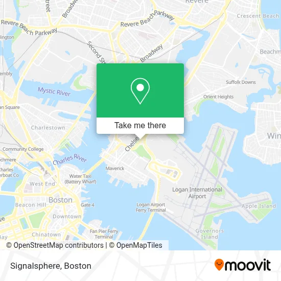
See Signalsphere, Boston, on the map
Public Transit to Signalsphere in Boston
Wondering how to get to Signalsphere in Boston? Moovit helps you find the best way to get to Signalsphere with step-by-step directions from the nearest public transit station.
Moovit provides free maps and live directions to help you navigate through your city. View schedules, routes, timetables, and find out how long does it take to get to Signalsphere in real time.
Looking for the nearest stop or station to Signalsphere? Check out this list of stops closest to your destination: Terminal A Next Stop (Wo; Bennington St @ Marion St; Logan Office Center / Water Transportation Docks; Blue Line - Mbta; Airport; Lewis Mall Wharf; Logan Airport Ferry Terminal.
Bus: 55, SL3, DV, WO, 120, 66, BLUE LINE SHUTTLE.Train: NEWBURYPORT/ROCKPORT.Subway: BLUE LINE.Ferry: EAST BOSTON FERRY, EAST.
Want to see if there’s another route that gets you there at an earlier time? Moovit helps you find alternative routes or times. Get directions from and directions to Signalsphere easily from the Moovit App or Website.
We make riding to Signalsphere easy, which is why over 1.7 million users, including users in Boston, trust Moovit as the best app for public transit. You don’t need to download an individual bus app or train app, Moovit is your all-in-one transit app that helps you find the best bus time or train time available.
For information on prices of subway, bus, train and ferry, costs and ride fares to Signalsphere, please check the Moovit app.
Use the app to navigate to popular places including to the airport, hospital, stadium, grocery store, mall, coffee shop, school, college, and university.
Signalsphere Address: C, AVE street in Boston
- Logan Express,
- East Boston,
- Massport bus 55 All terminals, MBTA Blue Line and rental car center,
- Entrance I-90 E,
- Airport Shuttle Bus #55,
- Rental Car Center - Logan Airport,
- AVIS,
- Boston Logan Intl Airport,
- Lucy's Beauty Salon,
- Boston Latin DJS,
- East Boston Ymca,
- YMCA,
- Sacred Heart Parish (Sacred Heart Italian Church),
- Oliveira's East Boston,
- Ups,
- Minas Hair Salon,
- East Boston Memorial Stadium,
- America Soccer Store,
- 156 W Newton Street,
- Boston Logan Int'l Airport (General Edward Lawrence Logan Int'l)
Places Near Signalsphere (Boston)
- Td Garden, Boston,
- Leader Bank Pavilion (Leader Bank Pavillion), Boston,
- Boston Common, Boston,
- Cheers, Boston,
- Prudential Center, Boston,
- Mgm Music Hall, Boston,
- Museum Of Science, Boston,
- Wilbur Theatre, Boston,
- Castle Island, Boston,
- Massachusetts General Hospital, Boston,
- House Of Blues, Boston,
- Isabella Stewart Gardner Museum, Boston,
- Boston Children's Hospital, Boston,
- Boston Convention & Exhibition Center, Boston,
- Faneuil Hall, Boston,
- Wang Theater, Boston,
- Seaport District, Boston,
- North End, Boston,
- Boston Medical Center, Boston,
- Quincy Market, Boston
How to get to popular places in Boston with public transit
Get around Boston by public transit!
Traveling around Boston has never been so easy. See step by step directions as you travel to any attraction, street or major public transit station. View bus and train schedules, arrival times, service alerts and detailed routes on a map, so you know exactly how to get to anywhere in Boston.
When traveling to any destination around Boston use Moovit's Live Directions with Get Off Notifications to know exactly where and how far to walk, how long to wait for your line, and how many stops are left. Moovit will alert you when it's time to get off — no need to constantly re-check whether yours is the next stop.
Wondering how to use public transit in Boston or how to pay for public transit in Boston? Moovit public transit app can help you navigate your way with public transit easily, and at minimum cost. It includes public transit fees, ticket prices, and costs. Looking for a map of Boston public transit lines? Moovit public transit app shows all public transit maps in Boston with all Bus, Train, Subway and Ferry routes and stops on an interactive map.
Boston has 4 transit type(s), including: Bus, Train, Subway and Ferry, operated by several transit agencies, including MBTA, Southeastern Regional Transit Authority, MetroWest Regional Transit Authority, Rhode Island Public Transit Authority, WRTA, Lowell Regional Transit Authority, Merrimack Valley Transit, Montachusett Regional Transit Authority, Cape Cod Regional Transit Authority, Brockton Area Transit Authority, Martha's Vineyard Transit Authority, the WAVE - Nantucket Regional Transit Authority, GATRA, Cape Ann Transportation Authority and Massport