Directions to Signarama Worcester, MA with public transportation
The following transit lines have routes that pass near Signarama Worcester, MA
 Bus: 30, 31, GREYHOUND US0230, 825.
How to get to Signarama Worcester, MA by bus?
Click on the bus route to see step by step directions with maps, line arrival times and updated time schedules.
Bus stop near Signarama Worcester, MA
- West Boylston St + Barnes Ave, 7 min walk,VIEW
Bus lines to Signarama Worcester, MA
What are the closest stations to Signarama Worcester, MA?
The closest stations to Signarama Worcester, MA are:
- West Boylston St + Barnes Ave is 534 yards away, 7 min walk.
Which bus lines stop near Signarama Worcester, MA?
These bus lines stop near Signarama Worcester, MA: 30, 31, GREYHOUND US0230.
What’s the nearest bus station to Signarama Worcester, MA?
The nearest bus station to Signarama Worcester, MA is West Boylston St + Barnes Ave. It’s a 7 min walk away.
What time is the first bus to Signarama Worcester, MA?
The 30 is the first bus that goes to Signarama Worcester, MA. It stops nearby at 6:01 AM.
What time is the last bus to Signarama Worcester, MA?
The 30 is the last bus that goes to Signarama Worcester, MA. It stops nearby at 10:35 PM.
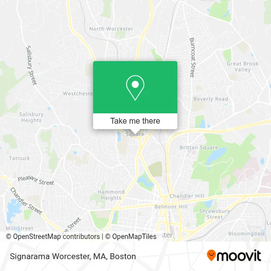
See Signarama Worcester, MA on the map
Public Transportation to Signarama Worcester, MA
Wondering how to get to Signarama Worcester, MA? Moovit helps you find the best way to get to Signarama Worcester, MA with step-by-step directions from the nearest public transit station.
Moovit provides free maps and live directions to help you navigate through your city. View schedules, routes, timetables, and find out how long does it take to get to Signarama Worcester, MA in real time.
Looking for the nearest stop or station to Signarama Worcester, MA? Check out this list of stops closest to your destination: West Boylston St + Barnes Ave.
Bus: 30, 31, GREYHOUND US0230, 825.
Want to see if there’s another route that gets you there at an earlier time? Moovit helps you find alternative routes or times. Get directions from and directions to Signarama Worcester, MA easily from the Moovit App or Website.
We make riding to Signarama Worcester, MA easy, which is why over 1.7 million users, including users in Worcester, trust Moovit as the best app for public transit. You don’t need to download an individual bus app or train app, Moovit is your all-in-one transit app that helps you find the best bus time or train time available.
For information on prices of bus and train, costs and ride fares to Signarama Worcester, MA, please check the Moovit app.
Use the app to navigate to popular places including to the airport, hospital, stadium, grocery store, mall, coffee shop, school, college, and university.
Signarama Worcester, MA Address: 456 Grove St Rear street in Worcester
- Central Mass Grown,
- Elizabeth Coghlan,
- Meletios D Chacharone,
- Crust,
- Edward Jones - Financial Advisor: Hamilton Soriano,
- Locksmith Laser Cut Keys,
- Bank of America,
- Senior Helpers,
- Redbox,
- Weecare,
- Educational Association of Worcester,
- Cornerstone Behavioral Health,
- DUNKIN',
- Better Business Bureau Central New England,
- Igreja Evangelica Nova Inglaterra,
- Sewer & Rooter Line Cleaning,
- Dreamworx Cycles,
- Tropical Smoothie Cafe,
- West Boylston St + Huntington Ave,
- Whattabargain Worcester
Places Near Signarama Worcester, MA
- Castle Island, Boston,
- Seaport District, Boston,
- Quincy Market, Boston,
- Cheers, Boston,
- Faneuil Hall, Boston,
- Prudential Center, Boston,
- Boston Children's Hospital, Boston,
- Wilbur Theatre, Boston,
- Massachusetts General Hospital, Boston,
- Boston Medical Center, Boston,
- Wang Theater, Boston,
- Boston Common, Boston,
- Museum Of Science, Boston,
- Leader Bank Pavilion (Leader Bank Pavillion), Boston,
- Isabella Stewart Gardner Museum, Boston,
- Boston Convention & Exhibition Center, Boston,
- Td Garden, Boston,
- Mgm Music Hall, Boston,
- House Of Blues, Boston,
- North End, Boston
How to get to popular places in Boston with public transit
Get around Worcester by public transit!
Traveling around Worcester has never been so easy. See step by step directions as you travel to any attraction, street or major public transit station. View bus and train schedules, arrival times, service alerts and detailed routes on a map, so you know exactly how to get to anywhere in Worcester.
When traveling to any destination around Worcester use Moovit's Live Directions with Get Off Notifications to know exactly where and how far to walk, how long to wait for your line, and how many stops are left. Moovit will alert you when it's time to get off — no need to constantly re-check whether yours is the next stop.
Wondering how to use public transit in Worcester or how to pay for public transit in Worcester? Moovit public transit app can help you navigate your way with public transit easily, and at minimum cost. It includes public transit fees, ticket prices, and costs. Looking for a map of Worcester public transit lines? Moovit public transit app shows all public transit maps in Worcester with all Bus, Train, Subway and Ferry routes and stops on an interactive map.
Boston has 4 transit type(s), including: Bus, Train, Subway and Ferry, operated by several transit agencies, including MBTA, Southeastern Regional Transit Authority, MetroWest Regional Transit Authority, Rhode Island Public Transit Authority, WRTA, Lowell Regional Transit Authority, Merrimack Valley Transit, Montachusett Regional Transit Authority, Cape Cod Regional Transit Authority, Brockton Area Transit Authority, Martha's Vineyard Transit Authority, the WAVE - Nantucket Regional Transit Authority, GATRA, Cape Ann Transportation Authority and Massport