Directions to Signnow (Brookline) with public transportation
The following transit lines have routes that pass near Signnow
 Bus: 66, FLIXBUS 2610, FLIXBUS N2605, FLIXBUS N2610, GREEN LINE C SHUTTLE.
- Train: FRAMINGHAM/WORCESTER.
- Subway: GREEN LINE C.
How to get to Signnow by bus?
Click on the bus route to see step by step directions with maps, line arrival times and updated time schedules.
From Back Bay, Boston
53 minFrom Waltham, MA, Waltham
63 minFrom South Boston Waterfront, Boston
58 minFrom Courtyard by Marriott Boston Logan Airport, Boston
81 minFrom Milton, MA, Milton
107 minFrom Terrace Room, Paige Hall, Medford
64 minFrom Newton-Wellesley Hospital, Newton
88 minFrom Embassy Suites-Boston, Boston
77 minFrom Watertown, MA, Watertown Town
45 min
How to get to Signnow by train?
Click on the train route to see step by step directions with maps, line arrival times and updated time schedules.
How to get to Signnow by subway?
Click on the subway route to see step by step directions with maps, line arrival times and updated time schedules.
Bus stops near Signnow in Brookline
Subway station near Signnow in Brookline
- Saint Paul Street, 6 min walk,VIEW
Bus lines to Signnow in Brookline
- 66, Brighton Center Via Brookline,VIEW
- FLIXBUS 2610, New York (Hudson Yards),VIEW
- FLIXBUS N2605, Henrico (Parham Rd Park & Ride),VIEW
- FLIXBUS N2610, Boston (South Station),VIEW
- GREEN LINE C SHUTTLE, Saint Mary's Street (Shuttle),VIEW
- GREEN LINE C SHUTTLE, Coolidge Corner (Shuttle),VIEW
- SHUTTLE, Cleveland Circle (Shuttle),VIEW
What are the closest stations to Signnow?
The closest stations to Signnow are:
- Harvard St @ Beacon St is 80 yards away, 2 min walk.
- Brookline is 97 yards away, 2 min walk.
- Coolidge Corner is 105 yards away, 2 min walk.
- Saint Paul Street is 470 yards away, 6 min walk.
Which bus line stops near Signnow?
66 (Nubian Via Allston)
Which train line stops near Signnow?
FRAMINGHAM/WORCESTER (#525 | Worcester)
Which subway line stops near Signnow?
GREEN LINE C (Cleveland Circle)
What’s the nearest subway station to Signnow in Brookline?
The nearest subway station to Signnow in Brookline is Saint Paul Street. It’s a 6 min walk away.
What’s the nearest bus station to Signnow in Brookline?
The nearest bus stations to Signnow in Brookline are Harvard St @ Beacon St, Brookline and Coolidge Corner. The closest one is a 2 min walk away.
What time is the first subway to Signnow in Brookline?
The GREEN LINE C is the first subway that goes to Signnow in Brookline. It stops nearby at 5:06 AM.
What time is the last subway to Signnow in Brookline?
The GREEN LINE C is the last subway that goes to Signnow in Brookline. It stops nearby at 2:16 AM.
What time is the first bus to Signnow in Brookline?
The 66 is the first bus that goes to Signnow in Brookline. It stops nearby at 4:59 AM.
What time is the last bus to Signnow in Brookline?
The FLIXBUS N2605 is the last bus that goes to Signnow in Brookline. It stops nearby at 9:05 AM.
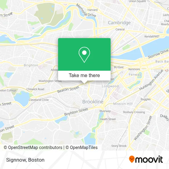
See Signnow, Brookline, on the map
Public Transit to Signnow in Brookline
Wondering how to get to Signnow in Brookline? Moovit helps you find the best way to get to Signnow with step-by-step directions from the nearest public transit station.
Moovit provides free maps and live directions to help you navigate through your city. View schedules, routes, timetables, and find out how long does it take to get to Signnow in real time.
Looking for the nearest stop or station to Signnow? Check out this list of stops closest to your destination: Harvard St @ Beacon St; Brookline; Coolidge Corner; Saint Paul Street.
Bus: 66, FLIXBUS 2610, FLIXBUS N2605, FLIXBUS N2610, GREEN LINE C SHUTTLE, GREEN LINE C SHUTTLE, SHUTTLE.Train: FRAMINGHAM/WORCESTER.Subway: GREEN LINE C.
Want to see if there’s another route that gets you there at an earlier time? Moovit helps you find alternative routes or times. Get directions from and directions to Signnow easily from the Moovit App or Website.
We make riding to Signnow easy, which is why over 1.7 million users, including users in Brookline, trust Moovit as the best app for public transit. You don’t need to download an individual bus app or train app, Moovit is your all-in-one transit app that helps you find the best bus time or train time available.
For information on prices of subway, bus and train, costs and ride fares to Signnow, please check the Moovit app.
Use the app to navigate to popular places including to the airport, hospital, stadium, grocery store, mall, coffee shop, school, college, and university.
Location: Brookline, Boston
- UPS,
- Hydrojetting Plumbers,
- Air9.Co*,
- Preply,
- Alexandra Haney, Psy.D.,
- Smile Gallery,
- Rooted Dental Company,
- Unique U Spa,
- Courtyard by Marriott Brookline,
- COURTYARD-Brookline (Courtyard by Marriott Boston Brookline),
- Beyond Menu,
- Sherri Quist Real Estate,
- Mls Property Information Network, Inc.,
- Coldwell Banker Modern Moves,
- Deborah M Gordon Real Estate Team,
- Diana Kuang - Coldwell Banker - Boston Real Estate Agent,
- Jill Streck- Realtor,
- Caldwell Locksmith,
- Six Po Hot Pot,
- When Pigs Fly Breads
Places Near Signnow (Brookline)
- Boston Children's Hospital, Boston,
- House Of Blues, Boston,
- North End, Boston,
- Td Garden, Boston,
- Cheers, Boston,
- Seaport District, Boston,
- Leader Bank Pavilion (Leader Bank Pavillion), Boston,
- Wilbur Theatre, Boston,
- Faneuil Hall, Boston,
- Boston Common, Boston,
- Wang Theater, Boston,
- Castle Island, Boston,
- Prudential Center, Boston,
- Boston Convention & Exhibition Center, Boston,
- Museum Of Science, Boston,
- Isabella Stewart Gardner Museum, Boston,
- Mgm Music Hall, Boston,
- Quincy Market, Boston,
- Massachusetts General Hospital, Boston,
- Boston Medical Center, Boston
How to get to popular places in Boston with public transit
Get around Brookline by public transit!
Traveling around Brookline has never been so easy. See step by step directions as you travel to any attraction, street or major public transit station. View bus and train schedules, arrival times, service alerts and detailed routes on a map, so you know exactly how to get to anywhere in Brookline.
When traveling to any destination around Brookline use Moovit's Live Directions with Get Off Notifications to know exactly where and how far to walk, how long to wait for your line, and how many stops are left. Moovit will alert you when it's time to get off — no need to constantly re-check whether yours is the next stop.
Wondering how to use public transit in Brookline or how to pay for public transit in Brookline? Moovit public transit app can help you navigate your way with public transit easily, and at minimum cost. It includes public transit fees, ticket prices, and costs. Looking for a map of Brookline public transit lines? Moovit public transit app shows all public transit maps in Brookline with all Bus, Train, Subway and Ferry routes and stops on an interactive map.
Boston has 4 transit type(s), including: Bus, Train, Subway and Ferry, operated by several transit agencies, including MBTA, Southeastern Regional Transit Authority, MetroWest Regional Transit Authority, Rhode Island Public Transit Authority, WRTA, Lowell Regional Transit Authority, Merrimack Valley Transit, Montachusett Regional Transit Authority, Cape Cod Regional Transit Authority, Brockton Area Transit Authority, Martha's Vineyard Transit Authority, the WAVE - Nantucket Regional Transit Authority, GATRA, Cape Ann Transportation Authority and Massport