Directions to Signs by Design (Worcester) with public transportation
The following transit lines have routes that pass near Signs by Design
 Bus: 5.
How to get to Signs by Design by bus?
Click on the bus route to see step by step directions with maps, line arrival times and updated time schedules.
Bus stop near Signs by Design in Worcester
- Massasoit Rd at Blithewood 1, 5 min walk,VIEW
Bus lines to Signs by Design in Worcester
- 5, Central Hub,VIEW
What are the closest stations to Signs by Design?
The closest stations to Signs by Design are:
- Massasoit Rd at Blithewood 1 is 343 yards away, 5 min walk.
Which bus line stops near Signs by Design?
5 (Central Hub→Broad Meadow Brook Audobon)
What’s the nearest bus station to Signs by Design in Worcester?
The nearest bus station to Signs by Design in Worcester is Massasoit Rd at Blithewood 1. It’s a 5 min walk away.
What time is the first bus to Signs by Design in Worcester?
The 5 is the first bus that goes to Signs by Design in Worcester. It stops nearby at 4:57 AM.
What time is the last bus to Signs by Design in Worcester?
The 5 is the last bus that goes to Signs by Design in Worcester. It stops nearby at 8:38 PM.
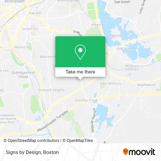
See Signs by Design, Worcester, on the map
Public Transit to Signs by Design in Worcester
Wondering how to get to Signs by Design in Worcester? Moovit helps you find the best way to get to Signs by Design with step-by-step directions from the nearest public transit station.
Moovit provides free maps and live directions to help you navigate through your city. View schedules, routes, timetables, and find out how long does it take to get to Signs by Design in real time.
Looking for the nearest stop or station to Signs by Design? Check out this list of stops closest to your destination: Massasoit Rd at Blithewood 1.
Bus: 5.
Want to see if there’s another route that gets you there at an earlier time? Moovit helps you find alternative routes or times. Get directions from and directions to Signs by Design easily from the Moovit App or Website.
We make riding to Signs by Design easy, which is why over 1.7 million users, including users in Worcester, trust Moovit as the best app for public transit. You don’t need to download an individual bus app or train app, Moovit is your all-in-one transit app that helps you find the best bus time or train time available.
For information on prices of bus and train, costs and ride fares to Signs by Design, please check the Moovit app.
Use the app to navigate to popular places including to the airport, hospital, stadium, grocery store, mall, coffee shop, school, college, and university.
Signs by Design Address: 492 Massasoit Rd street in Worcester
- Proving Groundz,
- Masoncharlie,
- Printsource,
- DG Internet Ventures,
- Cruise America RV Rental,
- C&C Temp Control,
- Home Garden Party,
- Beth Carmel Christian Counseling Center,
- Locksmith for Corporate Account,
- M&M Cleaning Services,
- Cristian Stefan MD,
- Borggaard Development,
- Temescal Wellness,
- Casa de Restauracion Jeremias 18,
- Good AS New Painting,
- San Bon,
- Kangaroo Crossing,
- Sunderland Woods Condo,
- Alvaro M Perez Electrician,
- Blackstone Bike Trail
Places Near Signs by Design (Worcester)
- Seaport District, Boston,
- Boston Common, Boston,
- Faneuil Hall, Boston,
- Leader Bank Pavilion (Leader Bank Pavillion), Boston,
- House Of Blues, Boston,
- Wang Theater, Boston,
- Cheers, Boston,
- Massachusetts General Hospital, Boston,
- Castle Island, Boston,
- Mgm Music Hall, Boston,
- Isabella Stewart Gardner Museum, Boston,
- Museum Of Science, Boston,
- Prudential Center, Boston,
- Td Garden, Boston,
- North End, Boston,
- Wilbur Theatre, Boston,
- Boston Medical Center, Boston,
- Boston Children's Hospital, Boston,
- Boston Convention & Exhibition Center, Boston,
- Quincy Market, Boston
How to get to popular places in Boston with public transit
Get around Worcester by public transit!
Traveling around Worcester has never been so easy. See step by step directions as you travel to any attraction, street or major public transit station. View bus and train schedules, arrival times, service alerts and detailed routes on a map, so you know exactly how to get to anywhere in Worcester.
When traveling to any destination around Worcester use Moovit's Live Directions with Get Off Notifications to know exactly where and how far to walk, how long to wait for your line, and how many stops are left. Moovit will alert you when it's time to get off — no need to constantly re-check whether yours is the next stop.
Wondering how to use public transit in Worcester or how to pay for public transit in Worcester? Moovit public transit app can help you navigate your way with public transit easily, and at minimum cost. It includes public transit fees, ticket prices, and costs. Looking for a map of Worcester public transit lines? Moovit public transit app shows all public transit maps in Worcester with all Bus, Train, Subway and Ferry routes and stops on an interactive map.
Boston has 4 transit type(s), including: Bus, Train, Subway and Ferry, operated by several transit agencies, including MBTA, Southeastern Regional Transit Authority, MetroWest Regional Transit Authority, Rhode Island Public Transit Authority, WRTA, Lowell Regional Transit Authority, Merrimack Valley Transit, Montachusett Regional Transit Authority, Cape Cod Regional Transit Authority, Brockton Area Transit Authority, Martha's Vineyard Transit Authority, the WAVE - Nantucket Regional Transit Authority, GATRA, Cape Ann Transportation Authority and Massport