Directions to Sika Sarnafil (Boston) with public transportation
The following transit lines have routes that pass near Sika Sarnafil
 Bus: 14.
- Train: PROVIDENCE/STOUGHTON.
How to get to Sika Sarnafil by bus?
Click on the bus route to see step by step directions with maps, line arrival times and updated time schedules.
Train station near Sika Sarnafil in Boston
- Stoughton, 25 min walk,VIEW
What are the closest stations to Sika Sarnafil?
The closest stations to Sika Sarnafil are:
- Stoughton is 2134 yards away, 25 min walk.
Which bus line stops near Sika Sarnafil?
14 (Cobbs Corner)
What’s the nearest train station to Sika Sarnafil in Boston?
The nearest train station to Sika Sarnafil in Boston is Stoughton. It’s a 25 min walk away.
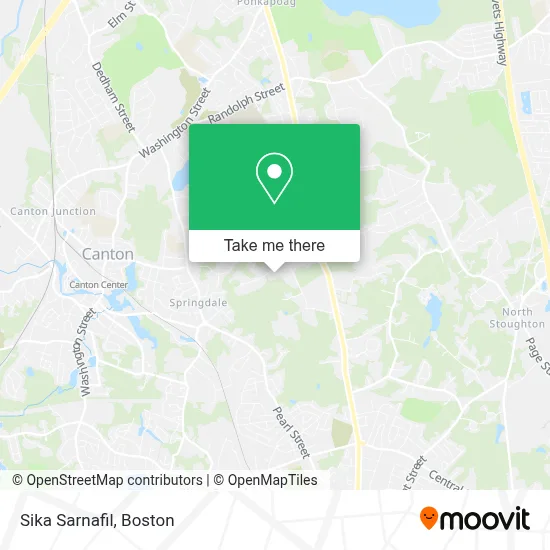
See Sika Sarnafil, Boston, on the map
Public Transit to Sika Sarnafil in Boston
Wondering how to get to Sika Sarnafil in Boston? Moovit helps you find the best way to get to Sika Sarnafil with step-by-step directions from the nearest public transit station.
Moovit provides free maps and live directions to help you navigate through your city. View schedules, routes, timetables, and find out how long does it take to get to Sika Sarnafil in real time.
Looking for the nearest stop or station to Sika Sarnafil? Check out this list of stops closest to your destination: Stoughton.
Bus: 14.Train: PROVIDENCE/STOUGHTON.
Want to see if there’s another route that gets you there at an earlier time? Moovit helps you find alternative routes or times. Get directions from and directions to Sika Sarnafil easily from the Moovit App or Website.
We make riding to Sika Sarnafil easy, which is why over 1.7 million users, including users in Boston, trust Moovit as the best app for public transit. You don’t need to download an individual bus app or train app, Moovit is your all-in-one transit app that helps you find the best bus time or train time available.
For information on prices of bus and train, costs and ride fares to Sika Sarnafil, please check the Moovit app.
Use the app to navigate to popular places including to the airport, hospital, stadium, grocery store, mall, coffee shop, school, college, and university.
Sika Sarnafil Address: 225 Dan Rd street in Boston
- Pepsi Bottling Group,
- Irish Cultural Center Of New England,
- 1UOL,
- Cyrus Properties,
- Can Four,
- Reservoir Pond Overlook: Tabernacle Of Glory Boston Campus,
- Artco,
- Waterfall Hills,
- Canton Reserve,
- Spain on Your Table,
- PJM Vacations,
- Ann's Fabrics,
- Carroll Flooring and Remodeling,
- Long Last Pressure Washing,
- Eastern Homes Realty,
- Capital Construction Contracting,
- Earl Newhouse Waterfront,
- Hfcn,
- Baron Burgess & Trifilo Llp - CLOSED,
- Josh the Janitor
Places Near Sika Sarnafil (Boston)
- Wilbur Theatre, Boston,
- Seaport District, Boston,
- Boston Common, Boston,
- Leader Bank Pavilion (Leader Bank Pavillion), Boston,
- House Of Blues, Boston,
- Mgm Music Hall, Boston,
- Boston Medical Center, Boston,
- Boston Children's Hospital, Boston,
- Quincy Market, Boston,
- Massachusetts General Hospital, Boston,
- Td Garden, Boston,
- Isabella Stewart Gardner Museum, Boston,
- Cheers, Boston,
- North End, Boston,
- Museum Of Science, Boston,
- Prudential Center, Boston,
- Castle Island, Boston,
- Wang Theater, Boston,
- Faneuil Hall, Boston,
- Boston Convention & Exhibition Center, Boston
How to get to popular places in Boston with public transit
Get around Boston by public transit!
Traveling around Boston has never been so easy. See step by step directions as you travel to any attraction, street or major public transit station. View bus and train schedules, arrival times, service alerts and detailed routes on a map, so you know exactly how to get to anywhere in Boston.
When traveling to any destination around Boston use Moovit's Live Directions with Get Off Notifications to know exactly where and how far to walk, how long to wait for your line, and how many stops are left. Moovit will alert you when it's time to get off — no need to constantly re-check whether yours is the next stop.
Wondering how to use public transit in Boston or how to pay for public transit in Boston? Moovit public transit app can help you navigate your way with public transit easily, and at minimum cost. It includes public transit fees, ticket prices, and costs. Looking for a map of Boston public transit lines? Moovit public transit app shows all public transit maps in Boston with all Bus, Train, Subway and Ferry routes and stops on an interactive map.
Boston has 4 transit type(s), including: Bus, Train, Subway and Ferry, operated by several transit agencies, including MBTA, Southeastern Regional Transit Authority, MetroWest Regional Transit Authority, Rhode Island Public Transit Authority, WRTA, Lowell Regional Transit Authority, Merrimack Valley Transit, Montachusett Regional Transit Authority, Cape Cod Regional Transit Authority, Brockton Area Transit Authority, Martha's Vineyard Transit Authority, the WAVE - Nantucket Regional Transit Authority, GATRA, Cape Ann Transportation Authority and Massport