Directions to Silk (Needham) with public transportation
The following transit lines have routes that pass near Silk
 Bus: 52, 59.
- Train: NEEDHAM.
- Subway: GREEN LINE D.
How to get to Silk by bus?
Click on the bus route to see step by step directions with maps, line arrival times and updated time schedules.
From Harvard Medical School, Boston
80 minFrom Beth Israel Deaconess Medical Center, Boston
79 minFrom Hilton Garden Inn Boston Brookline, Brookline
75 minFrom Georgetown, Massachusetts, Boston
141 minFrom Rosenberg Building Bidmc, Boston
78 minFrom Brighton, Boston
56 minFrom Harvard T.H. Chan School of Public Health, Boston
79 minFrom Allston, Boston
68 minFrom Beth Israel Deaconess Medical Center (Shapiro Garage), Boston
96 min
How to get to Silk by train?
Click on the train route to see step by step directions with maps, line arrival times and updated time schedules.
From Harvard Medical School, Boston
84 minFrom Beth Israel Deaconess Medical Center, Boston
112 minFrom Georgetown, Massachusetts, Boston
145 minFrom Rosenberg Building Bidmc, Boston
91 minFrom Harvard T.H. Chan School of Public Health, Boston
82 minFrom Allston, Boston
120 minFrom Beth Israel Deaconess Medical Center (Shapiro Garage), Boston
87 min
How to get to Silk by subway?
Click on the subway route to see step by step directions with maps, line arrival times and updated time schedules.
From Harvard Medical School, Boston
78 minFrom Beth Israel Deaconess Medical Center, Boston
64 minFrom Hilton Garden Inn Boston Brookline, Brookline
58 minFrom Rosenberg Building Bidmc, Boston
65 minFrom Brighton, Boston
78 minFrom Harvard T.H. Chan School of Public Health, Boston
86 minFrom Allston, Boston
73 minFrom Beth Israel Deaconess Medical Center (Shapiro Garage), Boston
66 min
Bus stop near Silk in Needham
- 156 Oak St, 10 min walk,VIEW
Train station near Silk in Needham
- Needham Center, 11 min walk,VIEW
Subway station near Silk in Needham
- Eliot, 22 min walk,VIEW
Bus lines to Silk in Needham
- 59, Needham Junction Via Needham St,VIEW
What are the closest stations to Silk?
The closest stations to Silk are:
- 156 Oak St is 745 yards away, 10 min walk.
- Needham Center is 890 yards away, 11 min walk.
- Eliot is 1812 yards away, 22 min walk.
Which bus lines stop near Silk?
These bus lines stop near Silk: 52, 59.
Which train line stops near Silk?
NEEDHAM (#625 | Needham Heights)
Which subway line stops near Silk?
GREEN LINE D (Riverside)
What’s the nearest subway station to Silk in Needham?
The nearest subway station to Silk in Needham is Eliot. It’s a 22 min walk away.
What’s the nearest train station to Silk in Needham?
The nearest train station to Silk in Needham is Needham Center. It’s a 11 min walk away.
What’s the nearest bus station to Silk in Needham?
The nearest bus station to Silk in Needham is 156 Oak St. It’s a 10 min walk away.
What time is the first subway to Silk in Needham?
The GREEN LINE D is the first subway that goes to Silk in Needham. It stops nearby at 4:48 AM.
What time is the last subway to Silk in Needham?
The GREEN LINE D is the last subway that goes to Silk in Needham. It stops nearby at 2:44 AM.
What time is the first train to Silk in Needham?
The NEEDHAM is the first train that goes to Silk in Needham. It stops nearby at 7:05 AM.
What time is the last train to Silk in Needham?
The NEEDHAM is the last train that goes to Silk in Needham. It stops nearby at 6:38 PM.
What time is the first bus to Silk in Needham?
The 59 is the first bus that goes to Silk in Needham. It stops nearby at 6:22 AM.
What time is the last bus to Silk in Needham?
The 59 is the last bus that goes to Silk in Needham. It stops nearby at 8:03 PM.
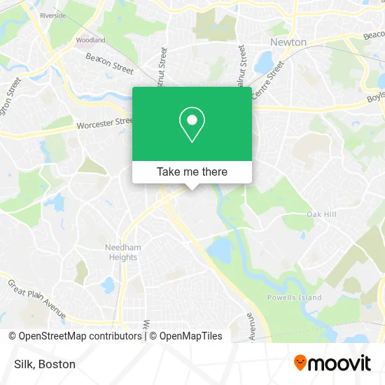
See Silk, Needham, on the map
Public Transit to Silk in Needham
Wondering how to get to Silk in Needham? Moovit helps you find the best way to get to Silk with step-by-step directions from the nearest public transit station.
Moovit provides free maps and live directions to help you navigate through your city. View schedules, routes, timetables, and find out how long does it take to get to Silk in real time.
Looking for the nearest stop or station to Silk? Check out this list of stops closest to your destination: 156 Oak St; Needham Center; Eliot.
Bus: 52, 59.Train: NEEDHAM.Subway: GREEN LINE D.
Want to see if there’s another route that gets you there at an earlier time? Moovit helps you find alternative routes or times. Get directions from and directions to Silk easily from the Moovit App or Website.
We make riding to Silk easy, which is why over 1.7 million users, including users in Needham, trust Moovit as the best app for public transit. You don’t need to download an individual bus app or train app, Moovit is your all-in-one transit app that helps you find the best bus time or train time available.
For information on prices of bus, subway and train, costs and ride fares to Silk, please check the Moovit app.
Use the app to navigate to popular places including to the airport, hospital, stadium, grocery store, mall, coffee shop, school, college, and university.
Silk Address: 75 2nd Ave street in Needham
- Sheraton-Needham Hotel ,
- Sheraton Boston Needham Hotel,
- Albion Interactive,
- Temple Beth Shalom,
- World Out World (Work Out World),
- Micro Time Computers,
- Streaming Stan 's Garage Door Repairs,
- Mobius Executive L,
- Serpentino Stained Glass,
- Restaurant Depot Warehouse,
- Wellesley Townsman,
- The Kendrick,
- Iccd Partners,
- SharkNinja Operating LLC,
- Homewood Suites by Hilton Needham Boston,
- Local Locksmith Service,
- Open Software Development,
- Homewood Suites,
- C & J Clark America,
- Nbcuniversal Boston Mediacenter
Places Near Silk (Needham)
- North End, Boston,
- Isabella Stewart Gardner Museum, Boston,
- Boston Convention & Exhibition Center, Boston,
- Leader Bank Pavilion (Leader Bank Pavillion), Boston,
- Boston Medical Center, Boston,
- Cheers, Boston,
- Wilbur Theatre, Boston,
- Faneuil Hall, Boston,
- Quincy Market, Boston,
- House Of Blues, Boston,
- Prudential Center, Boston,
- Td Garden, Boston,
- Boston Common, Boston,
- Massachusetts General Hospital, Boston,
- Seaport District, Boston,
- Castle Island, Boston,
- Museum Of Science, Boston,
- Mgm Music Hall, Boston,
- Wang Theater, Boston,
- Boston Children's Hospital, Boston
How to get to popular places in Boston with public transit
Get around Needham by public transit!
Traveling around Needham has never been so easy. See step by step directions as you travel to any attraction, street or major public transit station. View bus and train schedules, arrival times, service alerts and detailed routes on a map, so you know exactly how to get to anywhere in Needham.
When traveling to any destination around Needham use Moovit's Live Directions with Get Off Notifications to know exactly where and how far to walk, how long to wait for your line, and how many stops are left. Moovit will alert you when it's time to get off — no need to constantly re-check whether yours is the next stop.
Wondering how to use public transit in Needham or how to pay for public transit in Needham? Moovit public transit app can help you navigate your way with public transit easily, and at minimum cost. It includes public transit fees, ticket prices, and costs. Looking for a map of Needham public transit lines? Moovit public transit app shows all public transit maps in Needham with all Bus, Train, Subway and Ferry routes and stops on an interactive map.
Boston has 4 transit type(s), including: Bus, Train, Subway and Ferry, operated by several transit agencies, including MBTA, Southeastern Regional Transit Authority, MetroWest Regional Transit Authority, Rhode Island Public Transit Authority, WRTA, Lowell Regional Transit Authority, Merrimack Valley Transit, Montachusett Regional Transit Authority, Cape Cod Regional Transit Authority, Brockton Area Transit Authority, Martha's Vineyard Transit Authority, the WAVE - Nantucket Regional Transit Authority, GATRA, Cape Ann Transportation Authority and Massport