Directions to Silsden, Yorkshire (Boston) with public transportation
The following transit lines have routes that pass near Silsden, Yorkshire
 Bus: 354, 504, 92, 93, SL4.
- Train: FITCHBURG, FRAMINGHAM/WORCESTER, LOWELL, NEEDHAM.
- Subway: GREEN LINE B, GREEN LINE D, ORANGE LINE, RED LINE, BLUE LINE.
How to get to Silsden, Yorkshire by bus?
Click on the bus route to see step by step directions with maps, line arrival times and updated time schedules.
From The Burren, Somerville
58 minFrom FOUR POINTS BY SHERATON Boston Newton, Newton
34 minFrom Regent Theatre, Arlington
68 minFrom Faulkner Hospital, Boston
67 minFrom Arlington, MA, Arlington
79 minFrom Skating Club Of Boston, Boston
62 minFrom The Monument, Boston
49 minFrom Winter Hill, Somerville
49 minFrom Qea, Quincy
100 minFrom The Mall At Chestnut Hill, Newton
71 min
How to get to Silsden, Yorkshire by train?
Click on the train route to see step by step directions with maps, line arrival times and updated time schedules.
How to get to Silsden, Yorkshire by subway?
Click on the subway route to see step by step directions with maps, line arrival times and updated time schedules.
Subway stations near Silsden, Yorkshire in Boston
Bus stops near Silsden, Yorkshire in Boston
- Downtown Crossing - Franklin St @ Washington St, 2 min walk,VIEW
- Pearl St @ Congress St, 2 min walk,VIEW
- Federal St @ Franklin St, 4 min walk,VIEW
- Federal St @ Matthews St, 4 min walk,VIEW
- Otis St @ Summer St, 6 min walk,VIEW
- Chauncy St @ Summer St, 6 min walk,VIEW
- Park Street - Tremont St @ Winter St, 10 min walk,VIEW
- Park Street - Tremont St Opp Hamilton Pl, 11 min walk,VIEW
- Temple Pl @ Washington St, 11 min walk,VIEW
Bus lines to Silsden, Yorkshire in Boston
- RED LINE SHUTTLE, Ashmont - Park Street via Post Office,VIEW
- RED LINE SHUTTLE, JFK/UMass - Park Street via Post Office,VIEW
- RED LINE SHUTTLE, JFK/UMass - Park Street,VIEW
- 4, North Station,VIEW
- 15, Haymarket Via Fields Corner & Nubian,VIEW
- 39, Haymarket Via Forest Hills,VIEW
- 57, Haymarket Via Kenmore,VIEW
- 92, Sullivan,VIEW
- 93, Sullivan Via Navy Yard,VIEW
- 501, Downtown via Copley (Express) - Brighton via Copley (Express),VIEW
- 504, Downtown via Copley (Express) - Watertown via Copley and Newton Corner (Express),VIEW
- 505, Downtown (Express) - Waltham (Express),VIEW
- RED LINE SHUTTLE, Harvard - JFK/UMass via Congress Street,VIEW
- RED LINE SHUTTLE, Kendall/MIT - JFK/UMass,VIEW
- RED LINE SHUTTLE, Harvard - Broadway,VIEW
- RED LINE SHUTTLE, Kendall/MIT - Broadway via Downtown Crossing,VIEW
- RED LINE SHUTTLE, JFK/UMass - Kendall/MIT (Shuttle),VIEW
- 7, City Point Via East First St,VIEW
- RED LINE SHUTTLE, Jfk/Umass (Shuttle),VIEW
- 11, Chauncy & Summer,VIEW
What are the closest stations to Silsden, Yorkshire?
The closest stations to Silsden, Yorkshire are:
- State Street is 39 yards away, 1 min walk.
- Downtown Crossing - Franklin St @ Washington St is 147 yards away, 2 min walk.
- Pearl St @ Congress St is 151 yards away, 2 min walk.
- Federal St @ Franklin St is 246 yards away, 4 min walk.
- Government Center is 291 yards away, 4 min walk.
- Federal St @ Matthews St is 323 yards away, 4 min walk.
- Otis St @ Summer St is 427 yards away, 6 min walk.
- Chauncy St @ Summer St is 465 yards away, 6 min walk.
- Downtown Crossing is 499 yards away, 6 min walk.
- Park Street - Tremont St @ Winter St is 787 yards away, 10 min walk.
- Park Street - Tremont St Opp Hamilton Pl is 873 yards away, 11 min walk.
- Temple Pl @ Washington St is 890 yards away, 11 min walk.
Which bus lines stop near Silsden, Yorkshire?
These bus lines stop near Silsden, Yorkshire: 354, 504, 92, 93, SL4.
Which train lines stop near Silsden, Yorkshire?
These train lines stop near Silsden, Yorkshire: FITCHBURG, FRAMINGHAM/WORCESTER, LOWELL, NEEDHAM.
Which subway lines stop near Silsden, Yorkshire?
These subway lines stop near Silsden, Yorkshire: GREEN LINE B, GREEN LINE D, ORANGE LINE, RED LINE.
What’s the nearest subway station to Silsden, Yorkshire in Boston?
The nearest subway station to Silsden, Yorkshire in Boston is State Street. It’s a 1 min walk away.
What’s the nearest bus station to Silsden, Yorkshire in Boston?
The nearest bus stations to Silsden, Yorkshire in Boston are Downtown Crossing - Franklin St @ Washington St and Pearl St @ Congress St. The closest one is a 2 min walk away.
What time is the first subway to Silsden, Yorkshire in Boston?
The GREEN LINE E is the first subway that goes to Silsden, Yorkshire in Boston. It stops nearby at 5:05 AM.
What time is the last subway to Silsden, Yorkshire in Boston?
The GREEN LINE E is the last subway that goes to Silsden, Yorkshire in Boston. It stops nearby at 2:20 AM.
What time is the first bus to Silsden, Yorkshire in Boston?
The 57 is the first bus that goes to Silsden, Yorkshire in Boston. It stops nearby at 5:00 AM.
What time is the last bus to Silsden, Yorkshire in Boston?
The 11 is the last bus that goes to Silsden, Yorkshire in Boston. It stops nearby at 1:15 AM.
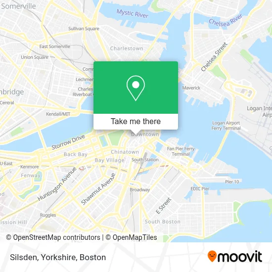
See Silsden, Yorkshire, Boston, on the map
Public Transit to Silsden, Yorkshire in Boston
Wondering how to get to Silsden, Yorkshire in Boston? Moovit helps you find the best way to get to Silsden, Yorkshire with step-by-step directions from the nearest public transit station.
Moovit provides free maps and live directions to help you navigate through your city. View schedules, routes, timetables, and find out how long does it take to get to Silsden, Yorkshire in real time.
Looking for the nearest stop or station to Silsden, Yorkshire? Check out this list of stops closest to your destination: State Street; Downtown Crossing - Franklin St @ Washington St; Pearl St @ Congress St; Federal St @ Franklin St; Government Center; Federal St @ Matthews St; Otis St @ Summer St; Chauncy St @ Summer St; Downtown Crossing; Park Street - Tremont St @ Winter St; Park Street - Tremont St Opp Hamilton Pl; Temple Pl @ Washington St.
Bus: 354, 504, 92, 93, SL4, 4, 15, 39, 57, RED LINE SHUTTLE, RED LINE SHUTTLE, RED LINE SHUTTLE, 501, 505, RED LINE SHUTTLE, RED LINE SHUTTLE.Train: FITCHBURG, FRAMINGHAM/WORCESTER, LOWELL, NEEDHAM.Subway: GREEN LINE B, GREEN LINE D, ORANGE LINE, RED LINE, BLUE LINE, GREEN LINE C, GREEN LINE E.
Want to see if there’s another route that gets you there at an earlier time? Moovit helps you find alternative routes or times. Get directions from and directions to Silsden, Yorkshire easily from the Moovit App or Website.
We make riding to Silsden, Yorkshire easy, which is why over 1.7 million users, including users in Boston, trust Moovit as the best app for public transit. You don’t need to download an individual bus app or train app, Moovit is your all-in-one transit app that helps you find the best bus time or train time available.
For information on prices of bus, subway and train, costs and ride fares to Silsden, Yorkshire, please check the Moovit app.
Use the app to navigate to popular places including to the airport, hospital, stadium, grocery store, mall, coffee shop, school, college, and university.
Location: Boston
- Capa the Global Education Network,
- Wainwright Bank & Trust,
- Mexico's Embassy in Boston,
- PRP Injection MD,
- Regina Russell's Tea Room,
- Millenium Tower,
- Northmarq Capital (North Bay Capital),
- Havas Edge,
- BBH,
- St. Anthony Shrine,
- Downtown,
- Trinity Church Boston Summer Street,
- Primark Boston,
- Millennium Tower Boston,
- 10 Summer St,
- Old Navy,
- Vermilion Software,
- Terry Atherton's Office,
- winter,
- Wework 33 Arch St
Places Near Silsden, Yorkshire (Boston)
- Boston Convention & Exhibition Center, Boston,
- Prudential Center, Boston,
- Leader Bank Pavilion (Leader Bank Pavillion), Boston,
- House Of Blues, Boston,
- Mgm Music Hall, Boston,
- Castle Island, Boston,
- Quincy Market, Boston,
- Boston Children's Hospital, Boston,
- Td Garden, Boston,
- Isabella Stewart Gardner Museum, Boston,
- Boston Common, Boston,
- Wang Theater, Boston,
- Wilbur Theatre, Boston,
- Seaport District, Boston,
- North End, Boston,
- Museum Of Science, Boston,
- Boston Medical Center, Boston,
- Cheers, Boston,
- Faneuil Hall, Boston,
- Massachusetts General Hospital, Boston
How to get to popular places in Boston with public transit
Get around Boston by public transit!
Traveling around Boston has never been so easy. See step by step directions as you travel to any attraction, street or major public transit station. View bus and train schedules, arrival times, service alerts and detailed routes on a map, so you know exactly how to get to anywhere in Boston.
When traveling to any destination around Boston use Moovit's Live Directions with Get Off Notifications to know exactly where and how far to walk, how long to wait for your line, and how many stops are left. Moovit will alert you when it's time to get off — no need to constantly re-check whether yours is the next stop.
Wondering how to use public transit in Boston or how to pay for public transit in Boston? Moovit public transit app can help you navigate your way with public transit easily, and at minimum cost. It includes public transit fees, ticket prices, and costs. Looking for a map of Boston public transit lines? Moovit public transit app shows all public transit maps in Boston with all Bus, Train, Subway and Ferry routes and stops on an interactive map.
Boston has 4 transit type(s), including: Bus, Train, Subway and Ferry, operated by several transit agencies, including MBTA, Southeastern Regional Transit Authority, MetroWest Regional Transit Authority, Rhode Island Public Transit Authority, WRTA, Lowell Regional Transit Authority, Merrimack Valley Transit, Montachusett Regional Transit Authority, Cape Cod Regional Transit Authority, Brockton Area Transit Authority, Martha's Vineyard Transit Authority, the WAVE - Nantucket Regional Transit Authority, GATRA, Cape Ann Transportation Authority and Massport