Directions to Simple Fare Catering (Medford) with public transportation
The following transit lines have routes that pass near Simple Fare Catering
 Bus: 80, 94, 95, 101, LOWELL LINE SHUTTLE.
- Train: LOWELL.
- Subway: GREEN LINE E, GREEN LINE B, GREEN LINE C, RED LINE.
How to get to Simple Fare Catering by bus?
Click on the bus route to see step by step directions with maps, line arrival times and updated time schedules.
From North End, Boston
45 minFrom Ruggles Station, Boston
66 minFrom Embassy Suites-Boston, Boston
80 minFrom Piers Park, Boston
91 minFrom Rental Car Center - Logan Airport, Boston
67 minFrom Embassy Suites Boston At Logan, Boston
80 minFrom The Lenox Hotel, Boston
62 minFrom Boston University, Boston
64 minFrom Homewood Suites by Hilton Boston Brookline-Longwood Medical, Brookline
73 minFrom 31 St. James Street, Boston
53 min
How to get to Simple Fare Catering by train?
Click on the train route to see step by step directions with maps, line arrival times and updated time schedules.
How to get to Simple Fare Catering by subway?
Click on the subway route to see step by step directions with maps, line arrival times and updated time schedules.
From North End, Boston
57 minFrom Ruggles Station, Boston
64 minFrom Embassy Suites-Boston, Boston
74 minFrom Piers Park, Boston
74 minFrom Rental Car Center - Logan Airport, Boston
66 minFrom Embassy Suites Boston At Logan, Boston
74 minFrom The Lenox Hotel, Boston
65 minFrom Boston University, Boston
80 minFrom Homewood Suites by Hilton Boston Brookline-Longwood Medical, Brookline
86 minFrom 31 St. James Street, Boston
64 min
Bus stops near Simple Fare Catering in Medford
Train station near Simple Fare Catering in Medford
- West Medford, 28 min walk,VIEW
Subway stations near Simple Fare Catering in Medford
Bus lines to Simple Fare Catering in Medford
What are the closest stations to Simple Fare Catering?
The closest stations to Simple Fare Catering are:
- High St @ Allston St is 97 yards away, 2 min walk.
- Boston Ave @ High St is 350 yards away, 5 min walk.
- West Medford is 476 yards away, 7 min walk.
- Medford/Tufts Station is 2397 yards away, 29 min walk.
- Davis Sq. is 3106 yards away, 37 min walk.
Which bus lines stop near Simple Fare Catering?
These bus lines stop near Simple Fare Catering: 80, 94, 95.
Which train line stops near Simple Fare Catering?
LOWELL (#323 | Lowell)
Which subway line stops near Simple Fare Catering?
GREEN LINE E (Lechmere)
What’s the nearest subway station to Simple Fare Catering in Medford?
The nearest subway station to Simple Fare Catering in Medford is Medford/Tufts Station. It’s a 29 min walk away.
What’s the nearest train station to Simple Fare Catering in Medford?
The nearest train station to Simple Fare Catering in Medford is West Medford. It’s a 28 min walk away.
What’s the nearest bus station to Simple Fare Catering in Medford?
The nearest bus station to Simple Fare Catering in Medford is High St @ Allston St. It’s a 2 min walk away.
What time is the first subway to Simple Fare Catering in Medford?
The GREEN LINE E is the first subway that goes to Simple Fare Catering in Medford. It stops nearby at 4:55 AM.
What time is the last subway to Simple Fare Catering in Medford?
The GREEN LINE E is the last subway that goes to Simple Fare Catering in Medford. It stops nearby at 2:41 AM.
What time is the first train to Simple Fare Catering in Medford?
The LOWELL is the first train that goes to Simple Fare Catering in Medford. It stops nearby at 5:29 AM.
What time is the last train to Simple Fare Catering in Medford?
The LOWELL is the last train that goes to Simple Fare Catering in Medford. It stops nearby at 12:20 AM.
What time is the first bus to Simple Fare Catering in Medford?
The 95 is the first bus that goes to Simple Fare Catering in Medford. It stops nearby at 4:56 AM.
What time is the last bus to Simple Fare Catering in Medford?
The 95 is the last bus that goes to Simple Fare Catering in Medford. It stops nearby at 1:36 AM.
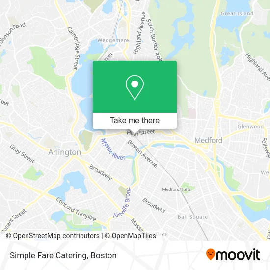
See Simple Fare Catering, Medford, on the map
Public Transit to Simple Fare Catering in Medford
Wondering how to get to Simple Fare Catering in Medford? Moovit helps you find the best way to get to Simple Fare Catering with step-by-step directions from the nearest public transit station.
Moovit provides free maps and live directions to help you navigate through your city. View schedules, routes, timetables, and find out how long does it take to get to Simple Fare Catering in real time.
Looking for the nearest stop or station to Simple Fare Catering? Check out this list of stops closest to your destination: High St @ Allston St; Boston Ave @ High St; West Medford; Medford/Tufts Station; Davis Sq..
Bus: 80, 94, 95, 101, LOWELL LINE SHUTTLE.Train: LOWELL.Subway: GREEN LINE E, GREEN LINE B, GREEN LINE C, RED LINE.
Want to see if there’s another route that gets you there at an earlier time? Moovit helps you find alternative routes or times. Get directions from and directions to Simple Fare Catering easily from the Moovit App or Website.
We make riding to Simple Fare Catering easy, which is why over 1.7 million users, including users in Medford, trust Moovit as the best app for public transit. You don’t need to download an individual bus app or train app, Moovit is your all-in-one transit app that helps you find the best bus time or train time available.
For information on prices of bus, subway and train, costs and ride fares to Simple Fare Catering, please check the Moovit app.
Use the app to navigate to popular places including to the airport, hospital, stadium, grocery store, mall, coffee shop, school, college, and university.
Simple Fare Catering Address: 460 High St street in Medford
- Big Kiki's Kickin Hot Sauce,
- Maria Fabiano - Maria Fabiano Realty,
- Es Finessed,
- Serenity Spa of the Orient,
- End Bakery,
- R&R Cleaners,
- SMC Cycles,
- West Medford Station,
- Medford Brewing Company,
- 02156,
- PP*Backyard Pots,
- St Raphael's Church Medford, MA,
- Sarah Beardslee,
- Libertyx Bitcoin ATM,
- Evangelical Haitian Church of Somerville / West Medford,
- Laubach Literacy,
- Pilleri Plumbing & Heating,
- Krasny Ugol ( Beautiful Corner ),
- West Medford Station Parking,
- Jaj Co.
Places Near Simple Fare Catering (Medford)
- Isabella Stewart Gardner Museum, Boston,
- North End, Boston,
- Mgm Music Hall, Boston,
- Leader Bank Pavilion (Leader Bank Pavillion), Boston,
- Quincy Market, Boston,
- Massachusetts General Hospital, Boston,
- Boston Convention & Exhibition Center, Boston,
- Castle Island, Boston,
- Museum Of Science, Boston,
- Td Garden, Boston,
- Faneuil Hall, Boston,
- House Of Blues, Boston,
- Boston Children's Hospital, Boston,
- Wang Theater, Boston,
- Cheers, Boston,
- Wilbur Theatre, Boston,
- Boston Medical Center, Boston,
- Boston Common, Boston,
- Seaport District, Boston,
- Prudential Center, Boston
How to get to popular places in Boston with public transit
Get around Medford by public transit!
Traveling around Medford has never been so easy. See step by step directions as you travel to any attraction, street or major public transit station. View bus and train schedules, arrival times, service alerts and detailed routes on a map, so you know exactly how to get to anywhere in Medford.
When traveling to any destination around Medford use Moovit's Live Directions with Get Off Notifications to know exactly where and how far to walk, how long to wait for your line, and how many stops are left. Moovit will alert you when it's time to get off — no need to constantly re-check whether yours is the next stop.
Wondering how to use public transit in Medford or how to pay for public transit in Medford? Moovit public transit app can help you navigate your way with public transit easily, and at minimum cost. It includes public transit fees, ticket prices, and costs. Looking for a map of Medford public transit lines? Moovit public transit app shows all public transit maps in Medford with all Bus, Train, Subway and Ferry routes and stops on an interactive map.
Boston has 4 transit type(s), including: Bus, Train, Subway and Ferry, operated by several transit agencies, including MBTA, Southeastern Regional Transit Authority, MetroWest Regional Transit Authority, Rhode Island Public Transit Authority, WRTA, Lowell Regional Transit Authority, Merrimack Valley Transit, Montachusett Regional Transit Authority, Cape Cod Regional Transit Authority, Brockton Area Transit Authority, Martha's Vineyard Transit Authority, the WAVE - Nantucket Regional Transit Authority, GATRA, Cape Ann Transportation Authority and Massport