Directions to Simulator Experience (Boston) with public transportation
The following transit lines have routes that pass near Simulator Experience
 Bus: 111, 39, 43, 69, EZRIDE.
- Train: FAIRMOUNT, FITCHBURG, FRAMINGHAM/WORCESTER, NEEDHAM, HAVERHILL.
- Subway: GREEN LINE D, GREEN LINE E, GREEN LINE B, GREEN LINE C, RED LINE.
How to get to Simulator Experience by bus?
Click on the bus route to see step by step directions with maps, line arrival times and updated time schedules.
From Jamaica Pond, Boston
79 minFrom Heartbreak Hill, Newton
80 minFrom Warrior Ice Arena, Boston
62 minFrom Sam Adams Boston Brewery Tour, Boston
85 minFrom Hebrew Rehab Center, Boston
77 minFrom The Mall At Chestnut Hill, Newton
90 minFrom McLean Hospital, Belmont
76 minFrom Newton, MA, Newton
80 minFrom Lower Mills, Boston
110 minFrom Revere Beach, Revere
69 min
How to get to Simulator Experience by train?
Click on the train route to see step by step directions with maps, line arrival times and updated time schedules.
How to get to Simulator Experience by subway?
Click on the subway route to see step by step directions with maps, line arrival times and updated time schedules.
From Jamaica Pond, Boston
46 minFrom Heartbreak Hill, Newton
65 minFrom Warrior Ice Arena, Boston
66 minFrom Sam Adams Boston Brewery Tour, Boston
37 minFrom Hebrew Rehab Center, Boston
56 minFrom The Mall At Chestnut Hill, Newton
73 minFrom Newton, MA, Newton
64 minFrom Lower Mills, Boston
58 minFrom Revere Beach, Revere
54 min
Bus stops near Simulator Experience in Boston
- Cambridge St @ Third St, 3 min walk,VIEW
- Lechmere - Monsignor O'Brien Hwy Opp Gore St, 4 min walk,VIEW
- Science Park/West End - Martha Rd @ Amy Ct, 6 min walk,VIEW
- Museum Way, 8 min walk,VIEW
- Morgan Ave., 10 min walk,VIEW
- Portland St @ Causeway St, 12 min walk,VIEW
- Lechmere, 12 min walk,VIEW
- Charles/Mgh - 325 Cambridge St, 13 min walk,VIEW
Subway stations near Simulator Experience in Boston
Train station near Simulator Experience in Boston
- North Station, 10 min walk,VIEW
Bus lines to Simulator Experience in Boston
- 69, Harvard,VIEW
- GREEN LINE SHUTTLE, Union Square (Shuttle),VIEW
- GREEN LINE E SHUTTLE, Government Center - Medford/Tufts (Shuttle),VIEW
- GREEN LINE E SHUTTLE, Medford/Tufts - North Station,VIEW
- GREEN LINE E SHUTTLE, North Station - Medford/Tufts (Shuttle),VIEW
- GREEN LINE SHUTTLE, North Station - Sullivan Square via East Somerville,VIEW
- GREEN LINE SHUTTLE, Medford/Tufts - Government Center via Union Square,VIEW
- GREEN LINE SHUTTLE, Union Square - Government Center,VIEW
- GREEN LINE SHUTTLE, Lechmere - North Station,VIEW
- EZRIDE, Inbound To North Station From Erie St,VIEW
- EZRIDE, Outbound North Station To Erie St Via Lechmere And Kendall,VIEW
- EZRIDE, Outbound To Erie St From North Station,VIEW
- EZRIDE, Inbound To North Station Via Kendall And Lechmere,VIEW
- EZRIDE, Outbound Lechemere To Kendall,VIEW
- EZRIDE, Inbound Kendall To Lechmere,VIEW
- 4, Design Center Via South Station,VIEW
- 80, Lechmere,VIEW
- 87, Arlington Center,VIEW
- 88, Lechmere,VIEW
- RED LINE SHUTTLE, Alewife - Park Street,VIEW
What are the closest stations to Simulator Experience?
The closest stations to Simulator Experience are:
- Cambridge St @ Third St is 185 yards away, 3 min walk.
- Lechmere - Monsignor O'Brien Hwy Opp Gore St is 243 yards away, 4 min walk.
- Science Park / West End is 283 yards away, 4 min walk.
- Science Park/West End - Martha Rd @ Amy Ct is 414 yards away, 6 min walk.
- Museum Way is 633 yards away, 8 min walk.
- North Station is 760 yards away, 10 min walk.
- Morgan Ave. is 820 yards away, 10 min walk.
- Portland St @ Causeway St is 938 yards away, 12 min walk.
- Lechmere is 965 yards away, 12 min walk.
- Charles/Mgh is 1008 yards away, 13 min walk.
- Charles/Mgh - 325 Cambridge St is 1051 yards away, 13 min walk.
- Community Collge is 1177 yards away, 14 min walk.
Which bus lines stop near Simulator Experience?
These bus lines stop near Simulator Experience: 111, 39, 43, 69, EZRIDE.
Which train lines stop near Simulator Experience?
These train lines stop near Simulator Experience: FAIRMOUNT, FITCHBURG, FRAMINGHAM/WORCESTER, NEEDHAM.
Which subway lines stop near Simulator Experience?
These subway lines stop near Simulator Experience: GREEN LINE D, GREEN LINE E.
What’s the nearest subway station to Simulator Experience in Boston?
The nearest subway station to Simulator Experience in Boston is Science Park / West End. It’s a 4 min walk away.
What’s the nearest train station to Simulator Experience in Boston?
The nearest train station to Simulator Experience in Boston is North Station. It’s a 10 min walk away.
What’s the nearest bus station to Simulator Experience in Boston?
The nearest bus station to Simulator Experience in Boston is Cambridge St @ Third St. It’s a 3 min walk away.
What time is the first subway to Simulator Experience in Boston?
The GREEN LINE E is the first subway that goes to Simulator Experience in Boston. It stops nearby at 4:55 AM.
What time is the last subway to Simulator Experience in Boston?
The GREEN LINE E is the last subway that goes to Simulator Experience in Boston. It stops nearby at 2:30 AM.
What time is the first train to Simulator Experience in Boston?
The LOWELL is the first train that goes to Simulator Experience in Boston. It stops nearby at 5:20 AM.
What time is the last train to Simulator Experience in Boston?
The LOWELL is the last train that goes to Simulator Experience in Boston. It stops nearby at 12:34 AM.
What time is the first bus to Simulator Experience in Boston?
The 80 is the first bus that goes to Simulator Experience in Boston. It stops nearby at 5:24 AM.
What time is the last bus to Simulator Experience in Boston?
The 69 is the last bus that goes to Simulator Experience in Boston. It stops nearby at 1:21 AM.
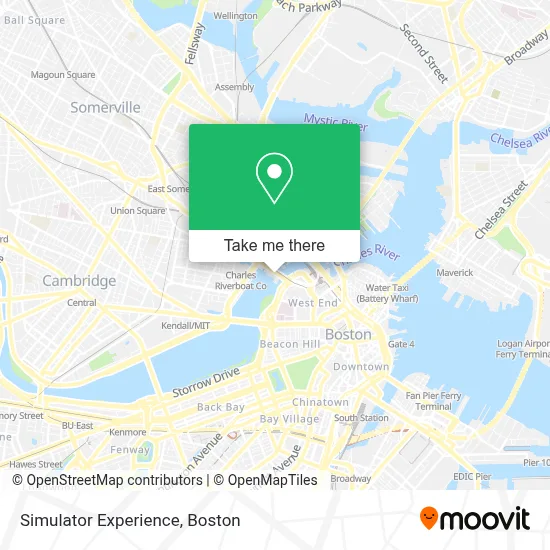
See Simulator Experience, Boston, on the map
Public Transit to Simulator Experience in Boston
Wondering how to get to Simulator Experience in Boston? Moovit helps you find the best way to get to Simulator Experience with step-by-step directions from the nearest public transit station.
Moovit provides free maps and live directions to help you navigate through your city. View schedules, routes, timetables, and find out how long does it take to get to Simulator Experience in real time.
Looking for the nearest stop or station to Simulator Experience? Check out this list of stops closest to your destination: Cambridge St @ Third St; Lechmere - Monsignor O'Brien Hwy Opp Gore St; Science Park / West End; Science Park/West End - Martha Rd @ Amy Ct; Museum Way; North Station; Morgan Ave.; Portland St @ Causeway St; Lechmere; Charles/Mgh; Charles/Mgh - 325 Cambridge St; Community Collge.
Bus: 111, 39, 43, 69, EZRIDE, GREEN LINE SHUTTLE.Train: FAIRMOUNT, FITCHBURG, FRAMINGHAM/WORCESTER, NEEDHAM, HAVERHILL, LOWELL, NEWBURYPORT/ROCKPORT, DOWNEASTER.Subway: GREEN LINE D, GREEN LINE E, GREEN LINE B, GREEN LINE C, RED LINE, ORANGE LINE.
Want to see if there’s another route that gets you there at an earlier time? Moovit helps you find alternative routes or times. Get directions from and directions to Simulator Experience easily from the Moovit App or Website.
We make riding to Simulator Experience easy, which is why over 1.7 million users, including users in Boston, trust Moovit as the best app for public transit. You don’t need to download an individual bus app or train app, Moovit is your all-in-one transit app that helps you find the best bus time or train time available.
For information on prices of subway, bus and train, costs and ride fares to Simulator Experience, please check the Moovit app.
Use the app to navigate to popular places including to the airport, hospital, stadium, grocery store, mall, coffee shop, school, college, and university.
Simulator Experience Address: 1 Museum of Science Drwy street in Boston
- MOS Discovery Center,
- Charles Hayden Planetarium,
- Museum of Science (Charles Hayden Planetarium),
- Museum Of Science,
- Mugar Omni IMAX Theatre,
- Hall of New England Life Zones,
- Hayden Planetarium,
- Hayden Planetarium MA USA,
- Charles River Dam Brg & Dr Paul Dudley White Bike Path,
- Gordon Current Science & Technology Center,
- Museum of Science Parking Garage,
- Museum of Science Parking Garage (The Msm of Sci Pking Garage),
- Northpoint Park,
- Charles River Esplanade,
- Nashua Street Jail (Suffolk County Jail),
- Leverett Circle,
- MBTA Science Park / West End Station,
- DanCyn Food Truck,
- Hult International Business School,
- Factor Bioscience
Places Near Simulator Experience (Boston)
- Boston Convention & Exhibition Center, Boston,
- Mgm Music Hall, Boston,
- Quincy Market, Boston,
- North End, Boston,
- Boston Children's Hospital, Boston,
- Leader Bank Pavilion (Leader Bank Pavillion), Boston,
- Wang Theater, Boston,
- Seaport District, Boston,
- Prudential Center, Boston,
- House Of Blues, Boston,
- Cheers, Boston,
- Isabella Stewart Gardner Museum, Boston,
- Massachusetts General Hospital, Boston,
- Wilbur Theatre, Boston,
- Boston Common, Boston,
- Castle Island, Boston,
- Faneuil Hall, Boston,
- Td Garden, Boston,
- Museum Of Science, Boston,
- Boston Medical Center, Boston
How to get to popular places in Boston with public transit
Get around Boston by public transit!
Traveling around Boston has never been so easy. See step by step directions as you travel to any attraction, street or major public transit station. View bus and train schedules, arrival times, service alerts and detailed routes on a map, so you know exactly how to get to anywhere in Boston.
When traveling to any destination around Boston use Moovit's Live Directions with Get Off Notifications to know exactly where and how far to walk, how long to wait for your line, and how many stops are left. Moovit will alert you when it's time to get off — no need to constantly re-check whether yours is the next stop.
Wondering how to use public transit in Boston or how to pay for public transit in Boston? Moovit public transit app can help you navigate your way with public transit easily, and at minimum cost. It includes public transit fees, ticket prices, and costs. Looking for a map of Boston public transit lines? Moovit public transit app shows all public transit maps in Boston with all Bus, Train, Subway and Ferry routes and stops on an interactive map.
Boston has 4 transit type(s), including: Bus, Train, Subway and Ferry, operated by several transit agencies, including MBTA, Southeastern Regional Transit Authority, MetroWest Regional Transit Authority, Rhode Island Public Transit Authority, WRTA, Lowell Regional Transit Authority, Merrimack Valley Transit, Montachusett Regional Transit Authority, Cape Cod Regional Transit Authority, Brockton Area Transit Authority, Martha's Vineyard Transit Authority, the WAVE - Nantucket Regional Transit Authority, GATRA, Cape Ann Transportation Authority and Massport