Directions to Sin City Superette (Lynn) with public transportation
The following transit lines have routes that pass near Sin City Superette
 Bus: 426, 441, 442, 455, 435.
- Train: NEWBURYPORT/ROCKPORT.
- Ferry: LYNN FERRY.
How to get to Sin City Superette by bus?
Click on the bus route to see step by step directions with maps, line arrival times and updated time schedules.
From Winthrop, Winthrop Town
75 minFrom Courtyard by Marriott Boston Logan Airport, Boston
50 minFrom 7F Everett Street, Revere
37 minFrom Melrose, MA, Melrose
75 minFrom Canobie Lake Park, Chelsea
57 minFrom Walmart, Saugus
65 minFrom Holiday Inn Express-Saugus, Saugus
65 minFrom Comfort Inn & Suites Logan International Airport, Revere
33 min
How to get to Sin City Superette by train?
Click on the train route to see step by step directions with maps, line arrival times and updated time schedules.
Bus stops near Sin City Superette in Lynn
Train station near Sin City Superette in Lynn
- Swampscott, 23 min walk,VIEW
Ferry station near Sin City Superette in Lynn
- Blossom Street Pier, 58 min walk,VIEW
Bus lines to Sin City Superette in Lynn
- 435, Neptune Towers - Salem Depot,VIEW
- 436, Central Square via Malls & Lynnfield St - Liberty Tree via North Shore Mall & Lynnfield St,VIEW
- 455, Wonderland via Central Square - Salem Depot via Central Square,VIEW
- 456, Central Square - Salem Depot,VIEW
- 429, Kings Lynn,VIEW
- 439, Nahant,VIEW
- 441, Wonderland Via Paradise Rd & Central Square,VIEW
- 442, West Lynn Garage Via Central Square & Humphrey St,VIEW
- 441/442, Ocean St Via Central Square,VIEW
- 426, Haymarket Via Cliftondale,VIEW
- NEWBURYPORT LINE SHUTTLE, Oak Grove (Local Shuttle),VIEW
- NEWBURYPORT/ROCKPORT LINE SHUTTLE, Swampscott (Shuttle),VIEW
- NEWBURYPORT/ROCKPORT LINE SHUTTLE, Beverly (Shuttle),VIEW
What are the closest stations to Sin City Superette?
The closest stations to Sin City Superette are:
- Washington St @ Munroe St is 119 yards away, 2 min walk.
- Oxford St @ Washington St is 155 yards away, 3 min walk.
- Union St @ Exchange St is 171 yards away, 3 min walk.
- Market St @ Commuter Rail is 359 yards away, 5 min walk.
- Market Street @ Lynn Commuter Rail is 406 yards away, 5 min walk.
- Swampscott is 1902 yards away, 23 min walk.
- Blossom Street Pier is 4915 yards away, 58 min walk.
Which bus lines stop near Sin City Superette?
These bus lines stop near Sin City Superette: 426, 441, 442, 455.
Which train line stops near Sin City Superette?
NEWBURYPORT/ROCKPORT (#27 | Rockport)
What’s the nearest train station to Sin City Superette in Lynn?
The nearest train station to Sin City Superette in Lynn is Swampscott. It’s a 23 min walk away.
What’s the nearest bus station to Sin City Superette in Lynn?
The nearest bus station to Sin City Superette in Lynn is Washington St @ Munroe St. It’s a 2 min walk away.
What time is the first train to Sin City Superette in Lynn?
The NEWBURYPORT/ROCKPORT is the first train that goes to Sin City Superette in Lynn. It stops nearby at 5:27 AM.
What time is the last train to Sin City Superette in Lynn?
The NEWBURYPORT/ROCKPORT is the last train that goes to Sin City Superette in Lynn. It stops nearby at 12:20 AM.
What time is the first bus to Sin City Superette in Lynn?
The 455 is the first bus that goes to Sin City Superette in Lynn. It stops nearby at 4:45 AM.
What time is the last bus to Sin City Superette in Lynn?
The 426 is the last bus that goes to Sin City Superette in Lynn. It stops nearby at 1:46 AM.
What time is the first ferry to Sin City Superette in Lynn?
The LYNN FERRY is the first ferry that goes to Sin City Superette in Lynn. It stops nearby at 6:00 AM.
What time is the last ferry to Sin City Superette in Lynn?
The LYNN FERRY is the last ferry that goes to Sin City Superette in Lynn. It stops nearby at 7:55 PM.
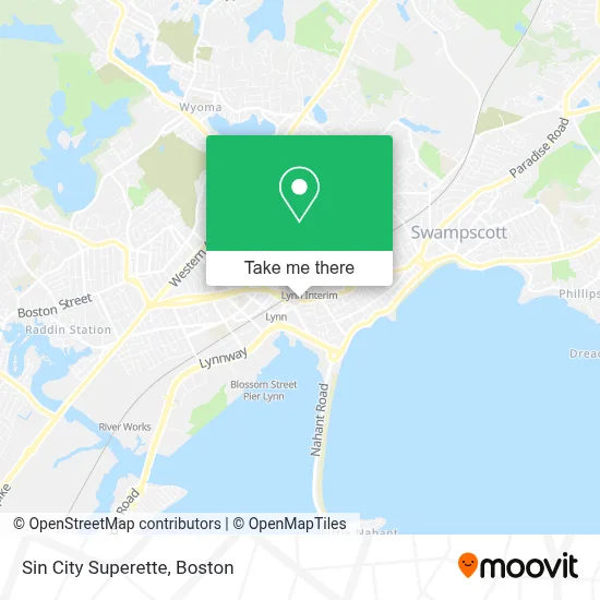
See Sin City Superette, Lynn, on the map
Public Transit to Sin City Superette in Lynn
Wondering how to get to Sin City Superette in Lynn? Moovit helps you find the best way to get to Sin City Superette with step-by-step directions from the nearest public transit station.
Moovit provides free maps and live directions to help you navigate through your city. View schedules, routes, timetables, and find out how long does it take to get to Sin City Superette in real time.
Looking for the nearest stop or station to Sin City Superette? Check out this list of stops closest to your destination: Washington St @ Munroe St; Oxford St @ Washington St; Union St @ Exchange St; Market St @ Commuter Rail; Market Street @ Lynn Commuter Rail; Swampscott; Blossom Street Pier.
Bus: 426, 441, 442, 455, 435, 436, 456, 429, 439, 441/442.Train: NEWBURYPORT/ROCKPORT.Ferry: LYNN FERRY.
Want to see if there’s another route that gets you there at an earlier time? Moovit helps you find alternative routes or times. Get directions from and directions to Sin City Superette easily from the Moovit App or Website.
We make riding to Sin City Superette easy, which is why over 1.7 million users, including users in Lynn, trust Moovit as the best app for public transit. You don’t need to download an individual bus app or train app, Moovit is your all-in-one transit app that helps you find the best bus time or train time available.
For information on prices of bus, train and subway, costs and ride fares to Sin City Superette, please check the Moovit app.
Use the app to navigate to popular places including to the airport, hospital, stadium, grocery store, mall, coffee shop, school, college, and university.
Sin City Superette Address: 71 EXCHANGE St street in Lynn
- Lysoa,
- Radio Vision,
- Iglesia Evangelica Restauraci on Y Vida,
- Sokharith Mey MD,
- Lynn Primary Care Center,
- Lynn Concrete Contractor,
- Precision Insurance,
- Family Day Care,
- Psychiatric Associates,
- USPS Collection Box - Blue Box,
- Lynn Commuter Rail,
- Lynn Community Health Center,
- Atlantic Upholstering,
- Lynn Adult Daycare,
- GLSS Providers,
- La Isla Bonita Aesthetics,
- Medical Malpractice & Negligence Lawyers,
- Bank of New England,
- Angela Schrank, Licsw,
- 24 Hours Plumbing
Places Near Sin City Superette (Lynn)
- Massachusetts General Hospital, Boston,
- Prudential Center, Boston,
- Isabella Stewart Gardner Museum, Boston,
- Museum Of Science, Boston,
- Leader Bank Pavilion (Leader Bank Pavillion), Boston,
- Cheers, Boston,
- Td Garden, Boston,
- Boston Medical Center, Boston,
- Faneuil Hall, Boston,
- House Of Blues, Boston,
- Castle Island, Boston,
- Mgm Music Hall, Boston,
- North End, Boston,
- Seaport District, Boston,
- Boston Children's Hospital, Boston,
- Wilbur Theatre, Boston,
- Boston Convention & Exhibition Center, Boston,
- Quincy Market, Boston,
- Boston Common, Boston,
- Wang Theater, Boston
How to get to popular places in Boston with public transit
Get around Lynn by public transit!
Traveling around Lynn has never been so easy. See step by step directions as you travel to any attraction, street or major public transit station. View bus and train schedules, arrival times, service alerts and detailed routes on a map, so you know exactly how to get to anywhere in Lynn.
When traveling to any destination around Lynn use Moovit's Live Directions with Get Off Notifications to know exactly where and how far to walk, how long to wait for your line, and how many stops are left. Moovit will alert you when it's time to get off — no need to constantly re-check whether yours is the next stop.
Wondering how to use public transit in Lynn or how to pay for public transit in Lynn? Moovit public transit app can help you navigate your way with public transit easily, and at minimum cost. It includes public transit fees, ticket prices, and costs. Looking for a map of Lynn public transit lines? Moovit public transit app shows all public transit maps in Lynn with all Bus, Train, Subway and Ferry routes and stops on an interactive map.
Boston has 4 transit type(s), including: Bus, Train, Subway and Ferry, operated by several transit agencies, including MBTA, Southeastern Regional Transit Authority, MetroWest Regional Transit Authority, Rhode Island Public Transit Authority, WRTA, Lowell Regional Transit Authority, Merrimack Valley Transit, Montachusett Regional Transit Authority, Cape Cod Regional Transit Authority, Brockton Area Transit Authority, Martha's Vineyard Transit Authority, the WAVE - Nantucket Regional Transit Authority, GATRA, Cape Ann Transportation Authority and Massport