How to get to Sink & Spout by bus?
Click on the bus route to see step by step directions with maps, line arrival times and updated time schedules.
How to get to Sink & Spout by train?
Click on the train route to see step by step directions with maps, line arrival times and updated time schedules.
Bus stops near Sink & Spout in Lowell
What are the closest stations to Sink & Spout?
The closest stations to Sink & Spout are:
- Across From 1075 Westford St is 112 yards away, 2 min walk.
- Middlesex St & Cornell St is 117 yards away, 2 min walk.
Which bus lines stop near Sink & Spout?
These bus lines stop near Sink & Spout: 14, 5.
Which train line stops near Sink & Spout?
LOWELL (#323 | Lowell)
What’s the nearest bus station to Sink & Spout in Lowell?
The nearest bus stations to Sink & Spout in Lowell are Across From 1075 Westford St and Middlesex St & Cornell St. The closest one is a 2 min walk away.
What time is the first bus to Sink & Spout in Lowell?
The 5 is the first bus that goes to Sink & Spout in Lowell. It stops nearby at 5:50 AM.
What time is the last bus to Sink & Spout in Lowell?
The 17 is the last bus that goes to Sink & Spout in Lowell. It stops nearby at 7:46 PM.
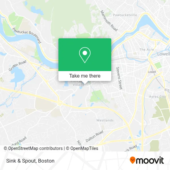
See Sink & Spout, Lowell, on the map
Public Transit to Sink & Spout in Lowell
Wondering how to get to Sink & Spout in Lowell? Moovit helps you find the best way to get to Sink & Spout with step-by-step directions from the nearest public transit station.
Moovit provides free maps and live directions to help you navigate through your city. View schedules, routes, timetables, and find out how long does it take to get to Sink & Spout in real time.
Looking for the nearest stop or station to Sink & Spout? Check out this list of stops closest to your destination: Across From 1075 Westford St; Middlesex St & Cornell St.
Bus: 14, 5, 17.Train: LOWELL.
Want to see if there’s another route that gets you there at an earlier time? Moovit helps you find alternative routes or times. Get directions from and directions to Sink & Spout easily from the Moovit App or Website.
We make riding to Sink & Spout easy, which is why over 1.7 million users, including users in Lowell, trust Moovit as the best app for public transit. You don’t need to download an individual bus app or train app, Moovit is your all-in-one transit app that helps you find the best bus time or train time available.
For information on prices of bus and train, costs and ride fares to Sink & Spout, please check the Moovit app.
Use the app to navigate to popular places including to the airport, hospital, stadium, grocery store, mall, coffee shop, school, college, and university.
Sink & Spout Address: 1035 Westford St Ste B street in Lowell
- Shrenikahennart,
- The Tower,
- Lowell Locksmith Shop,
- KUMON,
- Lowell Primary Care Center,
- Billerica Dental Office,
- Girl Scout Council,
- Celestial Endtime Ministries International,
- James Caulfield,
- Mill City Church,
- Neasc,
- 645 Princeton Blvd Parking,
- Lowell Fast Auto Glass Service,
- McGovern Ford at Drum Hill,
- Millcity Dance and Arts,
- Millcitydance,
- Medwell Health and Wellness Centers,
- Mama Angie's Steam Bun,
- Vishal Sohal,
- Studio Milk Tea
Places Near Sink & Spout (Lowell)
- Castle Island, Boston,
- Wang Theater, Boston,
- House Of Blues, Boston,
- Boston Children's Hospital, Boston,
- Seaport District, Boston,
- Wilbur Theatre, Boston,
- Leader Bank Pavilion (Leader Bank Pavillion), Boston,
- Boston Common, Boston,
- North End, Boston,
- Td Garden, Boston,
- Prudential Center, Boston,
- Quincy Market, Boston,
- Museum Of Science, Boston,
- Massachusetts General Hospital, Boston,
- Mgm Music Hall, Boston,
- Boston Medical Center, Boston,
- Isabella Stewart Gardner Museum, Boston,
- Boston Convention & Exhibition Center, Boston,
- Faneuil Hall, Boston,
- Cheers, Boston
How to get to popular places in Boston with public transit
Get around Lowell by public transit!
Traveling around Lowell has never been so easy. See step by step directions as you travel to any attraction, street or major public transit station. View bus and train schedules, arrival times, service alerts and detailed routes on a map, so you know exactly how to get to anywhere in Lowell.
When traveling to any destination around Lowell use Moovit's Live Directions with Get Off Notifications to know exactly where and how far to walk, how long to wait for your line, and how many stops are left. Moovit will alert you when it's time to get off — no need to constantly re-check whether yours is the next stop.
Wondering how to use public transit in Lowell or how to pay for public transit in Lowell? Moovit public transit app can help you navigate your way with public transit easily, and at minimum cost. It includes public transit fees, ticket prices, and costs. Looking for a map of Lowell public transit lines? Moovit public transit app shows all public transit maps in Lowell with all Bus, Train, Subway and Ferry routes and stops on an interactive map.
Boston has 4 transit type(s), including: Bus, Train, Subway and Ferry, operated by several transit agencies, including MBTA, Southeastern Regional Transit Authority, MetroWest Regional Transit Authority, Rhode Island Public Transit Authority, WRTA, Lowell Regional Transit Authority, Merrimack Valley Transit, Montachusett Regional Transit Authority, Cape Cod Regional Transit Authority, Brockton Area Transit Authority, Martha's Vineyard Transit Authority, the WAVE - Nantucket Regional Transit Authority, GATRA, Cape Ann Transportation Authority and Massport