Directions to Six Gables Designs (Boston) with public transportation
The following transit lines have routes that pass near Six Gables Designs
 Bus: 95X.
- Train: NORTHEAST REGIONAL.
How to get to Six Gables Designs by bus?
Click on the bus route to see step by step directions with maps, line arrival times and updated time schedules.
How to get to Six Gables Designs by train?
Click on the train route to see step by step directions with maps, line arrival times and updated time schedules.
Bus stop near Six Gables Designs in Boston
- Westerly Town Hall, 3 min walk,VIEW
Train station near Six Gables Designs in Boston
- Westerly Amtrak, 34 min walk,VIEW
Bus lines to Six Gables Designs in Boston
- 95X, Providence,VIEW
What are the closest stations to Six Gables Designs?
The closest stations to Six Gables Designs are:
- Westerly Town Hall is 163 yards away, 3 min walk.
- Westerly Amtrak is 2817 yards away, 34 min walk.
Which bus line stops near Six Gables Designs?
95X (Westerly)
Which train line stops near Six Gables Designs?
NORTHEAST REGIONAL (Norfolk)
What’s the nearest bus station to Six Gables Designs in Boston?
The nearest bus station to Six Gables Designs in Boston is Westerly Town Hall. It’s a 3 min walk away.
What time is the first train to Six Gables Designs in Boston?
The NORTHEAST REGIONAL is the first train that goes to Six Gables Designs in Boston. It stops nearby at 7:25 AM.
What time is the last train to Six Gables Designs in Boston?
The NORTHEAST REGIONAL is the last train that goes to Six Gables Designs in Boston. It stops nearby at 8:39 AM.
What time is the first bus to Six Gables Designs in Boston?
The 95X is the first bus that goes to Six Gables Designs in Boston. It stops nearby at 6:30 AM.
What time is the last bus to Six Gables Designs in Boston?
The 95X is the last bus that goes to Six Gables Designs in Boston. It stops nearby at 6:00 PM.
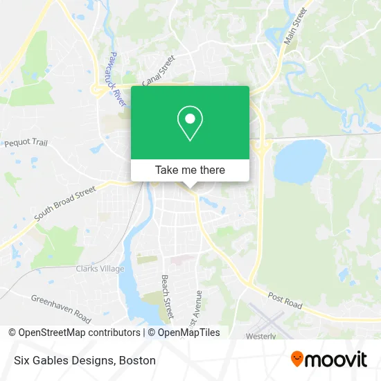
See Six Gables Designs, Boston, on the map
Public Transit to Six Gables Designs in Boston
Wondering how to get to Six Gables Designs in Boston? Moovit helps you find the best way to get to Six Gables Designs with step-by-step directions from the nearest public transit station.
Moovit provides free maps and live directions to help you navigate through your city. View schedules, routes, timetables, and find out how long does it take to get to Six Gables Designs in real time.
Looking for the nearest stop or station to Six Gables Designs? Check out this list of stops closest to your destination: Westerly Town Hall; Westerly Amtrak.
Bus: 95X.Train: NORTHEAST REGIONAL.
Want to see if there’s another route that gets you there at an earlier time? Moovit helps you find alternative routes or times. Get directions from and directions to Six Gables Designs easily from the Moovit App or Website.
We make riding to Six Gables Designs easy, which is why over 1.7 million users, including users in Boston, trust Moovit as the best app for public transit. You don’t need to download an individual bus app or train app, Moovit is your all-in-one transit app that helps you find the best bus time or train time available.
For information on prices of bus and train, costs and ride fares to Six Gables Designs, please check the Moovit app.
Use the app to navigate to popular places including to the airport, hospital, stadium, grocery store, mall, coffee shop, school, college, and university.
Six Gables Designs Address: 78 Granite St street in Boston
- A Simple Solution,
- Westerly Inclusion Preschool P,
- School Dept of Westerly,
- Chris Walsh Productions,
- Brick+Beam Studio,
- Footprints Reflexology,
- Cory's Rubbish Removal,
- Thompson Diane Licsw,
- South County Head Start,
- Napatree Vocational Services,
- Westerly Dental,
- AAA Bail Bonds,
- Masonic Lodge,
- Get Poppin Creativ,
- The Granite Theatre,
- Computadvice,
- Living Supplies Closet,
- Troop 16 Westerly Ri (Bsa),
- Strategic Focus,
- Coastal Eye Associates
Places Near Six Gables Designs (Boston)
- Leader Bank Pavilion (Leader Bank Pavillion), Boston,
- Prudential Center, Boston,
- Faneuil Hall, Boston,
- Quincy Market, Boston,
- Td Garden, Boston,
- Cheers, Boston,
- Mgm Music Hall, Boston,
- Wang Theater, Boston,
- Boston Convention & Exhibition Center, Boston,
- Massachusetts General Hospital, Boston,
- Isabella Stewart Gardner Museum, Boston,
- Boston Children's Hospital, Boston,
- Wilbur Theatre, Boston,
- North End, Boston,
- House Of Blues, Boston,
- Museum Of Science, Boston,
- Boston Medical Center, Boston,
- Boston Common, Boston,
- Castle Island, Boston,
- Seaport District, Boston
How to get to popular places in Boston with public transit
Get around Boston by public transit!
Traveling around Boston has never been so easy. See step by step directions as you travel to any attraction, street or major public transit station. View bus and train schedules, arrival times, service alerts and detailed routes on a map, so you know exactly how to get to anywhere in Boston.
When traveling to any destination around Boston use Moovit's Live Directions with Get Off Notifications to know exactly where and how far to walk, how long to wait for your line, and how many stops are left. Moovit will alert you when it's time to get off — no need to constantly re-check whether yours is the next stop.
Wondering how to use public transit in Boston or how to pay for public transit in Boston? Moovit public transit app can help you navigate your way with public transit easily, and at minimum cost. It includes public transit fees, ticket prices, and costs. Looking for a map of Boston public transit lines? Moovit public transit app shows all public transit maps in Boston with all Bus, Train, Subway and Ferry routes and stops on an interactive map.
Boston has 4 transit type(s), including: Bus, Train, Subway and Ferry, operated by several transit agencies, including MBTA, Southeastern Regional Transit Authority, MetroWest Regional Transit Authority, Rhode Island Public Transit Authority, WRTA, Lowell Regional Transit Authority, Merrimack Valley Transit, Montachusett Regional Transit Authority, Cape Cod Regional Transit Authority, Brockton Area Transit Authority, Martha's Vineyard Transit Authority, the WAVE - Nantucket Regional Transit Authority, GATRA, Cape Ann Transportation Authority and Massport