Directions to Skematic (Medford) with public transportation
The following transit lines have routes that pass near Skematic
 Bus: 105, 109, 110, 108, 134.
- Train: NEWBURYPORT/ROCKPORT, HAVERHILL.
- Subway: ORANGE LINE.
How to get to Skematic by bus?
Click on the bus route to see step by step directions with maps, line arrival times and updated time schedules.
From SoWa Vintage Market, Boston
93 minFrom MBTA Jackson Square Station, Boston
104 minFrom Walmart, Lynn
79 minFrom Sunrise Shuttle Pick Up, Boston
59 minFrom Centre St, Boston
107 minFrom Registry of Motor Vehicles (RMV) Boston, Boston
63 minFrom The Fairmont Copley Plaza Hotel, Boston
77 minFrom Choi's Health Spa, Saugus
67 minFrom The Wilbur, Boston
122 minFrom Macy's, Boston
61 min
How to get to Skematic by train?
Click on the train route to see step by step directions with maps, line arrival times and updated time schedules.
How to get to Skematic by subway?
Click on the subway route to see step by step directions with maps, line arrival times and updated time schedules.
From SoWa Vintage Market, Boston
43 minFrom MBTA Jackson Square Station, Boston
41 minFrom Sunrise Shuttle Pick Up, Boston
42 minFrom Centre St, Boston
45 minFrom Registry of Motor Vehicles (RMV) Boston, Boston
27 minFrom The Fairmont Copley Plaza Hotel, Boston
36 minFrom The Wilbur, Boston
59 minFrom Macy's, Boston
30 min
Subway station near Skematic in Medford
- Assembly, 4 min walk,VIEW
Bus stops near Skematic in Medford
Bus lines to Skematic in Medford
- 108, Wellington,VIEW
- 134, North Woburn Via Veterans Senior Center,VIEW
- 100, Elm St,VIEW
- 97, Wellington - Malden,VIEW
- 99, Wellington - Woodland Rd,VIEW
- 106, Wellington - Lebanon Loop,VIEW
- 110, Wellington - Wonderland,VIEW
- 112, Wood Island via Market Basket & Admiral's Hill - Wellington via Admiral's Hill & Market Basket,VIEW
What are the closest stations to Skematic?
The closest stations to Skematic are:
- Assembly is 296 yards away, 4 min walk.
- Middlesex Ave @ First St is 556 yards away, 7 min walk.
- Fellsway @ Bradbury Ave is 712 yards away, 9 min walk.
- Corporation Way is 841 yards away, 10 min walk.
- Oak Grove is 2256 yards away, 27 min walk.
- Chelsea is 5197 yards away, 64 min walk.
Which bus lines stop near Skematic?
These bus lines stop near Skematic: 105, 109, 110.
Which train line stops near Skematic?
NEWBURYPORT/ROCKPORT (#120 | North Station)
Which subway line stops near Skematic?
ORANGE LINE (Oak Grove)
What’s the nearest subway station to Skematic in Medford?
The nearest subway station to Skematic in Medford is Assembly. It’s a 4 min walk away.
What’s the nearest train station to Skematic in Medford?
The nearest train station to Skematic in Medford is Oak Grove. It’s a 27 min walk away.
What’s the nearest bus station to Skematic in Medford?
The nearest bus station to Skematic in Medford is Middlesex Ave @ First St. It’s a 7 min walk away.
What time is the first subway to Skematic in Medford?
The ORANGE LINE is the first subway that goes to Skematic in Medford. It stops nearby at 5:15 AM.
What time is the last subway to Skematic in Medford?
The ORANGE LINE is the last subway that goes to Skematic in Medford. It stops nearby at 1:59 AM.
What time is the first train to Skematic in Medford?
The HAVERHILL is the first train that goes to Skematic in Medford. It stops nearby at 5:35 AM.
What time is the last train to Skematic in Medford?
The NEWBURYPORT/ROCKPORT is the last train that goes to Skematic in Medford. It stops nearby at 12:06 AM.
What time is the first bus to Skematic in Medford?
The 110 is the first bus that goes to Skematic in Medford. It stops nearby at 5:00 AM.
What time is the last bus to Skematic in Medford?
The 110 is the last bus that goes to Skematic in Medford. It stops nearby at 2:08 AM.
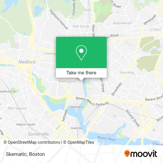
See Skematic, Medford, on the map
Public Transit to Skematic in Medford
Wondering how to get to Skematic in Medford? Moovit helps you find the best way to get to Skematic with step-by-step directions from the nearest public transit station.
Moovit provides free maps and live directions to help you navigate through your city. View schedules, routes, timetables, and find out how long does it take to get to Skematic in real time.
Looking for the nearest stop or station to Skematic? Check out this list of stops closest to your destination: Assembly; Middlesex Ave @ First St; Fellsway @ Bradbury Ave; Corporation Way; Oak Grove; Chelsea.
Bus: 105, 109, 110, 108, 134, 100, 97, 99, 106, 112.Train: NEWBURYPORT/ROCKPORT, HAVERHILL.Subway: ORANGE LINE.
Want to see if there’s another route that gets you there at an earlier time? Moovit helps you find alternative routes or times. Get directions from and directions to Skematic easily from the Moovit App or Website.
We make riding to Skematic easy, which is why over 1.7 million users, including users in Medford, trust Moovit as the best app for public transit. You don’t need to download an individual bus app or train app, Moovit is your all-in-one transit app that helps you find the best bus time or train time available.
For information on prices of bus, subway and train, costs and ride fares to Skematic, please check the Moovit app.
Use the app to navigate to popular places including to the airport, hospital, stadium, grocery store, mall, coffee shop, school, college, and university.
Skematic Address: 400 Rivers Edge Dr Fl 4 street in Medford
- Rivers Edge Walk,
- The Porch Southern Fare & Juke Joint,
- RE150,
- Ideal Turf Solutions,
- Rivergreen Park,
- CMF Cranio-Maxillofacial Surgery Associates,
- Mobil Mart,
- Sunrise Cuisine,
- H Mart,
- Amber Comeau, Psychiatric Nurse Practitioner,
- Molly Weiner, Counselor,
- Lotusworks,
- Malden City Yard,
- Malden Center, MA,
- Office People,
- Heritage Wholesalers,
- Madeline English School,
- Donut Villa Diner,
- Monogram Foods,
- Dollar Tree
Places Near Skematic (Medford)
- Td Garden, Boston,
- Leader Bank Pavilion (Leader Bank Pavillion), Boston,
- Boston Common, Boston,
- Cheers, Boston,
- Prudential Center, Boston,
- Mgm Music Hall, Boston,
- Museum Of Science, Boston,
- Wilbur Theatre, Boston,
- Castle Island, Boston,
- Massachusetts General Hospital, Boston,
- House Of Blues, Boston,
- Isabella Stewart Gardner Museum, Boston,
- Boston Children's Hospital, Boston,
- Boston Convention & Exhibition Center, Boston,
- Faneuil Hall, Boston,
- Wang Theater, Boston,
- Seaport District, Boston,
- North End, Boston,
- Boston Medical Center, Boston,
- Quincy Market, Boston
How to get to popular places in Boston with public transit
Get around Medford by public transit!
Traveling around Medford has never been so easy. See step by step directions as you travel to any attraction, street or major public transit station. View bus and train schedules, arrival times, service alerts and detailed routes on a map, so you know exactly how to get to anywhere in Medford.
When traveling to any destination around Medford use Moovit's Live Directions with Get Off Notifications to know exactly where and how far to walk, how long to wait for your line, and how many stops are left. Moovit will alert you when it's time to get off — no need to constantly re-check whether yours is the next stop.
Wondering how to use public transit in Medford or how to pay for public transit in Medford? Moovit public transit app can help you navigate your way with public transit easily, and at minimum cost. It includes public transit fees, ticket prices, and costs. Looking for a map of Medford public transit lines? Moovit public transit app shows all public transit maps in Medford with all Bus, Train, Subway and Ferry routes and stops on an interactive map.
Boston has 4 transit type(s), including: Bus, Train, Subway and Ferry, operated by several transit agencies, including MBTA, Southeastern Regional Transit Authority, MetroWest Regional Transit Authority, Rhode Island Public Transit Authority, WRTA, Lowell Regional Transit Authority, Merrimack Valley Transit, Montachusett Regional Transit Authority, Cape Cod Regional Transit Authority, Brockton Area Transit Authority, Martha's Vineyard Transit Authority, the WAVE - Nantucket Regional Transit Authority, GATRA, Cape Ann Transportation Authority and Massport