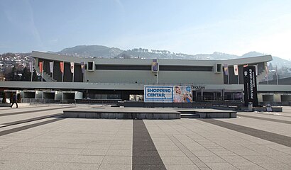
Directions to Skenderija station (Centar Sarajevo) with public transit
The following transit lines have routes that pass near Skenderija
How to get to Skenderija station by bus?
Click on the bus route to see step by step directions with maps, line arrival times and updated time schedules.
How to get to Skenderija station by tram?
Click on the tram route to see step by step directions with maps, line arrival times and updated time schedules.
Minibus stations near Skenderija station in Centar Sarajevo
- Skenderija, 1 min walk,
Tram stations near Skenderija station in Centar Sarajevo
- Skenderija, 1 min walk,
Light Rail stations near Skenderija station in Centar Sarajevo
- Skenderija, 2 min walk,
Bus stops near Skenderija stop in Centar Sarajevo
- Park, 3 min walk,
- Sutjeska, 5 min walk,
- Alipašina, 6 min walk,
- Čobanija, 12 min walk,
- Skenderija, 12 min walk,
Bus lines to Skenderija station in Centar Sarajevo
- 14, Park - Podhrastovi,
- 17B, Dom Armije - Breka II,
- 20B, Park - Bušća,
- 31E, Vijećnica - Dobrinja,
- 31E, Dobrinja (Komercijala) - Vijećnica,
- 200E, Baščaršija - Aerodrom,
- 27E-1, Hrasnica - Vijećnica,
- 21, Vogošća - Sutjeska,
- 21, Sutjeska - Vogošća,
- 22, Lješevo - Sutjeska,
- 22, Ilijaš - Sutjeska,
- 29, Kamenica - Sutjeska,
- 201, Ilijaš - Autobusni Kolodvor,
- 202, Autobusni Kolodvor - Kamenica,
- 16B, Koševsko Brdo - Dom Armije,
- 18, Pofalići - Drvenija,
- 41, Gornji Velešići - Drvenija,
- 41A, Donji Velešići - Drvenija,
- 59, Skenderija - Širokača,
What are the closest stations to Skenderija?
The closest stations to Skenderija are:
- Skenderija is 23 meters away, 1 min walk.
- Park is 198 meters away, 3 min walk.
- Sutjeska is 306 meters away, 5 min walk.
- Alipašina is 441 meters away, 6 min walk.
- Čobanija is 856 meters away, 12 min walk.
Which bus lines stop near Skenderija?
These bus lines stop near Skenderija: 18, 22, 27E-1, 31E, 41.
Which tram lines stop near Skenderija?
These tram lines stop near Skenderija: 103, 107.
Which light rail line stops near Skenderija?
3
What’s the nearest light rail station to Skenderija in Centar Sarajevo?
The nearest light rail station to Skenderija in Centar Sarajevo is Skenderija. It’s a 2 min walk away.
What’s the nearest tram station to Skenderija in Centar Sarajevo?
The nearest tram station to Skenderija in Centar Sarajevo is Skenderija. It’s a 1 min walk away.
What’s the nearest bus stop to Skenderija in Centar Sarajevo?
The nearest bus stop to Skenderija in Centar Sarajevo is Park. It’s a 3 min walk away.
What’s the nearest minibus station to Skenderija in Centar Sarajevo?
The nearest minibus station to Skenderija in Centar Sarajevo is Skenderija. It’s a 1 min walk away.
See Skenderija station, Centar Sarajevo, on the map
Public Transit to Skenderija in Centar Sarajevo
Looking for directions to Skenderija in Centar Sarajevo, Bosnia and Herzegovina?
Download the Moovit App to find the current schedule and step-by-step directions for Bus, Light Rail, Tram or Minibus routes that pass through Skenderija.
Looking for the nearest stops closest to Skenderija ? Check out this list of closest stops to your destination: Skenderija; Park; Sutjeska; Alipašina; Čobanija.
Bus: 18, 22, 27E-1, 31E, 41, 14, 17B, 20B, 200E, 21, 21, 29, 201, 202, 16B.Tram: 103, 107, 101, 102.Light Rail: 3.Minibus: 62, 98.
We make riding on public transit to Skenderija easy, which is why over 1.5 million users, including users in Centar Sarajevo trust Moovit as the best app for public transit.
Use the app to navigate to popular places including to the airport, hospital, stadium, grocery store, mall, coffee shop, school, college, and university.
Location: Centar Sarajevo, Sarajevo
Popular routes from Skenderija station, Centar Sarajevo
Minibus station near Skenderija station
Tram station near Skenderija station
Light Rail station near Skenderija station
Get around Centar Sarajevo by public transit!
Traveling around Centar Sarajevo has never been so easy. See step by step directions as you travel to any attraction, street or major public transit station. View bus and train schedules, arrival times, service alerts and detailed routes on a map, so you know exactly how to get to anywhere in Centar Sarajevo.
When traveling to any destination around Centar Sarajevo use Moovit's Live Directions with Get Off Notifications to know exactly where and how far to walk, how long to wait for your line, and how many stops are left. Moovit will alert you when it's time to get off — no need to constantly re-check whether yours is the next stop.
Wondering how to use public transit in Centar Sarajevo or how to pay for public transit in Centar Sarajevo? Moovit public transit app can help you navigate your way with public transit easily, and at minimum cost. It includes public transit fees, ticket prices, and costs. Looking for a map of Centar Sarajevo public transit lines? Moovit public transit app shows all public transit maps in Centar Sarajevo with all Bus, Tram, Light Rail, Minibus and Gondola routes and stops on an interactive map.
Sarajevo has 5 transit type(s), including: Bus, Tram, Light Rail, Minibus and Gondola, operated by several transit agencies, including Gras, Centrotrans and JP Sarajevo