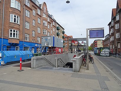
See Skjolds Plads 2, København, on the map
Directions to Skjolds Plads 2 (København) with public transportation
The following transit lines have routes that pass near Skjolds Plads 2
 Bus:
Bus: - Train:
- Metro:
How to get to Skjolds Plads 2 by bus?
Click on the bus route to see step by step directions with maps, line arrival times and updated time schedules.
How to get to Skjolds Plads 2 by train?
Click on the train route to see step by step directions with maps, line arrival times and updated time schedules.
How to get to Skjolds Plads 2 by metro?
Click on the metro route to see step by step directions with maps, line arrival times and updated time schedules.
Bus stations near Skjolds Plads 2 in København
- Universitetsparken (Jagtvej),5 min walk,
- Aldersrogade (Haraldsgade),5 min walk,
- Ægirsgade (Tagensvej),5 min walk,
- Jagtvej (Lersø Parkallé),5 min walk,
Train stations near Skjolds Plads 2 in København
- Bispebjerg St.,12 min walk,
Metro stations near Skjolds Plads 2 in København
- Vibenshus Runddel St. (Metro),13 min walk,
Bus lines to Skjolds Plads 2 in København
- 18,Emdrup Torv,
- 12,Svanemøllen St.,
- 6A,Emdrup Torv,
- 14,Østerbro Ryparken,
What are the closest stations to Skjolds Plads 2?
The closest stations to Skjolds Plads 2 are:
- Universitetsparken (Jagtvej) is 336 meters away, 5 min walk.
- Aldersrogade (Haraldsgade) is 342 meters away, 5 min walk.
- Ægirsgade (Tagensvej) is 356 meters away, 5 min walk.
- Jagtvej (Lersø Parkallé) is 381 meters away, 5 min walk.
- Bispebjerg St. is 922 meters away, 12 min walk.
- Vibenshus Runddel St. (Metro) is 944 meters away, 13 min walk.
Which bus lines stop near Skjolds Plads 2?
These bus lines stop near Skjolds Plads 2: 12, 18, 350S, 5C, 6A.
Which train line stops near Skjolds Plads 2?
F
Which metro line stops near Skjolds Plads 2?
M3
What’s the nearest metro station to Skjolds Plads 2 in København?
The nearest metro station to Skjolds Plads 2 in København is Vibenshus Runddel St. (Metro). It’s a 13 min walk away.
What’s the nearest train station to Skjolds Plads 2 in København?
The nearest train station to Skjolds Plads 2 in København is Bispebjerg St.. It’s a 12 min walk away.
What’s the nearest bus stop to Skjolds Plads 2 in København?
The nearest bus stops to Skjolds Plads 2 in København are Universitetsparken (Jagtvej), Aldersrogade (Haraldsgade), Ægirsgade (Tagensvej) and Jagtvej (Lersø Parkallé). The closest one is a 5 min walk away.
What time is the first metro to Skjolds Plads 2 in København?
The M3 is the first metro that goes to Skjolds Plads 2 in København. It stops nearby at 3:00 AM.
What time is the last metro to Skjolds Plads 2 in København?
The M3 is the last metro that goes to Skjolds Plads 2 in København. It stops nearby at 3:11 AM.
What time is the first train to Skjolds Plads 2 in København?
The F is the first train that goes to Skjolds Plads 2 in København. It stops nearby at 5:06 AM.
What time is the last train to Skjolds Plads 2 in København?
The F is the last train that goes to Skjolds Plads 2 in København. It stops nearby at 12:59 AM.
What time is the first bus to Skjolds Plads 2 in København?
The 6A is the first bus that goes to Skjolds Plads 2 in København. It stops nearby at 3:02 AM.
What time is the last bus to Skjolds Plads 2 in København?
The 6A is the last bus that goes to Skjolds Plads 2 in København. It stops nearby at 3:07 AM.
See Skjolds Plads 2, København, on the map
Public Transit to Skjolds Plads 2 in København
Wondering how to get to Skjolds Plads 2 in København, Denmark? Moovit helps you find the best way to get to Skjolds Plads 2 with step-by-step directions from the nearest public transit station.
Moovit provides free maps and live directions to help you navigate through your city. View schedules, routes, timetables, and find out how long does it take to get to Skjolds Plads 2 in real time.
Looking for the nearest stop or station to Skjolds Plads 2? Check out this list of stops closest to your destination: Universitetsparken (Jagtvej); Aldersrogade (Haraldsgade); Ægirsgade (Tagensvej); Jagtvej (Lersø Parkallé); Bispebjerg St.; Vibenshus Runddel St. (Metro).
Bus:Train:Metro:
Want to see if there’s another route that gets you there at an earlier time? Moovit helps you find alternative routes or times. Get directions from and directions to Skjolds Plads 2 easily from the Moovit App or Website.
We make riding to Skjolds Plads 2 easy, which is why over 1.5 million users, including users in København, trust Moovit as the best app for public transit. You don’t need to download an individual bus app or train app, Moovit is your all-in-one transit app that helps you find the best bus time or train time available.
For information on prices of bus, train and metro, costs and ride fares to Skjolds Plads 2, please check the Moovit app.
Use the app to navigate to popular places including to the airport, hospital, stadium, grocery store, mall, coffee shop, school, college, and university.
Skjolds Plads 2 Address: Skjolds Plads 2, 2200 København N, Danmark street in København
Attractions near Skjolds Plads 2
Foodsharing Copenhagen,Alexander Holm,Sa Lone Frisør,Aras,Mønt Vask Laundromat,Cafe Baretto,Professionshøjskolen Metropol - Sygeplejerskeuddannelsen,Kp Tagensvej,Db Line,Manakish Libanon,Byens Slagter,Tagensvej,Anna Maria Otocka,Kbh. Services,Krav Maga Copenhagen,Tagensvej 69 Cykler,Damefrisør Irene Heegaard,Titangade,Vuggestuen Olympia,AudioplanetHow to get to popular attractions in København with public transit
Middelfart, Middelfart,VIA University College Campus Aarhus C, Århus,Ry, Skanderborg,Busstop Silkeborgvej / Åby Ringvej, Århus,Rasteplads Lillebælt, Middelfart,Novo Nordisk/ Hagedornsvej, Gentofte,Vigerslev Alle Station, København,Lille Torv, Århus,Scandic Hotel Aarhus, Århus,Vejle Fjord,Kerteminde, Kerteminde,Matematisk Kantine, Aarhus Universitet, Århus,Munkebjerg Hotel & Casino, Vejle,Herlev Station, Herlev,Kolding Sygehus, Kolding,Molslinien, Max Mols, Odsherred,Haslev Station, Faxe,DXC Technology Denmark, København,Rødding, Viborg,Gågaden, OdenseGet around København by public transit!
Traveling around København has never been so easy. See step by step directions as you travel to any attraction, street or major public transit station. View bus and train schedules, arrival times, service alerts and detailed routes on a map, so you know exactly how to get to anywhere in København.
When traveling to any destination around København use Moovit's Live Directions with Get Off Notifications to know exactly where and how far to walk, how long to wait for your line, and how many stops are left. Moovit will alert you when it's time to get off — no need to constantly re-check whether yours is the next stop.
Wondering how to use public transit in København or how to pay for public transit in København? Moovit public transit app can help you navigate your way with public transit easily, and at minimum cost. It includes public transit fees, ticket prices, and costs. Looking for a map of København public transit lines? Moovit public transit app shows all public transit maps in København with all bus, train or metro routes and stops on an interactive map.
København has 3 transit type(s), including: bus, train or metro, operated by several transit agencies, including Metroselskabet, DSB S-tog, Lokaltog A/S, DSB S-tog, Midttrafik, Odense Letbane, DSB, NT, GoCollective, Midttrafik, Skånetrafiken, Metroselskabet, Movia, NT and Midttrafik