See Skovbrynet st., Bagsværd, on the map
Directions to Skovbrynet st. (Bagsværd) with public transportation
The following transit lines have routes that pass near Skovbrynet st.
 Bus:
Bus: - Train:
How to get to Skovbrynet st. by bus?
Click on the bus route to see step by step directions with maps, line arrival times and updated time schedules.
How to get to Skovbrynet st. by train?
Click on the train route to see step by step directions with maps, line arrival times and updated time schedules.
Train stations near Skovbrynet st. in Bagsværd
- Skovbrynet St.,3 min walk,
Bus stations near Skovbrynet st. in Bagsværd
- Bakkegården (Bagsværd Hovedgade),10 min walk,
- Værebroparken, Hillerødmotorvejen,12 min walk,
Bus lines to Skovbrynet st. in Bagsværd
- 165,Bagsværd St.,
- 40E,Skodsborg St.,
- 400,Hundige St.,
- 400S,Hundige St.,
What are the closest stations to Skovbrynet st.?
The closest stations to Skovbrynet st. are:
- Skovbrynet St. is 144 meters away, 3 min walk.
- Bakkegården (Bagsværd Hovedgade) is 700 meters away, 10 min walk.
- Værebroparken, Hillerødmotorvejen is 893 meters away, 12 min walk.
Which bus line stops near Skovbrynet st.?
68
Which train line stops near Skovbrynet st.?
B
What’s the nearest train station to Skovbrynet st. in Bagsværd?
The nearest train station to Skovbrynet st. in Bagsværd is Skovbrynet St.. It’s a 3 min walk away.
What’s the nearest bus stop to Skovbrynet st. in Bagsværd?
The nearest bus stop to Skovbrynet st. in Bagsværd is Bakkegården (Bagsværd Hovedgade). It’s a 10 min walk away.
See Skovbrynet st., Bagsværd, on the map
Public Transit to Skovbrynet st. in Bagsværd
Wondering how to get to Skovbrynet st. in Bagsværd, Denmark? Moovit helps you find the best way to get to Skovbrynet st. with step-by-step directions from the nearest public transit station.
Moovit provides free maps and live directions to help you navigate through your city. View schedules, routes, timetables, and find out how long does it take to get to Skovbrynet st. in real time.
Looking for the nearest stop or station to Skovbrynet st.? Check out this list of stops closest to your destination: Skovbrynet St.; Bakkegården (Bagsværd Hovedgade); Værebroparken.
Bus:Train:
Want to see if there’s another route that gets you there at an earlier time? Moovit helps you find alternative routes or times. Get directions from and directions to Skovbrynet st. easily from the Moovit App or Website.
We make riding to Skovbrynet st. easy, which is why over 1.5 million users, including users in Bagsværd, trust Moovit as the best app for public transit. You don’t need to download an individual bus app or train app, Moovit is your all-in-one transit app that helps you find the best bus time or train time available.
For information on prices of train and bus, costs and ride fares to Skovbrynet st., please check the Moovit app.
Use the app to navigate to popular places including to the airport, hospital, stadium, grocery store, mall, coffee shop, school, college, and university.
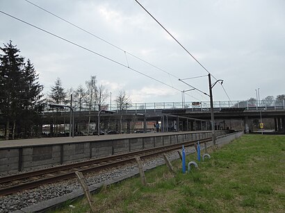
Skovbrynet st. Address: Skovdiget 1 street in Bagsværd
Skovbrynet station is a station on the Farum radial of the S-train network in Copenhagen, Denmark.Wiki
Attractions near Skovbrynet st.
Skovbrynet,Gladsaxe Kommune,Ab Restaurant,Bagsværd Hovedgade 296,Det røde spor - Hareskov,Akademisk boldklub,B 93 Kunstgræsbane,Bagsværd Kryds,CodeLean,Højgårds Vænge,Bagsværd Badminton Klub,Skovbrynet Skole,Skralde Skur / Motorcykel Skur,Nydamsvej,Værebro Center,Café Søhesten,Skovbrynet,Loop-It,Djævle Bakken Bagsværd,Cocioaba lui Steef 👏🏻😏How to get to popular attractions in Bagsværd with public transit
Ingerslev Marked, Århus,Hareskov st., Furesø,DSB Hovedkontor, Høje Taastrup,Fisketorvet, København,Kerteminde, Kerteminde,Lille Torv, Århus,Kolding Sygehus, Kolding,Center Pubben, Hørsholm Midtpunkt, Hørsholm,Tryg Forsikring Kantinen, Ballerup,Memphis Mansion, Randers,Vejle Fjord,Rudkøbing, Langeland,Ceres Arena, Århus,IKEA Restaurant & Cafe, Gentofte,Regionshospitalet Herning, Herning,Comwell Kolding, Kolding,Middelfart, Middelfart,Hotel Propellen Billund, Billund,Aarhus Rutebilstation, Århus,Busstop Silkeborgvej / Åby Ringvej, ÅrhusGet around Bagsværd by public transit!
Traveling around Bagsværd has never been so easy. See step by step directions as you travel to any attraction, street or major public transit station. View bus and train schedules, arrival times, service alerts and detailed routes on a map, so you know exactly how to get to anywhere in Bagsværd.
When traveling to any destination around Bagsværd use Moovit's Live Directions with Get Off Notifications to know exactly where and how far to walk, how long to wait for your line, and how many stops are left. Moovit will alert you when it's time to get off — no need to constantly re-check whether yours is the next stop.
Wondering how to use public transit in Bagsværd or how to pay for public transit in Bagsværd? Moovit public transit app can help you navigate your way with public transit easily, and at minimum cost. It includes public transit fees, ticket prices, and costs. Looking for a map of Bagsværd public transit lines? Moovit public transit app shows all public transit maps in Bagsværd with all train or bus routes and stops on an interactive map.
Bagsværd has 2 transit type(s), including: train or bus, operated by several transit agencies, including Metroselskabet, DSB S-tog, Lokaltog A/S, DSB S-tog, Midttrafik, Odense Letbane, DSB, NT, GoCollective, Midttrafik, Skånetrafiken, Metroselskabet, Movia, NT and Midttrafik