How to get to Slash Run by bus?
Click on the bus route to see step by step directions with maps, line arrival times and updated time schedules.
From Hubert H. Humphrey Building, Washington
54 minFrom Arlington, VA, Arlington County
71 minFrom Malcolm X Park, Washington
97 minFrom Saint Elizabeth's West Campus (DHS/USCG), Washington
83 minFrom Coast Guard HQ & Bus Bay D, Washington
90 minFrom Qsa, Arlington County
96 minFrom Crumbs & Whiskers, Washington
53 minFrom Mt Vernon Campus Of GWU, Washington
74 minFrom Hampton Inn Crystal City, Arlington County
99 minFrom The Westin Crystal City Hotel, Arlington County
97 min
How to get to Slash Run by metro?
Click on the metro route to see step by step directions with maps, line arrival times and updated time schedules.
From Hubert H. Humphrey Building, Washington
38 minFrom Arlington, VA, Arlington County
53 minFrom Malcolm X Park, Washington
58 minFrom Saint Elizabeth's West Campus (DHS/USCG), Washington
58 minFrom Coast Guard HQ & Bus Bay D, Washington
57 minFrom Qsa, Arlington County
44 minFrom Crumbs & Whiskers, Washington
68 minFrom Hampton Inn Crystal City, Arlington County
44 minFrom The Westin Crystal City Hotel, Arlington County
42 min
Bus stops near Slash Run in Washington
Metro stations near Slash Run in Washington
What are the closest stations to Slash Run?
The closest stations to Slash Run are:
- Upshur St Nw+2 St NW is 2 yards away, 1 min walk.
- Columbia Heights is 462 yards away, 6 min walk.
- Grant Cir Nw+Varnum St NW is 549 yards away, 7 min walk.
- Rhode Island Metro Station is 641 yards away, 8 min walk.
Which bus line stops near Slash Run?
D74 (East To Rhode Island Av)
Which metro lines stop near Slash Run?
These metro lines stop near Slash Run: GREEN, YELLOW.
What’s the nearest metro station to Slash Run in Washington?
The nearest metro station to Slash Run in Washington is Columbia Heights. It’s a 6 min walk away.
What’s the nearest bus station to Slash Run in Washington?
The nearest bus station to Slash Run in Washington is Upshur St Nw+2 St NW. It’s a 1 min walk away.
What time is the first metro to Slash Run in Washington?
The GREEN is the first metro that goes to Slash Run in Washington. It stops nearby at 5:11 AM.
What time is the last metro to Slash Run in Washington?
The GREEN is the last metro that goes to Slash Run in Washington. It stops nearby at 12:30 AM.
What time is the first bus to Slash Run in Washington?
The D74 is the first bus that goes to Slash Run in Washington. It stops nearby at 5:03 AM.
What time is the last bus to Slash Run in Washington?
The D74 is the last bus that goes to Slash Run in Washington. It stops nearby at 12:58 AM.
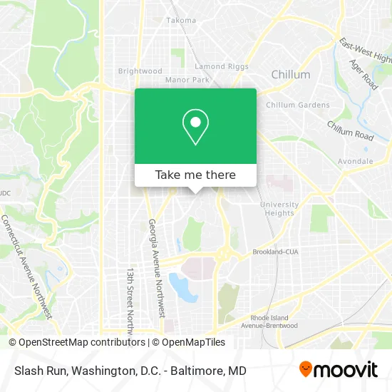
See Slash Run, Washington, on the map
Public Transit to Slash Run in Washington
Wondering how to get to Slash Run in Washington? Moovit helps you find the best way to get to Slash Run with step-by-step directions from the nearest public transit station.
Moovit provides free maps and live directions to help you navigate through your city. View schedules, routes, timetables, and find out how long does it take to get to Slash Run in real time.
Looking for the nearest stop or station to Slash Run? Check out this list of stops closest to your destination: Upshur St Nw+2 St NW; Columbia Heights; Grant Cir Nw+Varnum St NW; Rhode Island Metro Station.
Bus: D74, D44.Metro: GREEN, YELLOW, RED.
Want to see if there’s another route that gets you there at an earlier time? Moovit helps you find alternative routes or times. Get directions from and directions to Slash Run easily from the Moovit App or Website.
We make riding to Slash Run easy, which is why over 1.5 million users, including users in Washington, trust Moovit as the best app for public transit. You don’t need to download an individual bus app or train app, Moovit is your all-in-one transit app that helps you find the best bus time or train time available.
For information on prices of bus and metro, costs and ride fares to Slash Run, please check the Moovit app.
Use the app to navigate to popular places including to the airport, hospital, stadium, grocery store, mall, coffee shop, school, college, and university.
Slash Run Address: 201 Upshur St NW (at 2nd St NW) street in Washington
- Hitching Post Restaurant,
- Hitching Post,
- Rock Creek Church Rd and Upshur,
- President Lincoln's Cottage,
- Gap,
- Preparatory School of DC (Prep School),
- Varnum St NW (2nd and varnum),
- Creative Minds International Pcs,
- President Lincoln s Cottage at the Soldiers Home,
- Rock Creek Cemetery,
- Afrh,
- Ifc,
- President Lincoln's Cottage,
- United States Soldiers' and Airmen's Home National Cemetery,
- United States Soldiers' and Airmen's Home National Cemetery (Soldiers Home Cemetery),
- St. Paul's Episcopal Church, Rock Creek Parish,
- Rock Creek Church Yard & Cemetery,
- Grant Circle,
- New Hampshire Ave NW (new hampshire ave buchanan),
- New Hampshire Ave NW and Upshur
Places Near Slash Run (Washington)
- Sibley Memorial Hospital, Washington,
- PG Mall, Prince George's County,
- The Anthem, Washington,
- National Zoo, Washington,
- Museum Of The Bible, Washington,
- National Theatre, Washington,
- Washington National Cathedral, Washington,
- Marriott Marquis Washington, DC, Washington,
- Pennsylvania Ave NW (3rd st and pennsylvania), Washington,
- Georgetown, Washington,
- Warner Theatre, Washington,
- Basilica of the National Shrine, Washington,
- Amazon Hq2, Arlington County,
- Westfield Montgomery Mall, Montgomery County,
- Rock Creek Tennis Center, Washington,
- M&T Bank Stadium, Baltimore,
- Washington DC VA Medical Center, Washington,
- Capital One Arena, Washington,
- National Museum of African American History and Culture, Washington,
- Camden Yards, Baltimore
How to get to popular places in Washington, D.C. - Baltimore, MD with public transit
Get around Washington by public transit!
Traveling around Washington has never been so easy. See step by step directions as you travel to any attraction, street or major public transit station. View bus and train schedules, arrival times, service alerts and detailed routes on a map, so you know exactly how to get to anywhere in Washington.
When traveling to any destination around Washington use Moovit's Live Directions with Get Off Notifications to know exactly where and how far to walk, how long to wait for your line, and how many stops are left. Moovit will alert you when it's time to get off — no need to constantly re-check whether yours is the next stop.
Wondering how to use public transit in Washington or how to pay for public transit in Washington? Moovit public transit app can help you navigate your way with public transit easily, and at minimum cost. It includes public transit fees, ticket prices, and costs. Looking for a map of Washington public transit lines? Moovit public transit app shows all public transit maps in Washington with all Bus, Train, Metro, Light Rail and Ferry routes and stops on an interactive map.
Washington, D.C. - Baltimore, MD has 5 transit type(s), including: Bus, Train, Metro, Light Rail and Ferry, operated by several transit agencies, including WMATA, Montgomery County Ride On, Fairfax Connector, TheBus, PRTC, DASH - Alexandria, Arlington Transit (ART), RTA of Central Maryland, MDOT MTA, MDOT MTA Light RailLink, MDOT MTA Commuter Bus, MDOT MTA Local Bus, FXBGO!, Virginia Railway Express (VRE) and MARC