Directions to Sloane's (Boston) with public transportation
The following transit lines have routes that pass near Sloane's
 Bus: 501, 66, 70, 86.
- Train: FITCHBURG, FRAMINGHAM/WORCESTER.
- Subway: RED LINE, GREEN LINE B.
How to get to Sloane's by bus?
Click on the bus route to see step by step directions with maps, line arrival times and updated time schedules.
From Greyhound:Bus Station, Boston
32 minFrom Macy's, Boston
32 minFrom Newton-Wellesley Hospital, Newton
76 minFrom Faneuil Hall Marketplace, Boston
40 minFrom Maggiano's Little Italy, Boston
24 minFrom Constitution Beach, Boston
91 minFrom SharkNinja Operating LLC, Needham
82 minFrom Hilton Garden Inn Boston Logan Airport, Boston
82 minFrom Rental Car Center - Logan Airport, Boston
64 minFrom Winchester, MA, Winchester
92 min
How to get to Sloane's by train?
Click on the train route to see step by step directions with maps, line arrival times and updated time schedules.
How to get to Sloane's by subway?
Click on the subway route to see step by step directions with maps, line arrival times and updated time schedules.
From Greyhound:Bus Station, Boston
37 minFrom Macy's, Boston
36 minFrom Newton-Wellesley Hospital, Newton
88 minFrom Faneuil Hall Marketplace, Boston
43 minFrom Maggiano's Little Italy, Boston
44 minFrom Constitution Beach, Boston
64 minFrom Hilton Garden Inn Boston Logan Airport, Boston
66 minFrom Rental Car Center - Logan Airport, Boston
54 min
Subway stations near Sloane's in Boston
Bus stops near Sloane's in Boston
What are the closest stations to Sloane's?
The closest stations to Sloane's are:
- Harvard Square is 72 yards away, 1 min walk.
- 130 Western Ave is 260 yards away, 4 min walk.
- Western Ave @ Everett St is 437 yards away, 6 min walk.
- N Harvard St @ Gate 2 Harvard Stadium is 640 yards away, 8 min walk.
- Packards Corner is 686 yards away, 9 min walk.
Which bus lines stop near Sloane's?
These bus lines stop near Sloane's: 501, 66, 70, 86.
Which train lines stop near Sloane's?
These train lines stop near Sloane's: FITCHBURG, FRAMINGHAM/WORCESTER.
Which subway line stops near Sloane's?
RED LINE (Alewife)
What’s the nearest subway station to Sloane's in Boston?
The nearest subway station to Sloane's in Boston is Harvard Square. It’s a 1 min walk away.
What’s the nearest bus station to Sloane's in Boston?
The nearest bus station to Sloane's in Boston is 130 Western Ave. It’s a 4 min walk away.
What time is the first subway to Sloane's in Boston?
The GREEN LINE B is the first subway that goes to Sloane's in Boston. It stops nearby at 5:14 AM.
What time is the last subway to Sloane's in Boston?
The GREEN LINE B is the last subway that goes to Sloane's in Boston. It stops nearby at 2:26 AM.
What time is the first bus to Sloane's in Boston?
The 70 is the first bus that goes to Sloane's in Boston. It stops nearby at 4:30 AM.
What time is the last bus to Sloane's in Boston?
The 66 is the last bus that goes to Sloane's in Boston. It stops nearby at 2:29 AM.
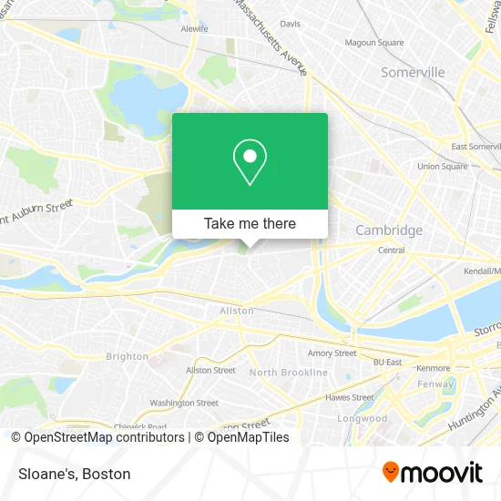
See Sloane's, Boston, on the map
Public Transit to Sloane's in Boston
Wondering how to get to Sloane's in Boston? Moovit helps you find the best way to get to Sloane's with step-by-step directions from the nearest public transit station.
Moovit provides free maps and live directions to help you navigate through your city. View schedules, routes, timetables, and find out how long does it take to get to Sloane's in real time.
Looking for the nearest stop or station to Sloane's? Check out this list of stops closest to your destination: Harvard Square; 130 Western Ave; Western Ave @ Everett St; N Harvard St @ Gate 2 Harvard Stadium; Packards Corner.
Bus: 501, 66, 70, 86.Train: FITCHBURG, FRAMINGHAM/WORCESTER.Subway: RED LINE, GREEN LINE B.
Want to see if there’s another route that gets you there at an earlier time? Moovit helps you find alternative routes or times. Get directions from and directions to Sloane's easily from the Moovit App or Website.
We make riding to Sloane's easy, which is why over 1.7 million users, including users in Boston, trust Moovit as the best app for public transit. You don’t need to download an individual bus app or train app, Moovit is your all-in-one transit app that helps you find the best bus time or train time available.
For information on prices of bus, subway and train, costs and ride fares to Sloane's, please check the Moovit app.
Use the app to navigate to popular places including to the airport, hospital, stadium, grocery store, mall, coffee shop, school, college, and university.
Sloane's Address: 197 N Harvard St street in Boston
- Continuum,
- 219 Western Ave & N Harvard St (Continuum),
- Trader Joe's,
- William E. Smith Playground,
- Smith Park Pumptrack,
- Teele Hall (Harvard Business School),
- Harvard Ed Portal,
- Western Ave (western avenue and stadium),
- Cumnock Fields,
- Office of University Publisher,
- Air Express Div Rea Express,
- Gordon Indoor Track- Harvard University,
- WBZ-TV ( CBS ),
- Harvard University Science And Engineering Complex (Sec),
- Night Shift Owl's Nest Allston,
- Harvard Stadium (Harvard Softball Field),
- Harvard Stadium,
- Soldiers Field Athletic Area,
- Christian Herter Community Garden (Herter Park Amphitheater),
- Spangler Food Court at Harvard Business School
Places Near Sloane's (Boston)
- Leader Bank Pavilion (Leader Bank Pavillion), Boston,
- Prudential Center, Boston,
- Quincy Market, Boston,
- Seaport District, Boston,
- Wang Theater, Boston,
- Massachusetts General Hospital, Boston,
- Museum Of Science, Boston,
- Wilbur Theatre, Boston,
- Td Garden, Boston,
- House Of Blues, Boston,
- North End, Boston,
- Boston Medical Center, Boston,
- Faneuil Hall, Boston,
- Mgm Music Hall, Boston,
- Isabella Stewart Gardner Museum, Boston,
- Boston Common, Boston,
- Boston Convention & Exhibition Center, Boston,
- Boston Children's Hospital, Boston,
- Cheers, Boston,
- Castle Island, Boston
How to get to popular places in Boston with public transit
Get around Boston by public transit!
Traveling around Boston has never been so easy. See step by step directions as you travel to any attraction, street or major public transit station. View bus and train schedules, arrival times, service alerts and detailed routes on a map, so you know exactly how to get to anywhere in Boston.
When traveling to any destination around Boston use Moovit's Live Directions with Get Off Notifications to know exactly where and how far to walk, how long to wait for your line, and how many stops are left. Moovit will alert you when it's time to get off — no need to constantly re-check whether yours is the next stop.
Wondering how to use public transit in Boston or how to pay for public transit in Boston? Moovit public transit app can help you navigate your way with public transit easily, and at minimum cost. It includes public transit fees, ticket prices, and costs. Looking for a map of Boston public transit lines? Moovit public transit app shows all public transit maps in Boston with all Bus, Train, Subway and Ferry routes and stops on an interactive map.
Boston has 4 transit type(s), including: Bus, Train, Subway and Ferry, operated by several transit agencies, including MBTA, Southeastern Regional Transit Authority, MetroWest Regional Transit Authority, Rhode Island Public Transit Authority, WRTA, Lowell Regional Transit Authority, Merrimack Valley Transit, Montachusett Regional Transit Authority, Cape Cod Regional Transit Authority, Brockton Area Transit Authority, Martha's Vineyard Transit Authority, the WAVE - Nantucket Regional Transit Authority, GATRA, Cape Ann Transportation Authority and Massport