Directions to Sloatsburg (Ramapo, Ny) with public transportation
The following transit lines have routes that pass near Sloatsburg
How to get to Sloatsburg by train?
Click on the train route to see step by step directions with maps, line arrival times and updated time schedules.
Train stations near Sloatsburg in Ramapo, Ny
- Sloatsburg , 19 min walk,
What are the closest stations to Sloatsburg?
The closest stations to Sloatsburg are:
- Sloatsburg is 1568 yards away, 19 min walk.
Which train line stops near Sloatsburg?
PJL
What’s the nearest train station to Sloatsburg in Ramapo, Ny?
The nearest train station to Sloatsburg in Ramapo, Ny is Sloatsburg. It’s a 19 min walk away.
See Sloatsburg, Ramapo, Ny, on the map
Public Transit to Sloatsburg in Ramapo, Ny
Wondering how to get to Sloatsburg in Ramapo, Ny, United States? Moovit helps you find the best way to get to Sloatsburg with step-by-step directions from the nearest public transit station.
Moovit provides free maps and live directions to help you navigate through your city. View schedules, routes, timetables, and find out how long does it take to get to Sloatsburg in real time.
Looking for the nearest stop or station to Sloatsburg? Check out this list of stops closest to your destination: Sloatsburg .
Train: PJL.
Want to see if there’s another route that gets you there at an earlier time? Moovit helps you find alternative routes or times. Get directions from and directions to Sloatsburg easily from the Moovit App or Website.
We make riding to Sloatsburg easy, which is why over 1.5 million users, including users in Ramapo, Ny, trust Moovit as the best app for public transit. You don’t need to download an individual bus app or train app, Moovit is your all-in-one transit app that helps you find the best bus time or train time available.
For information on prices of train, bus and subway, costs and ride fares to Sloatsburg, please check the Moovit app.
Use the app to navigate to popular places including to the airport, hospital, stadium, grocery store, mall, coffee shop, school, college, and university.
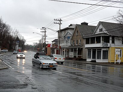
Sloatsburg Address: NY 10974 street in Ramapo, Ny
Attractions near Sloatsburg
Pinnacle Office Maintenance,Sleater Hill,Sloatsburg Elementary School,48 Washington Ave,Custom Exterior Systems Inc,49 2nd St,Pat Cannon Foot & Fiddle Dance,Dave Spielvogel,72 Sheridan St,2nd St (2nd street fairchild),59 Sheridan St (Sheridan Ave),70 2nd St,88 2nd St,Deep Clean Carpet & Upholstery Cleaners,Mort Haber Painting,2nd St (2nd washington ave),2 2nd St,Sloatsburg Community Ambulance Corps,Roland Zimmerman Elec Cntrctrs,Spectrum CLNG ServicesHow to get to popular attractions in Ramapo, Ny with public transit
Great Neck, Great Neck, Ny,Pier 40, Manhattan,17 east 102nd St., Manhattan,118-35 Queens Blvd, Queens,Inmigration 26 Federal Plaza, Manhattan,Cross County Mall, Yonkers, Ny,Roosevelt Field (Roosevelt Feild Shopping Mall), East Garden City, Ny,Plainfield, NJ, Plainfield, Nj,404 Pine St,711 3rd Ave, Manhattan,Armory Track & Field, Manhattan,Freehold center train station, Freehold, Nj,JFK American Airlines Terminal 8 Gate 44, Queens,Sojo Spa Club, Edgewater, Nj,305 Broadway, Manhattan,NJIT, Newark, Nj,City Hall 141 Worth Street, Manhattan,Englewood, NJ, Englewood, Nj,7th Ave (W 48th St & 7th ave), Manhattan,Moma, ManhattanGet around New York - New Jersey by public transit!
Traveling around New York - New Jersey has never been so easy. See step by step directions as you travel to any attraction, street or major public transit station. View bus and train schedules, arrival times, service alerts and detailed routes on a map, so you know exactly how to get to anywhere in New York - New Jersey.
When traveling to any destination around New York - New Jersey use Moovit's Live Directions with Get Off Notifications to know exactly where and how far to walk, how long to wait for your line, and how many stops are left. Moovit will alert you when it's time to get off — no need to constantly re-check whether yours is the next stop.
Wondering how to use public transit in New York - New Jersey or how to pay for public transit in New York - New Jersey? Moovit public transit app can help you navigate your way with public transit easily, and at minimum cost. It includes public transit fees, ticket prices, and costs. Looking for a map of New York - New Jersey public transit lines? Moovit public transit app shows all public transit maps in New York - New Jersey with all Bus, Train, Subway, Light Rail, Ferry and Cable Car routes and stops on an interactive map.
New York - New Jersey has 6 transit type(s), including: Bus, Train, Subway, Light Rail, Ferry and Cable Car, operated by several transit agencies, including MTA Subway, Metro-North Railroad, LIRR, PATH, Shore Line East, MTA Bus Company, MTA New York City Transit - Express routes, MTA Bus, NJ Transit, NYC Ferry, NICE bus, Bee-Line Bus, NJ Transit Rail, Norwalk Transit District, CTTransit - Waterbury-Meriden