Directions to Smart Choice Solutions (Malden) with public transportation
The following transit lines have routes that pass near Smart Choice Solutions
 Bus: 104, 105, 106, 99.
- Train: HAVERHILL, NEWBURYPORT/ROCKPORT.
- Subway: ORANGE LINE.
How to get to Smart Choice Solutions by bus?
Click on the bus route to see step by step directions with maps, line arrival times and updated time schedules.
From Saltie Girl, Boston
64 minFrom Massachusetts College of Art and Design, Boston
86 minFrom Tufts Medical Center - Biewend building, Boston
68 minFrom Boston Children's Hospital, Boston
73 minFrom 221 Longwood, Boston
88 minFrom Td Garden, Boston
48 minFrom Royal Sonesta Hotel, Cambridge
56 minFrom Folkman Auditorium, Children's Hospital Boston, Boston
69 minFrom 60 State St, Boston
49 minFrom 98 Binney St, Boston
70 min
How to get to Smart Choice Solutions by train?
Click on the train route to see step by step directions with maps, line arrival times and updated time schedules.
How to get to Smart Choice Solutions by subway?
Click on the subway route to see step by step directions with maps, line arrival times and updated time schedules.
From Saltie Girl, Boston
57 minFrom Massachusetts College of Art and Design, Boston
54 minFrom Tufts Medical Center - Biewend building, Boston
37 minFrom Boston Children's Hospital, Boston
62 minFrom 221 Longwood, Boston
57 minFrom Td Garden, Boston
30 minFrom Royal Sonesta Hotel, Cambridge
37 minFrom Folkman Auditorium, Children's Hospital Boston, Boston
62 minFrom 60 State St, Boston
30 minFrom 98 Binney St, Boston
62 min
Bus stops near Smart Choice Solutions in Malden
Train stations near Smart Choice Solutions in Malden
Subway station near Smart Choice Solutions in Malden
- Wellington, 42 min walk,VIEW
Bus lines to Smart Choice Solutions in Malden
What are the closest stations to Smart Choice Solutions?
The closest stations to Smart Choice Solutions are:
- Eastern Ave @ Main St is 182 yards away, 3 min walk.
- Main St @ Madison St is 201 yards away, 3 min walk.
- Centre St @ Main St is 271 yards away, 4 min walk.
- Chelsea is 887 yards away, 13 min walk.
- Wellington is 3563 yards away, 42 min walk.
- Oak Grove is 3642 yards away, 43 min walk.
Which bus lines stop near Smart Choice Solutions?
These bus lines stop near Smart Choice Solutions: 104, 105, 106.
Which train line stops near Smart Choice Solutions?
HAVERHILL (#229 | Haverhill)
Which subway line stops near Smart Choice Solutions?
ORANGE LINE (Oak Grove)
What’s the nearest train station to Smart Choice Solutions in Malden?
The nearest train station to Smart Choice Solutions in Malden is Chelsea. It’s a 13 min walk away.
What’s the nearest bus station to Smart Choice Solutions in Malden?
The nearest bus stations to Smart Choice Solutions in Malden are Eastern Ave @ Main St and Main St @ Madison St. The closest one is a 3 min walk away.
What time is the first subway to Smart Choice Solutions in Malden?
The ORANGE LINE is the first subway that goes to Smart Choice Solutions in Malden. It stops nearby at 5:15 AM.
What time is the last subway to Smart Choice Solutions in Malden?
The ORANGE LINE is the last subway that goes to Smart Choice Solutions in Malden. It stops nearby at 1:59 AM.
What time is the first train to Smart Choice Solutions in Malden?
The HAVERHILL is the first train that goes to Smart Choice Solutions in Malden. It stops nearby at 5:35 AM.
What time is the last train to Smart Choice Solutions in Malden?
The NEWBURYPORT/ROCKPORT is the last train that goes to Smart Choice Solutions in Malden. It stops nearby at 12:06 AM.
What time is the first bus to Smart Choice Solutions in Malden?
The 104 is the first bus that goes to Smart Choice Solutions in Malden. It stops nearby at 4:27 AM.
What time is the last bus to Smart Choice Solutions in Malden?
The 104 is the last bus that goes to Smart Choice Solutions in Malden. It stops nearby at 1:36 AM.
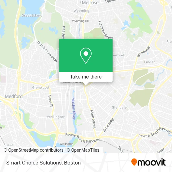
See Smart Choice Solutions, Malden, on the map
Public Transit to Smart Choice Solutions in Malden
Wondering how to get to Smart Choice Solutions in Malden? Moovit helps you find the best way to get to Smart Choice Solutions with step-by-step directions from the nearest public transit station.
Moovit provides free maps and live directions to help you navigate through your city. View schedules, routes, timetables, and find out how long does it take to get to Smart Choice Solutions in real time.
Looking for the nearest stop or station to Smart Choice Solutions? Check out this list of stops closest to your destination: Eastern Ave @ Main St; Main St @ Madison St; Centre St @ Main St; Chelsea; Wellington; Oak Grove.
Bus: 104, 105, 106, 99.Train: HAVERHILL, NEWBURYPORT/ROCKPORT.Subway: ORANGE LINE.
Want to see if there’s another route that gets you there at an earlier time? Moovit helps you find alternative routes or times. Get directions from and directions to Smart Choice Solutions easily from the Moovit App or Website.
We make riding to Smart Choice Solutions easy, which is why over 1.7 million users, including users in Malden, trust Moovit as the best app for public transit. You don’t need to download an individual bus app or train app, Moovit is your all-in-one transit app that helps you find the best bus time or train time available.
For information on prices of bus, subway and train, costs and ride fares to Smart Choice Solutions, please check the Moovit app.
Use the app to navigate to popular places including to the airport, hospital, stadium, grocery store, mall, coffee shop, school, college, and university.
Smart Choice Solutions Address: 40 Eastern Ave street in Malden
- BL Contractor,
- Khouri Services,
- Accounting Express,
- Nguyen Multi Service,
- Malden Locksmith PRO,
- Sterlinglocs,
- DWD Builders,
- Simple LJ,
- Bare It All with Cyn,
- Alpha Financial So,
- Dreamstar Studio,
- Meloondabeat,
- Gentyprovisions,
- Chiro Dynamics,
- Caliente Mexican Grill,
- DUNKIN',
- Diamond Dental - Malden,
- Sky Dental,
- Atlantic ATM,
- Beca Shoes
Places Near Smart Choice Solutions (Malden)
- Boston Children's Hospital, Boston,
- House Of Blues, Boston,
- North End, Boston,
- Td Garden, Boston,
- Cheers, Boston,
- Seaport District, Boston,
- Leader Bank Pavilion (Leader Bank Pavillion), Boston,
- Wilbur Theatre, Boston,
- Faneuil Hall, Boston,
- Boston Common, Boston,
- Wang Theater, Boston,
- Castle Island, Boston,
- Prudential Center, Boston,
- Boston Convention & Exhibition Center, Boston,
- Museum Of Science, Boston,
- Isabella Stewart Gardner Museum, Boston,
- Mgm Music Hall, Boston,
- Quincy Market, Boston,
- Massachusetts General Hospital, Boston,
- Boston Medical Center, Boston
How to get to popular places in Boston with public transit
Get around Malden by public transit!
Traveling around Malden has never been so easy. See step by step directions as you travel to any attraction, street or major public transit station. View bus and train schedules, arrival times, service alerts and detailed routes on a map, so you know exactly how to get to anywhere in Malden.
When traveling to any destination around Malden use Moovit's Live Directions with Get Off Notifications to know exactly where and how far to walk, how long to wait for your line, and how many stops are left. Moovit will alert you when it's time to get off — no need to constantly re-check whether yours is the next stop.
Wondering how to use public transit in Malden or how to pay for public transit in Malden? Moovit public transit app can help you navigate your way with public transit easily, and at minimum cost. It includes public transit fees, ticket prices, and costs. Looking for a map of Malden public transit lines? Moovit public transit app shows all public transit maps in Malden with all Bus, Train, Subway and Ferry routes and stops on an interactive map.
Boston has 4 transit type(s), including: Bus, Train, Subway and Ferry, operated by several transit agencies, including MBTA, Southeastern Regional Transit Authority, MetroWest Regional Transit Authority, Rhode Island Public Transit Authority, WRTA, Lowell Regional Transit Authority, Merrimack Valley Transit, Montachusett Regional Transit Authority, Cape Cod Regional Transit Authority, Brockton Area Transit Authority, Martha's Vineyard Transit Authority, the WAVE - Nantucket Regional Transit Authority, GATRA, Cape Ann Transportation Authority and Massport