Directions to Smart Life Nutrition (New Bedford) with public transportation
The following transit lines have routes that pass near Smart Life Nutrition
 Bus: 202, 204, 9.
- Train: FALL RIVER/NEW BEDFORD.
- Ferry: CUTTYHUNK FERRY, SEASTREAK, SEASTREAK.
How to get to Smart Life Nutrition by bus?
Click on the bus route to see step by step directions with maps, line arrival times and updated time schedules.
From B.M.C. Durfee High School, Fall River
77 minFrom Amazon Fulfillment Bos7, Fall River
146 minFrom Charlton Memorial Hospital, Fall River
97 minFrom Lizzy Borden House, Fall River
83 minFrom Walmart Fall River Supercenter, Fall River
91 minFrom RMV New Bedford, New Bedford
64 minFrom Bedford Industrial Park, New Bedford
66 minFrom Bristol Community College, Fall River
78 minFrom Mass Maritime Academy, Buzzards Bay
140 min
How to get to Smart Life Nutrition by train?
Click on the train route to see step by step directions with maps, line arrival times and updated time schedules.
Bus stops near Smart Life Nutrition in New Bedford
Train station near Smart Life Nutrition in New Bedford
- Church Street, 28 min walk,VIEW
Ferry stations near Smart Life Nutrition in New Bedford
Bus lines to Smart Life Nutrition in New Bedford
What are the closest stations to Smart Life Nutrition?
The closest stations to Smart Life Nutrition are:
- Acushnet Ave And Collette St is 33 yards away, 1 min walk.
- Ashley Blvd And Davis St is 219 yards away, 3 min walk.
- Church Street is 2336 yards away, 28 min walk.
- Cuttyhunk Ferry Pier, New Bedford, MA is 4435 yards away, 53 min walk.
- New Bedford, MA is 4536 yards away, 54 min walk.
Which bus lines stop near Smart Life Nutrition?
These bus lines stop near Smart Life Nutrition: 202, 204, 9.
Which train line stops near Smart Life Nutrition?
FALL RIVER/NEW BEDFORD (#2011 | New Bedford)
What’s the nearest train station to Smart Life Nutrition in New Bedford?
The nearest train station to Smart Life Nutrition in New Bedford is Church Street. It’s a 28 min walk away.
What’s the nearest bus station to Smart Life Nutrition in New Bedford?
The nearest bus station to Smart Life Nutrition in New Bedford is Acushnet Ave And Collette St. It’s a 1 min walk away.
What time is the first train to Smart Life Nutrition in New Bedford?
The FALL RIVER/NEW BEDFORD is the first train that goes to Smart Life Nutrition in New Bedford. It stops nearby at 4:16 AM.
What time is the last train to Smart Life Nutrition in New Bedford?
The FALL RIVER/NEW BEDFORD is the last train that goes to Smart Life Nutrition in New Bedford. It stops nearby at 1:38 AM.
What time is the first bus to Smart Life Nutrition in New Bedford?
The 202 is the first bus that goes to Smart Life Nutrition in New Bedford. It stops nearby at 5:30 AM.
What time is the last bus to Smart Life Nutrition in New Bedford?
The 202 is the last bus that goes to Smart Life Nutrition in New Bedford. It stops nearby at 9:38 PM.
What time is the first ferry to Smart Life Nutrition in New Bedford?
The SEASTREAK is the first ferry that goes to Smart Life Nutrition in New Bedford. It stops nearby at 8:20 AM.
What time is the last ferry to Smart Life Nutrition in New Bedford?
The SEASTREAK is the last ferry that goes to Smart Life Nutrition in New Bedford. It stops nearby at 8:40 PM.
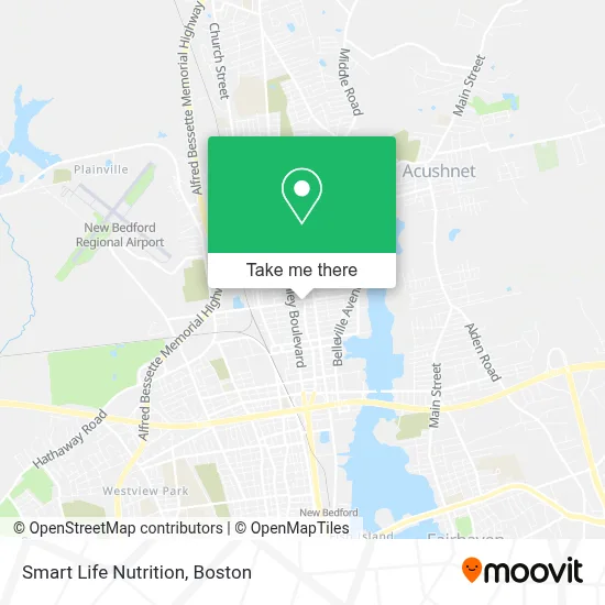
See Smart Life Nutrition, New Bedford, on the map
Public Transit to Smart Life Nutrition in New Bedford
Wondering how to get to Smart Life Nutrition in New Bedford? Moovit helps you find the best way to get to Smart Life Nutrition with step-by-step directions from the nearest public transit station.
Moovit provides free maps and live directions to help you navigate through your city. View schedules, routes, timetables, and find out how long does it take to get to Smart Life Nutrition in real time.
Looking for the nearest stop or station to Smart Life Nutrition? Check out this list of stops closest to your destination: Acushnet Ave And Collette St; Ashley Blvd And Davis St; Church Street; Cuttyhunk Ferry Pier; New Bedford, MA.
Bus: 202, 204, 9.Train: FALL RIVER/NEW BEDFORD.Ferry: CUTTYHUNK FERRY, SEASTREAK, SEASTREAK.
Want to see if there’s another route that gets you there at an earlier time? Moovit helps you find alternative routes or times. Get directions from and directions to Smart Life Nutrition easily from the Moovit App or Website.
We make riding to Smart Life Nutrition easy, which is why over 1.7 million users, including users in New Bedford, trust Moovit as the best app for public transit. You don’t need to download an individual bus app or train app, Moovit is your all-in-one transit app that helps you find the best bus time or train time available.
For information on prices of bus and train, costs and ride fares to Smart Life Nutrition, please check the Moovit app.
Use the app to navigate to popular places including to the airport, hospital, stadium, grocery store, mall, coffee shop, school, college, and university.
Smart Life Nutrition Address: 186 Nash Rd street in New Bedford
- Emma Car Audio,
- Ojm Home Improvement,
- Variedades la Bendicio,
- D Nicole Boutique,
- Ecco Lounge,
- El Paraiso Night Club New Bedford,
- On the Rocks Lounge,
- Praia Vibes Lounge,
- Planchado And Alterations El Centro,
- Soccer Post New Bedford,
- Evys Treasure and Collectibles,
- Igl Pentecostal Levantate Y Anda Inc,
- Jon-ter Realty,
- Scotty's Limousine Service,
- Vaz Construction,
- Td Bank Atm,
- Walgreens #3021,
- German American Bank Itm,
- ATM Walgreens,
- Quinn Photography
Places Near Smart Life Nutrition (New Bedford)
- Boston Medical Center, Boston,
- North End, Boston,
- Wang Theater, Boston,
- House Of Blues, Boston,
- Museum Of Science, Boston,
- Boston Common, Boston,
- Boston Convention & Exhibition Center, Boston,
- Isabella Stewart Gardner Museum, Boston,
- Cheers, Boston,
- Mgm Music Hall, Boston,
- Wilbur Theatre, Boston,
- Seaport District, Boston,
- Castle Island, Boston,
- Td Garden, Boston,
- Faneuil Hall, Boston,
- Massachusetts General Hospital, Boston,
- Prudential Center, Boston,
- Quincy Market, Boston,
- Leader Bank Pavilion (Leader Bank Pavillion), Boston,
- Boston Children's Hospital, Boston
How to get to popular places in Boston with public transit
Get around New Bedford by public transit!
Traveling around New Bedford has never been so easy. See step by step directions as you travel to any attraction, street or major public transit station. View bus and train schedules, arrival times, service alerts and detailed routes on a map, so you know exactly how to get to anywhere in New Bedford.
When traveling to any destination around New Bedford use Moovit's Live Directions with Get Off Notifications to know exactly where and how far to walk, how long to wait for your line, and how many stops are left. Moovit will alert you when it's time to get off — no need to constantly re-check whether yours is the next stop.
Wondering how to use public transit in New Bedford or how to pay for public transit in New Bedford? Moovit public transit app can help you navigate your way with public transit easily, and at minimum cost. It includes public transit fees, ticket prices, and costs. Looking for a map of New Bedford public transit lines? Moovit public transit app shows all public transit maps in New Bedford with all Bus, Train, Subway and Ferry routes and stops on an interactive map.
Boston has 4 transit type(s), including: Bus, Train, Subway and Ferry, operated by several transit agencies, including MBTA, Southeastern Regional Transit Authority, MetroWest Regional Transit Authority, Rhode Island Public Transit Authority, WRTA, Lowell Regional Transit Authority, Merrimack Valley Transit, Montachusett Regional Transit Authority, Cape Cod Regional Transit Authority, Brockton Area Transit Authority, Martha's Vineyard Transit Authority, the WAVE - Nantucket Regional Transit Authority, GATRA, Cape Ann Transportation Authority and Massport