How to get to Smart Talk Mobile by bus?
Click on the bus route to see step by step directions with maps, line arrival times and updated time schedules.
From The Strand Theater, Boston
70 minFrom The Banshee Bar, Boston
72 minFrom Dorchester, Boston
74 minFrom Randolph, MA, Randolph
60 minFrom Marina Bay, Quincy
70 minFrom 240 Mount Vernon Street, Boston
90 minFrom Curry College, Milton
80 minFrom UMass Boston Campus Center, Boston
118 minFrom Codman Square, Boston
71 minFrom Uphams Corner, Boston
76 min
How to get to Smart Talk Mobile by train?
Click on the train route to see step by step directions with maps, line arrival times and updated time schedules.
From The Strand Theater, Boston
90 minFrom The Banshee Bar, Boston
73 minFrom Dorchester, Boston
98 minFrom Randolph, MA, Randolph
69 minFrom 240 Mount Vernon Street, Boston
74 minFrom Curry College, Milton
105 minFrom UMass Boston Campus Center, Boston
92 minFrom Codman Square, Boston
96 minFrom Uphams Corner, Boston
80 min
How to get to Smart Talk Mobile by subway?
Click on the subway route to see step by step directions with maps, line arrival times and updated time schedules.
Bus stop near Smart Talk Mobile in Quincy
- Quincy Ave @ President Plaza, 3 min walk,VIEW
Subway station near Smart Talk Mobile in Quincy
- Wollaston, 27 min walk,VIEW
Train stations near Smart Talk Mobile in Quincy
Bus lines to Smart Talk Mobile in Quincy
- 225, Quincy Center Via Southern Artery,VIEW
What are the closest stations to Smart Talk Mobile?
The closest stations to Smart Talk Mobile are:
- Quincy Ave @ President Plaza is 173 yards away, 3 min walk.
- Wollaston is 2292 yards away, 27 min walk.
- Weymouth Landing/East Braintree is 2677 yards away, 32 min walk.
- Braintree is 4101 yards away, 48 min walk.
Which bus lines stop near Smart Talk Mobile?
These bus lines stop near Smart Talk Mobile: 215, 225, 238.
Which train lines stop near Smart Talk Mobile?
These train lines stop near Smart Talk Mobile: FALL RIVER/NEW BEDFORD, GREENBUSH.
Which subway line stops near Smart Talk Mobile?
RED LINE (Ashmont/Braintree)
What’s the nearest subway station to Smart Talk Mobile in Quincy?
The nearest subway station to Smart Talk Mobile in Quincy is Wollaston. It’s a 27 min walk away.
What’s the nearest bus station to Smart Talk Mobile in Quincy?
The nearest bus station to Smart Talk Mobile in Quincy is Quincy Ave @ President Plaza. It’s a 3 min walk away.
What time is the first subway to Smart Talk Mobile in Quincy?
The RED LINE is the first subway that goes to Smart Talk Mobile in Quincy. It stops nearby at 5:09 AM.
What time is the last subway to Smart Talk Mobile in Quincy?
The RED LINE is the last subway that goes to Smart Talk Mobile in Quincy. It stops nearby at 2:00 AM.
What time is the first train to Smart Talk Mobile in Quincy?
The FALL RIVER/NEW BEDFORD is the first train that goes to Smart Talk Mobile in Quincy. It stops nearby at 5:27 AM.
What time is the last train to Smart Talk Mobile in Quincy?
The KINGSTON is the last train that goes to Smart Talk Mobile in Quincy. It stops nearby at 12:25 AM.
What time is the first bus to Smart Talk Mobile in Quincy?
The 225 is the first bus that goes to Smart Talk Mobile in Quincy. It stops nearby at 5:12 AM.
What time is the last bus to Smart Talk Mobile in Quincy?
The 225 is the last bus that goes to Smart Talk Mobile in Quincy. It stops nearby at 12:52 AM.
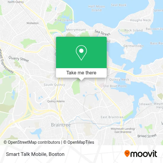
See Smart Talk Mobile, Quincy, on the map
Public Transit to Smart Talk Mobile in Quincy
Wondering how to get to Smart Talk Mobile in Quincy? Moovit helps you find the best way to get to Smart Talk Mobile with step-by-step directions from the nearest public transit station.
Moovit provides free maps and live directions to help you navigate through your city. View schedules, routes, timetables, and find out how long does it take to get to Smart Talk Mobile in real time.
Looking for the nearest stop or station to Smart Talk Mobile? Check out this list of stops closest to your destination: Quincy Ave @ President Plaza; Wollaston; Weymouth Landing/East Braintree; Braintree.
Bus: 215, 225, 238.Train: FALL RIVER/NEW BEDFORD, GREENBUSH, CAPEFLYER, KINGSTON.Subway: RED LINE.
Want to see if there’s another route that gets you there at an earlier time? Moovit helps you find alternative routes or times. Get directions from and directions to Smart Talk Mobile easily from the Moovit App or Website.
We make riding to Smart Talk Mobile easy, which is why over 1.7 million users, including users in Quincy, trust Moovit as the best app for public transit. You don’t need to download an individual bus app or train app, Moovit is your all-in-one transit app that helps you find the best bus time or train time available.
For information on prices of bus, subway and train, costs and ride fares to Smart Talk Mobile, please check the Moovit app.
Use the app to navigate to popular places including to the airport, hospital, stadium, grocery store, mall, coffee shop, school, college, and university.
Smart Talk Mobile Address: 219 Quincy Ave street in Quincy
- Shang Hai Soup Dumpling,
- Eomma Tastes,
- Jessica Beauty,
- Happy Duck,
- Lollicup Quincy,
- Taiyou Japanese Shabu & Sushi,
- China Pearl,
- DUNKIN',
- Kam Man Food,
- Atm East West Bank,
- Rc Cleaning,
- Lucky,
- Iman Islamic Center,
- Kuchipudi,
- Presidents Plaza Shopping Center,
- Quincy Website Design & Digital Marketing,
- Noble Product Services,
- Kumon Math And Reading Center Of Quincy - Quincy Ave.,
- Bitstop Bitcoin Atm,
- Benchmark Senior Living
Places Near Smart Talk Mobile (Quincy)
- House Of Blues, Boston,
- Faneuil Hall, Boston,
- Quincy Market, Boston,
- Museum Of Science, Boston,
- Boston Children's Hospital, Boston,
- Wang Theater, Boston,
- Isabella Stewart Gardner Museum, Boston,
- Boston Common, Boston,
- Leader Bank Pavilion (Leader Bank Pavillion), Boston,
- Cheers, Boston,
- Prudential Center, Boston,
- Td Garden, Boston,
- Massachusetts General Hospital, Boston,
- Seaport District, Boston,
- Boston Medical Center, Boston,
- Castle Island, Boston,
- Boston Convention & Exhibition Center, Boston,
- Mgm Music Hall, Boston,
- North End, Boston,
- Wilbur Theatre, Boston
How to get to popular places in Boston with public transit
Get around Quincy by public transit!
Traveling around Quincy has never been so easy. See step by step directions as you travel to any attraction, street or major public transit station. View bus and train schedules, arrival times, service alerts and detailed routes on a map, so you know exactly how to get to anywhere in Quincy.
When traveling to any destination around Quincy use Moovit's Live Directions with Get Off Notifications to know exactly where and how far to walk, how long to wait for your line, and how many stops are left. Moovit will alert you when it's time to get off — no need to constantly re-check whether yours is the next stop.
Wondering how to use public transit in Quincy or how to pay for public transit in Quincy? Moovit public transit app can help you navigate your way with public transit easily, and at minimum cost. It includes public transit fees, ticket prices, and costs. Looking for a map of Quincy public transit lines? Moovit public transit app shows all public transit maps in Quincy with all Bus, Train, Subway and Ferry routes and stops on an interactive map.
Boston has 4 transit type(s), including: Bus, Train, Subway and Ferry, operated by several transit agencies, including MBTA, Southeastern Regional Transit Authority, MetroWest Regional Transit Authority, Rhode Island Public Transit Authority, WRTA, Lowell Regional Transit Authority, Merrimack Valley Transit, Montachusett Regional Transit Authority, Cape Cod Regional Transit Authority, Brockton Area Transit Authority, Martha's Vineyard Transit Authority, the WAVE - Nantucket Regional Transit Authority, GATRA, Cape Ann Transportation Authority and Massport