Directions to Smile-Vision (Watertown Town) with public transportation
The following transit lines have routes that pass near Smile-Vision
 Bus: 504, 70, 71.
- Train: FITCHBURG, FRAMINGHAM/WORCESTER.
- Subway: GREEN LINE B.
How to get to Smile-Vision by bus?
Click on the bus route to see step by step directions with maps, line arrival times and updated time schedules.
From Hampton Inn Boston, Boston
65 minFrom Salem St, Boston
58 minFrom 98 Binney St, Boston
59 minFrom One Financial Center, Boston
43 minFrom Boston North Station, Boston
60 minFrom Whole Foods, Boston
44 minFrom Canopy-Boston, Boston
53 minFrom Moderna Therapeutics - Corporate Headquarters, Cambridge
52 minFrom Bova's Bakery, Boston
70 minFrom La Famiglia Giorgio's, Boston
58 min
How to get to Smile-Vision by train?
Click on the train route to see step by step directions with maps, line arrival times and updated time schedules.
From Hampton Inn Boston, Boston
114 minFrom Salem St, Boston
72 minFrom 98 Binney St, Boston
72 minFrom One Financial Center, Boston
68 minFrom Boston North Station, Boston
59 minFrom Whole Foods, Boston
77 minFrom Canopy-Boston, Boston
74 minFrom Bova's Bakery, Boston
72 minFrom La Famiglia Giorgio's, Boston
72 min
Bus stops near Smile-Vision in Watertown Town
Subway station near Smile-Vision in Watertown Town
- Chiswick Road, 23 min walk,VIEW
Train stations near Smile-Vision in Watertown Town
What are the closest stations to Smile-Vision?
The closest stations to Smile-Vision are:
- Mt Auburn St @ Main St is 447 yards away, 6 min walk.
- Arsenal St @ Louise St is 457 yards away, 6 min walk.
- Chiswick Road is 1864 yards away, 23 min walk.
- Newtonville is 2054 yards away, 24 min walk.
- Waverley is 2766 yards away, 33 min walk.
Which bus lines stop near Smile-Vision?
These bus lines stop near Smile-Vision: 504, 70.
Which train lines stop near Smile-Vision?
These train lines stop near Smile-Vision: FITCHBURG, FRAMINGHAM/WORCESTER.
What’s the nearest subway station to Smile-Vision in Watertown Town?
The nearest subway station to Smile-Vision in Watertown Town is Chiswick Road. It’s a 23 min walk away.
What’s the nearest train station to Smile-Vision in Watertown Town?
The nearest train station to Smile-Vision in Watertown Town is Newtonville. It’s a 24 min walk away.
What’s the nearest bus station to Smile-Vision in Watertown Town?
The nearest bus stations to Smile-Vision in Watertown Town are Mt Auburn St @ Main St and Arsenal St @ Louise St. The closest one is a 6 min walk away.
What time is the first subway to Smile-Vision in Watertown Town?
The GREEN LINE B is the first subway that goes to Smile-Vision in Watertown Town. It stops nearby at 5:01 AM.
What time is the last subway to Smile-Vision in Watertown Town?
The GREEN LINE B is the last subway that goes to Smile-Vision in Watertown Town. It stops nearby at 2:39 AM.
What time is the first train to Smile-Vision in Watertown Town?
The FRAMINGHAM/WORCESTER is the first train that goes to Smile-Vision in Watertown Town. It stops nearby at 5:25 AM.
What time is the last train to Smile-Vision in Watertown Town?
The FRAMINGHAM/WORCESTER is the last train that goes to Smile-Vision in Watertown Town. It stops nearby at 12:17 AM.
What time is the first bus to Smile-Vision in Watertown Town?
The 70 is the first bus that goes to Smile-Vision in Watertown Town. It stops nearby at 4:38 AM.
What time is the last bus to Smile-Vision in Watertown Town?
The 71 is the last bus that goes to Smile-Vision in Watertown Town. It stops nearby at 1:27 AM.
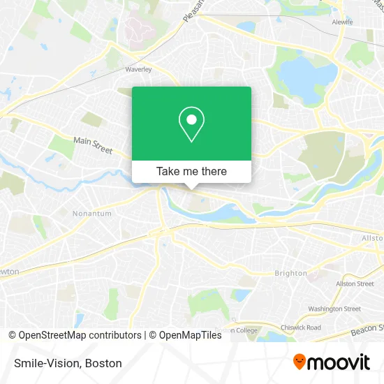
See Smile-Vision, Watertown Town, on the map
Public Transit to Smile-Vision in Watertown Town
Wondering how to get to Smile-Vision in Watertown Town? Moovit helps you find the best way to get to Smile-Vision with step-by-step directions from the nearest public transit station.
Moovit provides free maps and live directions to help you navigate through your city. View schedules, routes, timetables, and find out how long does it take to get to Smile-Vision in real time.
Looking for the nearest stop or station to Smile-Vision? Check out this list of stops closest to your destination: Mt Auburn St @ Main St; Arsenal St @ Louise St; Chiswick Road; Newtonville; Waverley.
Bus: 504, 70, 71.Train: FITCHBURG, FRAMINGHAM/WORCESTER.Subway: GREEN LINE B.
Want to see if there’s another route that gets you there at an earlier time? Moovit helps you find alternative routes or times. Get directions from and directions to Smile-Vision easily from the Moovit App or Website.
We make riding to Smile-Vision easy, which is why over 1.7 million users, including users in Watertown Town, trust Moovit as the best app for public transit. You don’t need to download an individual bus app or train app, Moovit is your all-in-one transit app that helps you find the best bus time or train time available.
For information on prices of bus, subway and train, costs and ride fares to Smile-Vision, please check the Moovit app.
Use the app to navigate to popular places including to the airport, hospital, stadium, grocery store, mall, coffee shop, school, college, and university.
Smile-Vision Address: 135 N Beacon St street in Watertown Town
- Watertown, MA,
- Imai Keller Moore,
- Get Lively: Health & Fitness,
- Move & Groove Watertown,
- Dal Contractors,
- Ecast Productions,
- Extra Innings Watertown,
- Sanda Fighting Arts,
- Twin Tige 100 Parker S,
- Perkins School For the Blind,
- Bostonian Towing,
- Perkins School,
- Alvarados Painting,
- Thorpe Construction,
- Gables Arsenal Street,
- Craigs Kempo Karate Academy,
- Matthew Chen,
- People's United Bank,
- M&T Bank,
- Phillips Congregational Church
Places Near Smile-Vision (Watertown Town)
- Isabella Stewart Gardner Museum, Boston,
- North End, Boston,
- Mgm Music Hall, Boston,
- Leader Bank Pavilion (Leader Bank Pavillion), Boston,
- Quincy Market, Boston,
- Massachusetts General Hospital, Boston,
- Boston Convention & Exhibition Center, Boston,
- Castle Island, Boston,
- Museum Of Science, Boston,
- Td Garden, Boston,
- Faneuil Hall, Boston,
- House Of Blues, Boston,
- Boston Children's Hospital, Boston,
- Wang Theater, Boston,
- Cheers, Boston,
- Wilbur Theatre, Boston,
- Boston Medical Center, Boston,
- Boston Common, Boston,
- Seaport District, Boston,
- Prudential Center, Boston
How to get to popular places in Boston with public transit
Get around Watertown Town by public transit!
Traveling around Watertown Town has never been so easy. See step by step directions as you travel to any attraction, street or major public transit station. View bus and train schedules, arrival times, service alerts and detailed routes on a map, so you know exactly how to get to anywhere in Watertown Town.
When traveling to any destination around Watertown Town use Moovit's Live Directions with Get Off Notifications to know exactly where and how far to walk, how long to wait for your line, and how many stops are left. Moovit will alert you when it's time to get off — no need to constantly re-check whether yours is the next stop.
Wondering how to use public transit in Watertown Town or how to pay for public transit in Watertown Town? Moovit public transit app can help you navigate your way with public transit easily, and at minimum cost. It includes public transit fees, ticket prices, and costs. Looking for a map of Watertown Town public transit lines? Moovit public transit app shows all public transit maps in Watertown Town with all Bus, Train, Subway and Ferry routes and stops on an interactive map.
Boston has 4 transit type(s), including: Bus, Train, Subway and Ferry, operated by several transit agencies, including MBTA, Southeastern Regional Transit Authority, MetroWest Regional Transit Authority, Rhode Island Public Transit Authority, WRTA, Lowell Regional Transit Authority, Merrimack Valley Transit, Montachusett Regional Transit Authority, Cape Cod Regional Transit Authority, Brockton Area Transit Authority, Martha's Vineyard Transit Authority, the WAVE - Nantucket Regional Transit Authority, GATRA, Cape Ann Transportation Authority and Massport