Directions to Sneaky Dee's (Toronto) with public transportation
The following transit lines have routes that pass near Sneaky Dee's
How to get to Sneaky Dee's by bus?
Click on the bus route to see step by step directions with maps, line arrival times and updated time schedules.
How to get to Sneaky Dee's by train?
Click on the train route to see step by step directions with maps, line arrival times and updated time schedules.
How to get to Sneaky Dee's by subway?
Click on the subway route to see step by step directions with maps, line arrival times and updated time schedules.
Streetcar stations near Sneaky Dee's in Toronto
- College St at Bathurst St,1 min walk,
- Dundas St West at Bathurst St (Toronto Western Hospital),6 min walk,
Bus stations near Sneaky Dee's in Toronto
- Bathurst St at College St,1 min walk,
- Bathurst St at Ulster St,6 min walk,
Bus lines to Sneaky Dee's in Toronto
- 307,BATHURST NIGHT BUS,
- 511,BATHURST,
- 307S,Bathurst St at Bloor St West,
What are the closest stations to Sneaky Dee's?
The closest stations to Sneaky Dee's are:
- College St at Bathurst St is 37 meters away, 1 min walk.
- Bathurst St at College St is 59 meters away, 1 min walk.
- Bathurst St at Ulster St is 408 meters away, 6 min walk.
- Dundas St West at Bathurst St (Toronto Western Hospital) is 439 meters away, 6 min walk.
Which bus lines stop near Sneaky Dee's?
These bus lines stop near Sneaky Dee's: 506, 511.
Which train lines stop near Sneaky Dee's?
These train lines stop near Sneaky Dee's: BR, LW.
Which subway lines stop near Sneaky Dee's?
These subway lines stop near Sneaky Dee's: 1, 2.
What’s the nearest Streetcar station to Sneaky Dee's in Toronto?
The nearest Streetcar station to Sneaky Dee's in Toronto is College St at Bathurst St. It’s a 1 min walk away.
What’s the nearest bus stop to Sneaky Dee's in Toronto?
The nearest bus stop to Sneaky Dee's in Toronto is Bathurst St at College St. It’s a 1 min walk away.
See Sneaky Dee's, Toronto, on the map
Public Transit to Sneaky Dee's in Toronto
Wondering how to get to Sneaky Dee's in Toronto, Canada? Moovit helps you find the best way to get to Sneaky Dee's with step-by-step directions from the nearest public transit station.
Moovit provides free maps and live directions to help you navigate through your city. View schedules, routes, timetables, and find out how long does it take to get to Sneaky Dee's in real time.
Looking for the nearest stop or station to Sneaky Dee's? Check out this list of stops closest to your destination: College St at Bathurst St; Bathurst St at College St; Bathurst St at Ulster St; Dundas St West at Bathurst St (Toronto Western Hospital).
Bus:506511307307STrain:BRLWSubway:12
Want to see if there’s another route that gets you there at an earlier time? Moovit helps you find alternative routes or times. Get directions from and directions to Sneaky Dee's easily from the Moovit App or Website.
We make riding to Sneaky Dee's easy, which is why over 1.5 million users, including users in Toronto, trust Moovit as the best app for public transit. You don’t need to download an individual bus app or train app, Moovit is your all-in-one transit app that helps you find the best bus time or train time available.
For information on prices of bus, subway, Streetcar and train, costs and ride fares to Sneaky Dee's, please check the Moovit app.
Use the app to navigate to popular places including to the airport, hospital, stadium, grocery store, mall, coffee shop, school, college, and university.
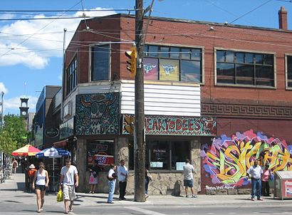
Sneaky Dee's Address: Bathurst Street street in Toronto
Attractions near Sneaky Dee's
Rbc Financial Group,474 Bathurst St,Sneaky Dee's Restaurant & Concert Venue,Bathurst Street,Nest Toronto,The Hideout,The Channel Club,TTB Trading Co.,Xing Dance Studio,Little Jerry,489 College St,El Rancho,Markham St,College & Bathurst,32 Chicken St.,Green Room,The Beer Store,York civic centre,511 Streetcar Replacement Bus,Coffee Culture Cafe & EateryHow to get to popular attractions in Toronto with public transit
Communitech Hub, Kitchener,Orangeville, Ontario, Orangeville,Gateway Terminal, Brampton,Kitchener Memorial Auditorium Complex, Kitchener,Trinity Common Bus Terminal, Brampton,Starbucks, Toronto,Yorkdale Shopping Centre, Toronto,Oshawa, Ontario, Oshawa,Barrie, Ontario, Barrie,The Keg Steakhouse + Bar - Keg Mansion, Toronto,Oliver & Bonacini Café Grill, Yonge and Front, Toronto,Pacific Mall, Markham,GoodLife Fitness Centres, Toronto,Lahore Tikka House, Toronto,The Junction, Toronto,Union Restaurant, Toronto,Aldershot VIA/GO Station, Burlington,Woodbridge, Ontario, Vaughan,GoodLife Fitness Centres, Toronto,Cf Toronto Eaton Centre Shipping / Receiving, TorontoGet around Toronto by public transit!
Traveling around Toronto has never been so easy. See step by step directions as you travel to any attraction, street or major public transit station. View bus and train schedules, arrival times, service alerts and detailed routes on a map, so you know exactly how to get to anywhere in Toronto.
When traveling to any destination around Toronto use Moovit's Live Directions with Get Off Notifications to know exactly where and how far to walk, how long to wait for your line, and how many stops are left. Moovit will alert you when it's time to get off — no need to constantly re-check whether yours is the next stop.
Wondering how to use public transit in Toronto or how to pay for public transit in Toronto? Moovit public transit app can help you navigate your way with public transit easily, and at minimum cost. It includes public transit fees, ticket prices, and costs. Looking for a map of Toronto public transit lines? Moovit public transit app shows all public transit maps in Toronto with all bus, subway, Streetcar or train routes and stops on an interactive map.
Toronto has 4 transit type(s), including: bus, subway, Streetcar or train, operated by several transit agencies, including TTC, TTC Streetcar, Toronto Subway, GO Transit Bus, GO Transit, Amtrak, York Region Transit, Grand River Transit, Guelph Transit, grt, Hamilton Street Railway, MiWay, Brampton Transit, Burlington Transit and Oakville Transit