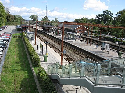
See Snekkersten St, Helsingør, on the map
Directions to Snekkersten St (Helsingør) with public transportation
The following transit lines have routes that pass near Snekkersten St
 Bus:
Bus: - Train:
How to get to Snekkersten St by bus?
Click on the bus route to see step by step directions with maps, line arrival times and updated time schedules.
How to get to Snekkersten St by train?
Click on the train route to see step by step directions with maps, line arrival times and updated time schedules.
Bus stations near Snekkersten St in Helsingør
- Snekkersten St. (Nørrevej),3 min walk,
- Snekkersten Stationsvej (Strandvejen),4 min walk,
Train stations near Snekkersten St in Helsingør
- Espergærde St.,4 min walk,
- Mørdrup St.,20 min walk,
- Helsingør St.,42 min walk,
Bus lines to Snekkersten St in Helsingør
- 801A,Klostermosevej Nord (Klostermosevej) - Espergærde St.,
- 802,Snekkersten St. - Helsingør St.,
- 803,Helsingør St. - Snekkersten St.,
- 804,Hornbæk St. - Erhvervsskolen (Esrumvej),
- 388,Helsingør St.,
What are the closest stations to Snekkersten St?
The closest stations to Snekkersten St are:
- Snekkersten St. (Nørrevej) is 213 meters away, 3 min walk.
- Snekkersten Stationsvej (Strandvejen) is 224 meters away, 4 min walk.
- Espergærde St. is 300 meters away, 4 min walk.
- Mørdrup St. is 1527 meters away, 20 min walk.
- Helsingør St. is 3181 meters away, 42 min walk.
Which bus lines stop near Snekkersten St?
These bus lines stop near Snekkersten St: 388, 801A, 802.
Which train lines stop near Snekkersten St?
These train lines stop near Snekkersten St: 930R, RE.
What’s the nearest train station to Snekkersten St in Helsingør?
The nearest train station to Snekkersten St in Helsingør is Espergærde St.. It’s a 4 min walk away.
What’s the nearest bus stop to Snekkersten St in Helsingør?
The nearest bus stop to Snekkersten St in Helsingør is Snekkersten St. (Nørrevej). It’s a 3 min walk away.
What time is the first train to Snekkersten St in Helsingør?
The RE is the first train that goes to Snekkersten St in Helsingør. It stops nearby at 4:21 AM.
What time is the last train to Snekkersten St in Helsingør?
The RE is the last train that goes to Snekkersten St in Helsingør. It stops nearby at 1:38 AM.
What time is the first bus to Snekkersten St in Helsingør?
The 388 is the first bus that goes to Snekkersten St in Helsingør. It stops nearby at 5:35 AM.
What time is the last bus to Snekkersten St in Helsingør?
The 388 is the last bus that goes to Snekkersten St in Helsingør. It stops nearby at 12:12 AM.
See Snekkersten St, Helsingør, on the map
Public Transit to Snekkersten St in Helsingør
Wondering how to get to Snekkersten St in Helsingør, Denmark? Moovit helps you find the best way to get to Snekkersten St with step-by-step directions from the nearest public transit station.
Moovit provides free maps and live directions to help you navigate through your city. View schedules, routes, timetables, and find out how long does it take to get to Snekkersten St in real time.
Looking for the nearest stop or station to Snekkersten St? Check out this list of stops closest to your destination: Snekkersten St. (Nørrevej); Snekkersten Stationsvej (Strandvejen); Espergærde St.; Mørdrup St.; Helsingør St..
Bus:Train:
Want to see if there’s another route that gets you there at an earlier time? Moovit helps you find alternative routes or times. Get directions from and directions to Snekkersten St easily from the Moovit App or Website.
We make riding to Snekkersten St easy, which is why over 1.5 million users, including users in Helsingør, trust Moovit as the best app for public transit. You don’t need to download an individual bus app or train app, Moovit is your all-in-one transit app that helps you find the best bus time or train time available.
For information on prices of train and bus, costs and ride fares to Snekkersten St, please check the Moovit app.
Use the app to navigate to popular places including to the airport, hospital, stadium, grocery store, mall, coffee shop, school, college, and university.
Location: Helsingør, Denmark
Attractions near Snekkersten St
Kræftens Bekæmpelse, Igen Snekkersten,Igen Kræftens Bekæmpelse Genbrug,Ignisia Aps,Mqm Holding ApS,Ue Nielsen Aps,Cope Consulting,Visnek,Comwell Borupgaard Snekkersten,Erik Stagsted A/S,Lille Nord-Snekkersten,Peter Nordin,Ramskov Holding Aps,Center for Narrativ Terapi,Holmgren, Anette Kofod,7-Eleven Nørrevej 93,Kim Petersen Invest Aps,Føtex,Zapp Events,Sportsscience Consulting V / Jens Bojsen-Møller,Crj Grafisk ApsHow to get to popular attractions in Helsingør with public transit
VIA University College Campus Aarhus C, Århus,Sæby, Frederikshavn,Hotel Propellen Billund, Billund,Høje Taastrup Station, Busholdepladsen, Høje Taastrup,Ceres Arena, Århus,Aalborg Vestby Station, Aalborg,Busstop - Odense Banegård Center, Odense,Slagelse, Slagelse,Vejle Transportcenter, Vejle,Rødding, Viborg,Aarhus Rutebilstation, Århus,Ormslev, Århus,Dansk Supermarked, Århus,Løkken Strand, Hjørring,Munkebjerg Hotel & Casino, Vejle,IKEA Restaurant & Cafe, Gentofte,Ingerslev Marked, Århus,Tryg Forsikring Kantinen, Ballerup,Ølstykke St., Egedal,COWI A/S, Lyngby-TaarbækGet around Helsingør by public transit!
Traveling around Helsingør has never been so easy. See step by step directions as you travel to any attraction, street or major public transit station. View bus and train schedules, arrival times, service alerts and detailed routes on a map, so you know exactly how to get to anywhere in Helsingør.
When traveling to any destination around Helsingør use Moovit's Live Directions with Get Off Notifications to know exactly where and how far to walk, how long to wait for your line, and how many stops are left. Moovit will alert you when it's time to get off — no need to constantly re-check whether yours is the next stop.
Wondering how to use public transit in Helsingør or how to pay for public transit in Helsingør? Moovit public transit app can help you navigate your way with public transit easily, and at minimum cost. It includes public transit fees, ticket prices, and costs. Looking for a map of Helsingør public transit lines? Moovit public transit app shows all public transit maps in Helsingør with all train or bus routes and stops on an interactive map.
Helsingør has 2 transit type(s), including: train or bus, operated by several transit agencies, including Metroselskabet, DSB S-tog, Lokaltog A/S, DSB S-tog, Midttrafik, Odense Letbane, DSB, NT, GoCollective, Midttrafik, Skånetrafiken, Metroselskabet, Movia, NT and Midttrafik