Directions to Snell Golf (New Bedford) with public transportation
The following transit lines have routes that pass near Snell Golf
 Bus: 204, 221.
- Train: FALL RIVER/NEW BEDFORD.
How to get to Snell Golf by bus?
Click on the bus route to see step by step directions with maps, line arrival times and updated time schedules.
From Amazon Fulfillment Bos7, Fall River
114 minFrom Lizzy Borden House, Fall River
97 minFrom Charlton Memorial Hospital, Fall River
127 minFrom B.M.C. Durfee High School, Fall River
108 minFrom Bristol Community College, Fall River
109 minFrom Walmart Fall River Supercenter, Fall River
122 minFrom Falmouth MA USA, Falmouth
126 minFrom Mass Maritime Academy, Buzzards Bay
153 min
How to get to Snell Golf by train?
Click on the train route to see step by step directions with maps, line arrival times and updated time schedules.
Bus stops near Snell Golf in New Bedford
Train station near Snell Golf in New Bedford
- Church Street, 38 min walk,VIEW
Bus lines to Snell Golf in New Bedford
What are the closest stations to Snell Golf?
The closest stations to Snell Golf are:
- Ashley Blvd And Dewey St is 717 yards away, 9 min walk.
- Child And Family Services is 2158 yards away, 26 min walk.
- Church Street is 3251 yards away, 38 min walk.
Which bus line stops near Snell Golf?
204 (Ashley Blvd)
Which train line stops near Snell Golf?
FALL RIVER/NEW BEDFORD (#2017 | New Bedford)
What’s the nearest bus station to Snell Golf in New Bedford?
The nearest bus station to Snell Golf in New Bedford is Ashley Blvd And Dewey St. It’s a 9 min walk away.
What time is the first train to Snell Golf in New Bedford?
The FALL RIVER/NEW BEDFORD is the first train that goes to Snell Golf in New Bedford. It stops nearby at 4:22 AM.
What time is the last train to Snell Golf in New Bedford?
The FALL RIVER/NEW BEDFORD is the last train that goes to Snell Golf in New Bedford. It stops nearby at 1:28 AM.
What time is the first bus to Snell Golf in New Bedford?
The 204 is the first bus that goes to Snell Golf in New Bedford. It stops nearby at 5:49 AM.
What time is the last bus to Snell Golf in New Bedford?
The 204 is the last bus that goes to Snell Golf in New Bedford. It stops nearby at 8:39 PM.
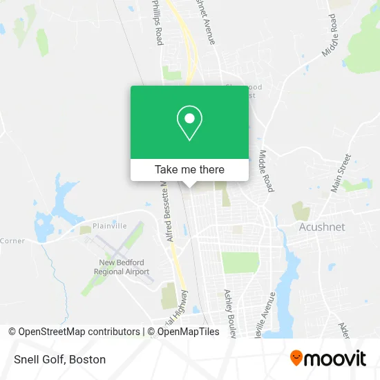
See Snell Golf, New Bedford, on the map
Public Transit to Snell Golf in New Bedford
Wondering how to get to Snell Golf in New Bedford? Moovit helps you find the best way to get to Snell Golf with step-by-step directions from the nearest public transit station.
Moovit provides free maps and live directions to help you navigate through your city. View schedules, routes, timetables, and find out how long does it take to get to Snell Golf in real time.
Looking for the nearest stop or station to Snell Golf? Check out this list of stops closest to your destination: Ashley Blvd And Dewey St; Child And Family Services; Church Street.
Bus: 204, 221.Train: FALL RIVER/NEW BEDFORD.
Want to see if there’s another route that gets you there at an earlier time? Moovit helps you find alternative routes or times. Get directions from and directions to Snell Golf easily from the Moovit App or Website.
We make riding to Snell Golf easy, which is why over 1.7 million users, including users in New Bedford, trust Moovit as the best app for public transit. You don’t need to download an individual bus app or train app, Moovit is your all-in-one transit app that helps you find the best bus time or train time available.
For information on prices of bus and train, costs and ride fares to Snell Golf, please check the Moovit app.
Use the app to navigate to popular places including to the airport, hospital, stadium, grocery store, mall, coffee shop, school, college, and university.
Snell Golf Address: 779 Church St street in New Bedford
- Fisher College,
- Woodward's Auto Parts,
- Win Waste Innovations,
- Church Street Garage,
- Western Union,
- Greater New Bedford Regional Vocational Technical High School,
- Greater New Bedford Vocational Technical School,
- James Mello Realty,
- Frades Disposal Inc,
- MS. Lucia Vargas Williams Licsw,
- Greater New Bedfo,
- Bonzie Colson II Skills Academy,
- Reidar's Trawl-Scallop Gear And Marine Supply,
- Frades Disposal Is Now Win Waste Innovations,
- Richard Tax Service,
- Automagic Window Tinting,
- Child & Family Services,
- Bassett Home Furnishings,
- The Garage,
- Rapid Rooter Inc
Places Near Snell Golf (New Bedford)
- Prudential Center, Boston,
- Boston Children's Hospital, Boston,
- Mgm Music Hall, Boston,
- Museum Of Science, Boston,
- Boston Medical Center, Boston,
- Wang Theater, Boston,
- Td Garden, Boston,
- Cheers, Boston,
- Massachusetts General Hospital, Boston,
- North End, Boston,
- Leader Bank Pavilion (Leader Bank Pavillion), Boston,
- Boston Convention & Exhibition Center, Boston,
- Quincy Market, Boston,
- Seaport District, Boston,
- House Of Blues, Boston,
- Boston Common, Boston,
- Wilbur Theatre, Boston,
- Faneuil Hall, Boston,
- Isabella Stewart Gardner Museum, Boston,
- Castle Island, Boston
How to get to popular places in Boston with public transit
Get around New Bedford by public transit!
Traveling around New Bedford has never been so easy. See step by step directions as you travel to any attraction, street or major public transit station. View bus and train schedules, arrival times, service alerts and detailed routes on a map, so you know exactly how to get to anywhere in New Bedford.
When traveling to any destination around New Bedford use Moovit's Live Directions with Get Off Notifications to know exactly where and how far to walk, how long to wait for your line, and how many stops are left. Moovit will alert you when it's time to get off — no need to constantly re-check whether yours is the next stop.
Wondering how to use public transit in New Bedford or how to pay for public transit in New Bedford? Moovit public transit app can help you navigate your way with public transit easily, and at minimum cost. It includes public transit fees, ticket prices, and costs. Looking for a map of New Bedford public transit lines? Moovit public transit app shows all public transit maps in New Bedford with all Bus, Train, Subway and Ferry routes and stops on an interactive map.
Boston has 4 transit type(s), including: Bus, Train, Subway and Ferry, operated by several transit agencies, including MBTA, Southeastern Regional Transit Authority, MetroWest Regional Transit Authority, Rhode Island Public Transit Authority, WRTA, Lowell Regional Transit Authority, Merrimack Valley Transit, Montachusett Regional Transit Authority, Cape Cod Regional Transit Authority, Brockton Area Transit Authority, Martha's Vineyard Transit Authority, the WAVE - Nantucket Regional Transit Authority, GATRA, Cape Ann Transportation Authority and Massport