How to get to Snipes by bus?
Click on the bus route to see step by step directions with maps, line arrival times and updated time schedules.
From The Friendly Toast, Boston
62 minFrom CambridgeSide (Cambridgeside Galleria), Cambridge
77 minFrom Copley Square, Boston
54 minFrom Lolita Cocina & Tequila Bar, Boston
62 minFrom John Hancock Tower, Boston
54 minFrom Renaissance Boston Waterfront Hotel (Renaissance Waterfront Conference Center), Boston
65 minFrom Bostonia Public House, Boston
36 minFrom City Hall To Go, Boston
53 minFrom Bistro du Midi, Boston
54 minFrom Whole Foods, Boston
57 min
How to get to Snipes by subway?
Click on the subway route to see step by step directions with maps, line arrival times and updated time schedules.
From The Friendly Toast, Boston
66 minFrom CambridgeSide (Cambridgeside Galleria), Cambridge
76 minFrom Copley Square, Boston
69 minFrom Lolita Cocina & Tequila Bar, Boston
68 minFrom John Hancock Tower, Boston
69 minFrom Renaissance Boston Waterfront Hotel (Renaissance Waterfront Conference Center), Boston
79 minFrom Bostonia Public House, Boston
57 minFrom City Hall To Go, Boston
90 minFrom Bistro du Midi, Boston
68 minFrom Whole Foods, Boston
70 min
Bus stop near Snipes in Revere
- Charger St @ Squire Rd, 2 min walk,VIEW
Subway station near Snipes in Revere
- Beachmont, 30 min walk,VIEW
What are the closest stations to Snipes?
The closest stations to Snipes are:
- Charger St @ Squire Rd is 93 yards away, 2 min walk.
- Beachmont is 2555 yards away, 30 min walk.
Which bus lines stop near Snipes?
These bus lines stop near Snipes: 119, 426, 429, 450.
Which subway line stops near Snipes?
BLUE LINE (Wonderland)
What’s the nearest subway station to Snipes in Revere?
The nearest subway station to Snipes in Revere is Beachmont. It’s a 30 min walk away.
What’s the nearest bus station to Snipes in Revere?
The nearest bus station to Snipes in Revere is Charger St @ Squire Rd. It’s a 2 min walk away.
What time is the first subway to Snipes in Revere?
The BLUE LINE is the first subway that goes to Snipes in Revere. It stops nearby at 5:12 AM.
What time is the last subway to Snipes in Revere?
The BLUE LINE is the last subway that goes to Snipes in Revere. It stops nearby at 2:10 AM.
What time is the first bus to Snipes in Revere?
The 119 is the first bus that goes to Snipes in Revere. It stops nearby at 5:00 AM.
What time is the last bus to Snipes in Revere?
The 119 is the last bus that goes to Snipes in Revere. It stops nearby at 10:55 PM.
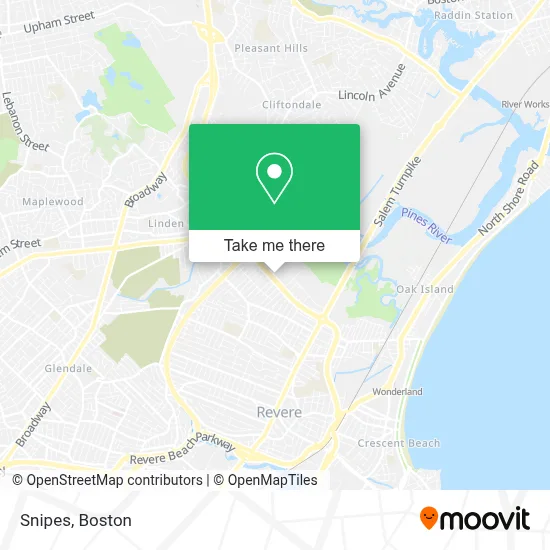
See Snipes, Revere, on the map
Public Transit to Snipes in Revere
Wondering how to get to Snipes in Revere? Moovit helps you find the best way to get to Snipes with step-by-step directions from the nearest public transit station.
Moovit provides free maps and live directions to help you navigate through your city. View schedules, routes, timetables, and find out how long does it take to get to Snipes in real time.
Looking for the nearest stop or station to Snipes? Check out this list of stops closest to your destination: Charger St @ Squire Rd; Beachmont.
Bus: 119, 426, 429, 450, 411.Subway: BLUE LINE.
Want to see if there’s another route that gets you there at an earlier time? Moovit helps you find alternative routes or times. Get directions from and directions to Snipes easily from the Moovit App or Website.
We make riding to Snipes easy, which is why over 1.7 million users, including users in Revere, trust Moovit as the best app for public transit. You don’t need to download an individual bus app or train app, Moovit is your all-in-one transit app that helps you find the best bus time or train time available.
For information on prices of bus and subway, costs and ride fares to Snipes, please check the Moovit app.
Use the app to navigate to popular places including to the airport, hospital, stadium, grocery store, mall, coffee shop, school, college, and university.
Snipes Address: 339 Squire Rd, Suite 140-142 street in Revere
- Chase,
- Market Basket (Market Basket #74 Revere),
- Price Rite Pharmacy,
- Northgate Shopping Plaza (Nortgate Shopping Center),
- Dunkin',
- MoneyGram,
- Bus Stop at Northgate,
- Petco Revere,
- Market Basket,
- Coinstar,
- KeyMe,
- Coinstar - Bitcoin ATM,
- Advanced Technology Patient Center,
- MBTA Bus Route 426/426W,
- 15 Locksmith Near Me,
- Platinum Sound Studios,
- Super Threading,
- Next Level Graphics,
- Kat Beauty Cosmetics,
- Gondim Aesthetics
Places Near Snipes (Revere)
- Museum Of Science, Boston,
- Castle Island, Boston,
- Faneuil Hall, Boston,
- Isabella Stewart Gardner Museum, Boston,
- Cheers, Boston,
- Td Garden, Boston,
- Seaport District, Boston,
- Mgm Music Hall, Boston,
- Leader Bank Pavilion (Leader Bank Pavillion), Boston,
- Wang Theater, Boston,
- Boston Medical Center, Boston,
- Wilbur Theatre, Boston,
- Prudential Center, Boston,
- North End, Boston,
- Massachusetts General Hospital, Boston,
- House Of Blues, Boston,
- Boston Convention & Exhibition Center, Boston,
- Boston Common, Boston,
- Quincy Market, Boston,
- Boston Children's Hospital, Boston
How to get to popular places in Boston with public transit
Get around Revere by public transit!
Traveling around Revere has never been so easy. See step by step directions as you travel to any attraction, street or major public transit station. View bus and train schedules, arrival times, service alerts and detailed routes on a map, so you know exactly how to get to anywhere in Revere.
When traveling to any destination around Revere use Moovit's Live Directions with Get Off Notifications to know exactly where and how far to walk, how long to wait for your line, and how many stops are left. Moovit will alert you when it's time to get off — no need to constantly re-check whether yours is the next stop.
Wondering how to use public transit in Revere or how to pay for public transit in Revere? Moovit public transit app can help you navigate your way with public transit easily, and at minimum cost. It includes public transit fees, ticket prices, and costs. Looking for a map of Revere public transit lines? Moovit public transit app shows all public transit maps in Revere with all Bus, Train, Subway and Ferry routes and stops on an interactive map.
Boston has 4 transit type(s), including: Bus, Train, Subway and Ferry, operated by several transit agencies, including MBTA, Southeastern Regional Transit Authority, MetroWest Regional Transit Authority, Rhode Island Public Transit Authority, WRTA, Lowell Regional Transit Authority, Merrimack Valley Transit, Montachusett Regional Transit Authority, Cape Cod Regional Transit Authority, Brockton Area Transit Authority, Martha's Vineyard Transit Authority, the WAVE - Nantucket Regional Transit Authority, GATRA, Cape Ann Transportation Authority and Massport