Directions to Snipped N Slayed (Medford) with public transportation
The following transit lines have routes that pass near Snipped N Slayed
 Bus: 100, 101, 95.
- Train: HAVERHILL, ORANGE LINE, LOWELL.
- Subway: ORANGE LINE, GREEN LINE B, GREEN LINE C, GREEN LINE E.
How to get to Snipped N Slayed by bus?
Click on the bus route to see step by step directions with maps, line arrival times and updated time schedules.
From Flynn Cruiseport Boston, Boston
57 minFrom Omni Hotel Seaport (2021), Boston
57 minFrom Mission Hill, Boston
90 minFrom Wayfair, Boston
71 minFrom Aloft Boston Seaport, Boston
56 minFrom Mass Eye & Ear, Boston
87 minFrom Residence Inn by Marriott Boston Downtown/South End, Boston
63 minFrom MBTA Kenmore Station, Boston
76 minFrom Boston City Hall, Boston
96 minFrom Paradise Rock Club, Boston
71 min
How to get to Snipped N Slayed by subway?
Click on the subway route to see step by step directions with maps, line arrival times and updated time schedules.
From Omni Hotel Seaport (2021), Boston
62 minFrom Mission Hill, Boston
70 minFrom Wayfair, Boston
54 minFrom Aloft Boston Seaport, Boston
67 minFrom Mass Eye & Ear, Boston
70 minFrom Residence Inn by Marriott Boston Downtown/South End, Boston
60 minFrom MBTA Kenmore Station, Boston
60 minFrom Boston City Hall, Boston
54 minFrom Paradise Rock Club, Boston
76 min
Bus stops near Snipped N Slayed in Medford
Subway station near Snipped N Slayed in Medford
- Ball Square Station, 11 min walk,VIEW
Train stations near Snipped N Slayed in Medford
Bus lines to Snipped N Slayed in Medford
What are the closest stations to Snipped N Slayed?
The closest stations to Snipped N Slayed are:
- 390 Salem St is 392 yards away, 5 min walk.
- Fellsway W @ Fells Ave is 549 yards away, 7 min walk.
- Ball Square Station is 851 yards away, 11 min walk.
- Oak Grove is 1023 yards away, 12 min walk.
- West Medford is 3086 yards away, 37 min walk.
Which bus lines stop near Snipped N Slayed?
These bus lines stop near Snipped N Slayed: 100, 101.
Which subway line stops near Snipped N Slayed?
ORANGE LINE (Oak Grove)
What’s the nearest subway station to Snipped N Slayed in Medford?
The nearest subway station to Snipped N Slayed in Medford is Ball Square Station. It’s a 11 min walk away.
What’s the nearest train station to Snipped N Slayed in Medford?
The nearest train station to Snipped N Slayed in Medford is Oak Grove. It’s a 12 min walk away.
What’s the nearest bus station to Snipped N Slayed in Medford?
The nearest bus station to Snipped N Slayed in Medford is 390 Salem St. It’s a 5 min walk away.
What time is the first subway to Snipped N Slayed in Medford?
The GREEN LINE E is the first subway that goes to Snipped N Slayed in Medford. It stops nearby at 4:55 AM.
What time is the last subway to Snipped N Slayed in Medford?
The GREEN LINE E is the last subway that goes to Snipped N Slayed in Medford. It stops nearby at 2:41 AM.
What time is the first train to Snipped N Slayed in Medford?
The LOWELL is the first train that goes to Snipped N Slayed in Medford. It stops nearby at 5:31 AM.
What time is the last train to Snipped N Slayed in Medford?
The LOWELL is the last train that goes to Snipped N Slayed in Medford. It stops nearby at 12:20 AM.
What time is the first bus to Snipped N Slayed in Medford?
The 101 is the first bus that goes to Snipped N Slayed in Medford. It stops nearby at 4:52 AM.
What time is the last bus to Snipped N Slayed in Medford?
The 101 is the last bus that goes to Snipped N Slayed in Medford. It stops nearby at 1:31 AM.
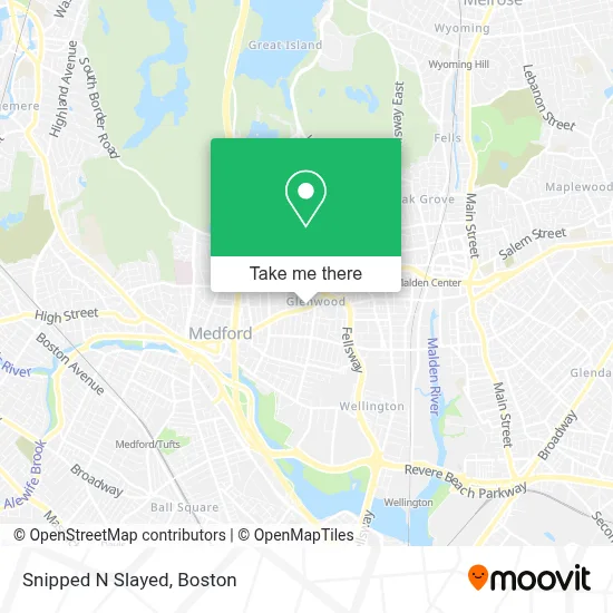
See Snipped N Slayed, Medford, on the map
Public Transit to Snipped N Slayed in Medford
Wondering how to get to Snipped N Slayed in Medford? Moovit helps you find the best way to get to Snipped N Slayed with step-by-step directions from the nearest public transit station.
Moovit provides free maps and live directions to help you navigate through your city. View schedules, routes, timetables, and find out how long does it take to get to Snipped N Slayed in real time.
Looking for the nearest stop or station to Snipped N Slayed? Check out this list of stops closest to your destination: 390 Salem St; Fellsway W @ Fells Ave; Ball Square Station; Oak Grove; West Medford.
Bus: 100, 101, 95.Train: HAVERHILL, ORANGE LINE, LOWELL.Subway: ORANGE LINE, GREEN LINE B, GREEN LINE C, GREEN LINE E.
Want to see if there’s another route that gets you there at an earlier time? Moovit helps you find alternative routes or times. Get directions from and directions to Snipped N Slayed easily from the Moovit App or Website.
We make riding to Snipped N Slayed easy, which is why over 1.7 million users, including users in Medford, trust Moovit as the best app for public transit. You don’t need to download an individual bus app or train app, Moovit is your all-in-one transit app that helps you find the best bus time or train time available.
For information on prices of bus and subway, costs and ride fares to Snipped N Slayed, please check the Moovit app.
Use the app to navigate to popular places including to the airport, hospital, stadium, grocery store, mall, coffee shop, school, college, and university.
Snipped N Slayed Address: 410 Salem St street in Medford
- Styled by BB Riah,
- Gilbert Insurance Agency Inc- Medford,
- Heritage Florist,
- Massage Nirvana,
- DUNKIN',
- Kwench Juice Cafe,
- Studio Hair 26,
- Insurance Associates,
- Care Builder Group,
- Jackson Fuel Corporation,
- Cement Shoes,
- Farshad Ghobbeh DMD,
- Auto Locksmith LTD,
- Blink Fitness,
- T-Mobile,
- Target,
- Morrison Park,
- Blink Fitness - Medford,
- Eventthem Studios,
- Eventthem
Places Near Snipped N Slayed (Medford)
- Td Garden, Boston,
- Museum Of Science, Boston,
- Massachusetts General Hospital, Boston,
- Cheers, Boston,
- Quincy Market, Boston,
- Boston Children's Hospital, Boston,
- Boston Convention & Exhibition Center, Boston,
- Isabella Stewart Gardner Museum, Boston,
- Wilbur Theatre, Boston,
- Leader Bank Pavilion (Leader Bank Pavillion), Boston,
- North End, Boston,
- Mgm Music Hall, Boston,
- Boston Medical Center, Boston,
- Seaport District, Boston,
- Faneuil Hall, Boston,
- Castle Island, Boston,
- Wang Theater, Boston,
- House Of Blues, Boston,
- Prudential Center, Boston,
- Boston Common, Boston
How to get to popular places in Boston with public transit
Get around Medford by public transit!
Traveling around Medford has never been so easy. See step by step directions as you travel to any attraction, street or major public transit station. View bus and train schedules, arrival times, service alerts and detailed routes on a map, so you know exactly how to get to anywhere in Medford.
When traveling to any destination around Medford use Moovit's Live Directions with Get Off Notifications to know exactly where and how far to walk, how long to wait for your line, and how many stops are left. Moovit will alert you when it's time to get off — no need to constantly re-check whether yours is the next stop.
Wondering how to use public transit in Medford or how to pay for public transit in Medford? Moovit public transit app can help you navigate your way with public transit easily, and at minimum cost. It includes public transit fees, ticket prices, and costs. Looking for a map of Medford public transit lines? Moovit public transit app shows all public transit maps in Medford with all Bus, Train, Subway and Ferry routes and stops on an interactive map.
Boston has 4 transit type(s), including: Bus, Train, Subway and Ferry, operated by several transit agencies, including MBTA, Southeastern Regional Transit Authority, MetroWest Regional Transit Authority, Rhode Island Public Transit Authority, WRTA, Lowell Regional Transit Authority, Merrimack Valley Transit, Montachusett Regional Transit Authority, Cape Cod Regional Transit Authority, Brockton Area Transit Authority, Martha's Vineyard Transit Authority, the WAVE - Nantucket Regional Transit Authority, GATRA, Cape Ann Transportation Authority and Massport